
Nisbet, Teviot Bridge


Road Bridge (19th Century)
Site Name Nisbet, Teviot Bridge
Classification Road Bridge (19th Century)
Alternative Name(s) River Teviot; Burnfoot Stream
Canmore ID 146142
Site Number NT62NE 20
NGR NT 67480 25436
Datum OSGB36 - NGR
Permalink http://canmore.org.uk/site/146142


- Council Scottish Borders, The
- Parish Crailing
- Former Region Borders
- Former District Roxburgh
- Former County Roxburghshire
NT62NE 20 67480 25436
Location formerly cited as NT 6748 2543.
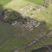
(Location cited as NT 675 254). Bridge, Nisbet, late 19th century. A 3-span bridge, with riveted bowed trusses, probably steel, on masonry piers with rounded cutwaters.
J R Hume 1976.
This bridge carries the B6400 public road over the River Teviot to the S of the village of Nisbet (NT62NE 17).
Informatiuon from RCAHMS (RJCM), 2 February 2006.

