Ashentrool
Enclosure(S) (Post Medieval), Farmstead (Post Medieval), Field System (Post Medieval), Track (Post Medieval)
Site Name Ashentrool
Classification Enclosure(S) (Post Medieval), Farmstead (Post Medieval), Field System (Post Medieval), Track (Post Medieval)
Alternative Name(s) Longcraig
Canmore ID 145099
Site Number NS89NW 86
NGR NS 8230 9983
Datum OSGB36 - NGR
Permalink http://canmore.org.uk/site/145099
- Council Stirling
- Parish Logie (Stirling)
- Former Region Central
- Former District Stirling
- Former County Stirlingshire
Field Visit (9 April 1997)
NS89NW 86 8230 9983
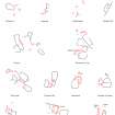
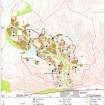
A farmstead comprising two rectangular buildings, a hut and an enclosure is situated on the leading edge of a bracken-covered terrace to the W of the coniferous plantation on Ashentrool. The two buildings (MENS97 10, 11) are turf-banked and measure 8.4m by 2.8m internally and 8.5m by 5m overall respectively. The hut (MENS97 12) measures 3.7m by 2.3m internally and lies just to the S of the rectangular turf-banked enclosure. A deeply hollowed trackway approaches the farmstead from the SW.
The terrace to the N is covered by faint rigs and intermittent banks (NS 8230 9990), forming part of a field-system which is visible on vertical aerial photographs (RAF 106G/SCOT/UK120, frame no. 3112, 20 June 1946) extending into the plantation.
(MENS97 10-2)
Visited by RCAHMS (DCC) 9 April 1997


