Dumyat
Farmstead (Post Medieval), Hut (Post Medieval), Rig And Furrow (Post Medieval)
Site Name Dumyat
Classification Farmstead (Post Medieval), Hut (Post Medieval), Rig And Furrow (Post Medieval)
Canmore ID 145073
Site Number NS89NW 76
NGR NS 8401 9828
Datum OSGB36 - NGR
Permalink http://canmore.org.uk/site/145073
- Council Stirling
- Parish Logie (Stirling)
- Former Region Central
- Former District Stirling
- Former County Stirlingshire
Field Visit (2 June 1997)
NS89NW 76 8401 9828
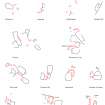
Two enclosures, a subrectangular building and a hut may have formed a small farmstead on a grassy terrace above the farm track on the NE flank of Dumyat. The building (MENS97 112) measures 12.4m by 5.3m over a turf bank spread to 0.9m in thickness and 0.2m in height, and has been divided into two compartments. A rectangular enclosure takes in a sheltered hollow in the lee of a small knoll on the W side of the building. To the SW of the enclosure there is a hut (MENS97 111) which measures 6.7m from WNW to ESE by 3.6m internally. What may be an outshot or perhaps a different phase of construction extends for 6.5m to the N and measures 4.2m in breadth overall. A broad, sheltered terrace to the SSW is covered in faint furrows, most of which seem to lie within an incomplete enclosure measuring about 50m from NW to SE by 40m transversely. A subrectangular hut (MENS97 110, NS 8397 9831) measuring 7.9m by 4.2m over a low turf bank lies on a terrace to the NW.
(MENS97 110-2)
Visited by RCAHMS (DCC) 2 June 1997


