
Loss Hill


Copper Mine(S) (18th Century), Enclosure (Post Medieval)
Site Name Loss Hill
Classification Copper Mine(S) (18th Century), Enclosure (Post Medieval)
Alternative Name(s) Ashentrool
Canmore ID 145011
Site Number NS89NW 56.08
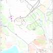
NGR NS 8320 9951
Datum OSGB36 - NGR
Permalink http://canmore.org.uk/site/145011

- Council Stirling
- Parish Logie (Stirling)
- Former Region Central
- Former District Stirling
- Former County Stirlingshire
Field Visit (5 May 1997)
NS89NW 56.08 8320 9951
At the base of the SSW flank of Loss Hill there are three filled in and grassed-over adits (NS 8320 9955, NS 8320 9951 and NS 8335 9955), each with a spoil heap to the S. Two further spoil heaps (NS 8317 9953 and 8321 9947) may have been produced by smaller excavations into the hillside. To the SW of one of these spoil heaps there is a small turf-and-stone-banked subrectangular enclosure (NS 8320 9947).
There is some evidence for a scheme which might have encompassed Loss in the 1720s, but most of the work at Loss took place between 1761 and 1763 (information from John Harrison, see also NS89NW 56.06).
Visited by RCAHMS (DCC) 5 May 1997

