Newbattle Viaduct
Railway Viaduct (19th Century)
Site Name Newbattle Viaduct
Classification Railway Viaduct (19th Century)
Alternative Name(s) The Waverley Line; Lothianbridge Viaduct; River South Esk Viaduct; Innocent Railway; Edinburgh To Hawick Branch Railway; Dalhousie Viaduct
Canmore ID 143953
Site Number NT36SW 41
NGR NT 32695 64844
NGR Description From c. NT 32561 64934 to c.NT 32841 64750
Datum OSGB36 - NGR
Permalink http://canmore.org.uk/site/143953
- Council Midlothian
- Parish Newbattle
- Former Region Lothian
- Former District Midlothian
- Former County Midlothian
NT36SW 41 32595 64844
Not to be confused with Glenesk Bridge (NT 32372 67136), for which see NT36NW 171.
For corresponding road bridge (adjacent to NE), see NT36SW 65.
Incoporates information from cancelled duplicated site NT36SW 67
Newbattle Viaduct [NAT]
OS (GIS) AIB, April 2006.
The Object Name Book of the Ordnance Survey describes Newbattle Viaduct as 'A viaduct on the Edinburgh and Hawick line of Railway on the estate of Newbattle it consists of 22 arches spanning the River Esk and a ravine and was built at an expense of £21,000.
Name Book 1852
This spectacular bridge/viaduct across the River South Esk, constructed at his expense, enabled the Marquis of Lothian to extend the Edinburgh and Dalkeith Railway S from Dalhousie Mains to his coal pits at Arniston. Stone pillars and cast iron Gothic arches supported the timber structure of the bridge, which was 1,011 ft. long.
J Thomas 1971.
(Location cited as NT 325 650 to NT 329 648). Dalhousie Viaduct, Newtongrange, opened 1849 by the Edinburgh and Hawick Rly. A 23-span viaduct, with brick arch rings, and coursed-rubble piers and spandrels. The last arch at the S end is a skew road arch with a masonry arch ring.
J R Hume 1976.
There was considerable debate over the financing of this extensive viaduct, a structure which was necessary in order to bridge the River South Esk and access the Lothian and Dundas collieries. The Marquis of Lothian was reluctant to spend the money due to the fact that the Lothian estates were entailed and it was considered unsuitable for Dundas, who owned the Arniston estate, to pay. However, it was eventually built, after a delay of some four years.
M J Worling 1991.
This bridge across the River South Esk enabled the Marquis of Lothian to gain rail access to his colliery at Arniston after construction was completed in January 1832.
G Douglas, A Jervis, M McDonald, N Niblock and W Barr 1993.
This viaduct is clearly marked on the 1st edition of the OS 6-inch map (Edinburghshire 1854, sheet 13), on the 2nd edition of the OS 6-inch map (Edinburghshire 1895, sheet viiiSW), on the current edition of the OS 1:10000 map (1991) and on the OS Basic Scale raster map (ND).
The above sources do not concur over the ownership of the Arniston estate, Worling (1991) maintaining that it belonged to the Dundas family and the other sources placing the Arniston collieries in the hands of the Marquis of Lothian. The Lothian family owned the Newbattle estate and pits at Easthouses, Bryans and Lingerwood, all on the S side of the River South Esk, according to Worling, so would anyway have had a vested interest in extending the railway S of the river, regardless of the ownership of the Arniston colliery.
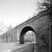
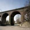
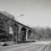
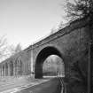
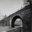
At NT 3282 6476 the viaduct carries the railway over a road which is clearly shown on the 1st edition of the OS 6-inch map (Edinburghshire 1854, sheeet 13) and on the 2nd edition of the OS 6-inch map (Edinburghshire 1895, sheet viiiSW). It is shown on the current edition of the OS 1:10000 map (1991) and on the OS Basic Scale raster map (ND) carrying the dismantled railway over the A7.
Information from RCAHMS (MD) 2 August 2001.
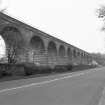
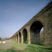
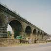
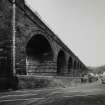
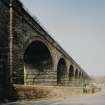
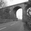
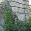
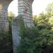
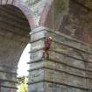
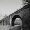
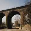
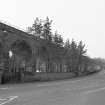
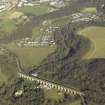
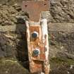
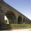
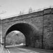
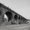
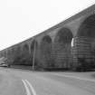
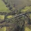
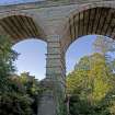
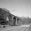
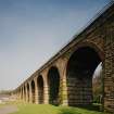
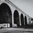
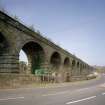
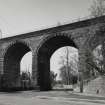
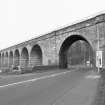
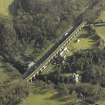
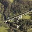
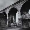
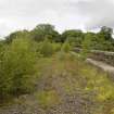
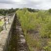
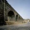
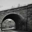
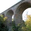
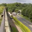
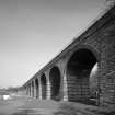
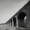
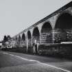
Completed in 1847 by John Miller, a long disused viaduct which carried the Waverley route from Edinburgh to Carlisle over the valley of the River South Esk to the north-west of Newtongrange (NT36SW 63). It comprises 23 rock-faced sandstone semi-circular arches, the piers of which have been reinforced with iron strappings. The viaduct passes over the river at its north-west end, the much longer pier being protected from the action of the river by deep curved cutwaters.
Information from RCAHMS (MKO), 2001.
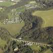
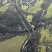
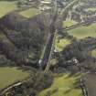
This viaduct carried the Edinburgh-Carlisle 'Waverley Route' of the (former) North British Rly over the RiverSouth Esk and two public roads; the river here forms the boundary between the parishes of Cockpen (to the NW) and Newbattle (to the SE). The entire line closed to regular passenger traffic on 6 January 1969. The viaduct apparently forms part of a cycle track, but forms part of the portion of the route for which reopening is projected.
The location assigned to this record defines the midpoint of the structure. The available map evidence suggests that it extends from NT C. 32561 64934 to NT c. 32841 64750.
Information from RCAHMS (RJCM), 26 April 2006.
Construction (1847)
Project (2007)
This project was undertaken to input site information listed in 'Civil engineering heritage: Scotland - Lowlands and Borders' by R Paxton and J Shipway, 2007.
Publication Account (2007)
The Newbattle or Dalhousie Viaduct is a 23-span masonry viaduct with brick arch rings on the North British Edinburgh & Hawick Railway, passing about 80 ft above the South Esk.. It was completed in 1847 and has 14 spans of 39 ft, seven of 38 ft, one of 44 ft and one of 43 ft 10 in., the easternmost over the A7 road being a skew arch. The brick arch rings are characteristic of Miller’s practice. The line closed in 1972 but plans are now being made to re-open it to Hawick. It replaced a unique 24- span cast-iron pointed arch and timber viaduct designed by John Williamson in 1830 and opened on 21 January 1832.
R Paxton and J Shipway 2007
Reproduced from 'Civil Engineering heritage: Scotland - Lowlands and Borders' with kind permission of Thomas Telford Publishers.
Project (April 2009 - February 2015)
The Borders Railway Project proposals are to reinstate the Newcraighall to Tweedbank section of the former Waverley Line. The reinstated railway line will be approximately 48km long and the majority of the route will use the existing railway embankment.
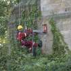
Several field surveys, archaeological evaluations and standing building surveys were undertaken by CFA Archaeology from April 2009 until February 2015.
CFA Archaeology
Standing Building Recording (October 2011 - April 2012)
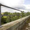
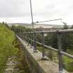
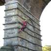
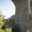
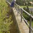
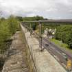
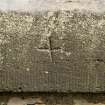
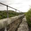
NT 32695 64844 Lothianbridge (Newbattle Viaduct) This viaduct carried the Edinburgh to Carlisle ‘Waverley Route’ of the former North British Railway over the River South Esk and two public roads; the river here forms the boundary between the parishes of Cockpen, to the NW and Newbattle to the SE. Accredited to the engineer John Millar and opened in 1849, the railway viaduct consists of 23 semi-circular arches and is constructed of coursed rock-faced sandstone with brick voussoirs and soffits. The bridge also contains ashlar imposts with hood moulding over the arches. The parapet is tooled sandstone with ashlar copings and metal railings. Reinforcement using iron straps is present along the soffits and piers. The pier bases have projecting stonework and blind recessed arches infilled with coursed tooled sandstone. The last arch which is skewed over a road at the SE end, has stone voussoirs and flanking buttresses built of rock-faces stone. Two arches resting on a pier with deep curved ashlar cutwaters span the River South Esk. The 1852 OS Name Book mentions that the viaduct was built at an expense of £21,000. There was considerable debate over the financing of this extensive viaduct, a structure that was necessary in order to bridge the River South Esk and access the Lothian and Dundas collieries. The Marquis of Lothian was reluctant to spend the money and it was considered unsuitable for Dundas, who owned the Arniston estate, to pay (Worling 1991). It was eventually built at the expense of the Marquis of Lothian (Thomas 1971).
Archive: RCAHMS (intended). Report: East Lothian HER and RCAHMS
Funder: ERM Ltd on behalf of Transport Scotland
Graeme Carruthers, Mike Cressey, Magnus Kirby, Ian Suddaby - CFA Archaeology Ltd, 2013
(Source: DES)


