Pricing Change
New pricing for orders of material from this site will come into place shortly. Charges for supply of digital images, digitisation on demand, prints and licensing will be altered.
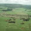
Culloden Moor, The Graves Of The Clans
Commemorative Stone(S) (Period Unassigned), Grave(S) (Period Unassigned)
Site Name Culloden Moor, The Graves Of The Clans
Classification Commemorative Stone(S) (Period Unassigned), Grave(S) (Period Unassigned)
Alternative Name(s) Culloden Muir; Culloden Moor, Memorial Cairn; Graves Of The Clans, Cairn And Well Of The Dead
Canmore ID 14204
Site Number NH74NW 17.03
NGR NH 7425 4499
Datum OSGB36 - NGR
Permalink http://canmore.org.uk/site/14204
- Council Highland
- Parish Croy And Dalcross (Inverness)
- Former Region Highland
- Former District Inverness
- Former County Inverness-shire
NH74NW 17.3 7425 4499.
(Area NH 74254499) Grave (NAT) - (site not clear)
Grave (NAT)-(N of Commemorative cairn)
Graves (NAT)
a Grave of the Mackintoshes (three)
b Grave of the MacGillivrays, Macleans, Maclachlans and Atholl Highlanders (one)
c Grave of the Stewarts of Appin (one)
d Grave of the Camerons (one)
e Grave of the Mackintoshes (one)
f.g. Graves of Mixed Clans (two)
h. Grave of the Frasers (one)
Grave (NAT) (Immediately N of Graves of the Campbells)
Graves of the Campbells (NAT)-(Two)
Grave (NAT) (60m SW of Graves of the Campbells)
OS 6"map, Inverness-shire, 2nd ed., (1906)
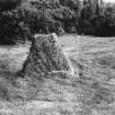
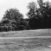
The principal graves are on an elevated piece of ground and consist of two or three grass covered mounds rising slightly above the adjoining heath.
Name Book 1871
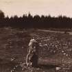
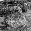
The principal graves are as described by ONB. Some are marked by an inscribed stone only, others (Campbells) have neither stone nor mounds. The four graves shown on OS 25" at NH 7416 4485, NH 7417 4484, NH 7412 4479 and NH 7409 4474 respectively are all graves of the Campbells (Neil MacDonald, Warden NTS, Culloden). There is also a stone inscribed to the Campbells at NH 7414 4493. A stone close to the Well of the Dead is inscribed to the Chief of the MacGillivrays (Information from Mr Neil MacDonald, Warden, National Trust for Scotland, Culloden). The grave shown on OS 25" at NH 7405 4515 is believed to be of the MacDonalds. The grave shown on OS 25" at NH 7397 4508 which is marked by a stone known as the Keppoch Stone is believed to mark the spot where Alexander MacDonald chief of the Keppoch MacDonalds' fell.
Visited by OS (WDJ) 24 April 1962.
Scheduled as Culloden Battlefield, Graves of the Clans, Cairn and Well of the Dead.
Information from Historic Scotland, scheduling document dated 8 September 2003.
Excavation (December 2006 - April 2007)
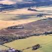
NH 7420 4498 Scheduled monument consent has been granted for various works in the clan graves area at Culloden Battlefield, in advance of a major reinterpretation of the battlefield. Between December 2006 and April 2007 the following work was undertaken by the NTS:
1. Crazy paving inserted in the 1960s or 1970s used to ‘front’ each of the grave markers on the S side of the old road. Most of this paving was removed in the mid-1980s but one area had been left in front of one of the ‘Mixed Clans’ stones. It was agreed that this modern intrusion should be removed to return the area to a semblance of how it would have been when the grave markers were erected in 1880/1881. A 2m by 2.2m zone was marked out. The turf was removed, the Caithness flagstones were recorded and most were taken away, and then the area was turfed with grass from beside the current visitor centre. No artefacts were found. A few flagstones were left in situ but will be removed once the grave marker has been set upright again.
2. In 1983/4 a gravel path had been created across the scheduled site, passing from the Well of the Dead, across the clan graves area and on to the Campbell Stone. At the same time the route of the main road, which also used to cross the area, was moved some 250m Nwards and the old road was broken up and its line grassed over. A review of the footpaths across the battlefield resulted in proposals for re-establishing the
original route of the road as the main footpath, and removing the more recent route. This would return the clan graves area to a semblance of how it would have been in the 1880s. To establish the exact line of the old road the probable line was surveyed onto the ground from details given on the 1:2500 OS map. Two trenches (3 x 1m and 4 x 1m) were then excavated, to confirm the route. One caught the S edge of the road, the other its Northern edge. Most of the tarmac must have been removed when the road was broken up in the 1980s, but the very hardpacked stone/gravel road metalling with bitumen through its surface was still in situ at a depth of only 200mm. The new path that was created in June 2007 used this old road metalling as a foundation, with any earlier road layers remaining untouched below.
Archive to be deposited with NTS SMR and RCAHMS.
Funder: National Trust for Scotland.


