Fettercairn - Fochabers Military Road
Military Road (18th Century)
Site Name Fettercairn - Fochabers Military Road
Classification Military Road (18th Century)
Canmore ID 141947
Site Number NO67NE 57
NGR NO 6600 7685
NGR Description From NO 6553 7500 to NO 6521 7999
Datum OSGB36 - NGR
Permalink http://canmore.org.uk/site/141947
- Council Aberdeenshire
- Parish Fordoun
- Former Region Grampian
- Former District Kincardine And Deeside
- Former County Kincardineshire
NO67NE 57.00 from 6553 7500 to 6521 7999. MR 18.
Formerly LIN 516.
NO67NE 57.01 66504 78185 Clattering Bridge
For Craigmoston Bridge (NO 6540 7538), see NO67NE 24.
The military road continues N, climbing steeply.
W Taylor 1976.
The military road continues N, veering E to cross a burn just S of a road heading for Stonehaven. The road maintains a course going N, crossing a river and then taking a fork to the W, where an E fork leads to Drumtouch. It continues on a line NW through the mountains.
G Taylor and A Skinner 1776.
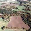
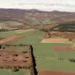
The military road is evident at NO 6629 7786 and NO 6547 7941 as an overgrown carriageway 6.7m wide. Elsewhere it is mainly overlaid by modern roads.
Visited by OS (ISS) 10 August 1971.
NO 6553 7500 to NO 6545 7539 modern road probably on line.
NO 6540 7538 modern bridge (NO67NE 24).
NO 6545 7539 to NO 6596 7675 modern track probably on line.
NO 6596 7675 to NO 6608 7700 grass track possibly on line.
NO 6608 7700 to NO 6629 7756 no trace.
NO 6629 7756 to NO 6645 7797 overgrown carriageway 7m wide levelled into E slope. Back drain evident where necessary.
NO 6645 7797 to NO 6650 7810 road almost destroyed by modern embankment.
NO 6650 7810 to NO 6650 7819 modern road on line.
NO 6650 7819 plaque on bridge (NO67NE 57.01) of 1961 states on site of the Clatterin? Brig of 1780. No trace of military work.
NO 6650 7819 to NO 6574 7894 modern road on line.
NO 6574 7894 to NO 6528 7984 heather-covered carriageway 6m wide, terraced into W facing slope, with back drain.
NO 6528 7984 to NO 6521 7999 modern road on line.
Visited by OS August 1971.


