
Pricing Change
New pricing for orders of material from this site will come into place shortly. Charges for supply of digital images, digitisation on demand, prints and licensing will be altered.
Craggie Cottage


Field System (Prehistoric), Hut Circle(S) (Prehistoric)
Site Name Craggie Cottage
Classification Field System (Prehistoric), Hut Circle(S) (Prehistoric)
Canmore ID 14106
Site Number NH73NW 10
NGR NH 732 382
NGR Description Centred NH 732 382
Datum OSGB36 - NGR
Permalink http://canmore.org.uk/site/14106


- Council Highland
- Parish Daviot And Dunlichity
- Former Region Highland
- Former District Inverness
- Former County Inverness-shire
Field Visit (30 August 1963)
Field Visit (9 April 1970)
NH73NW 10 centred 732 382.
(A: NH 7325 3846) Hut Circle (NR)
(B: NH 7321 3842) Hut Circle (NR)
(C: NH 7313 3825)
(J: NH 7314 3824) Hut Circles (NR)
(K: NH 7314 3823)
(D: NH 7308 3822) Hut Circle (NR)
(E: NH 7298 3821) Hut Circle (NR)
(F: NH 7321 3819)
(G: NH 7322 3820) Hut Circles (NR)
(H: NH 7323 3825) Hut Circle (NR)
OS 6"map, (1967)
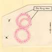
Centred at NH 732 382 in an area of cleared woodland on a NW-facing slope, is a settlement of 12 circular and one oval stone-walled huts ('A' - 'N') and an associated field system.. (Ten of the huts ('A' - 'K') were found and surveyed by OS in 1963).
Hut 'A' measures c. 8.5m in diameter between the centres of a wall spread to c. 2.0m all round. Outer facing stones are discernible in the S arc, and one inner in the NW. In the ENE arc is a 'simple' entrance, c. 1.0m wide. The hut is built against natural rock outcrop on the W side.
'B' is c. 7.5m in diameter between the centres of a wall spread to c. 2.0m all round. Occasional inner and outer facing stones are visible but insufficient to allow accurate measurement of overall diameter or wall thickness. The 'simple' entrance, c. 1.0m wide, is in the ENE.
'C' is c. 10.0m in diameter between the centres of a wall spread to c. 2.5m all round. Occasional outer facing stones are evident, and the 'simple' entrance, c. 2.0m wide, is in the W.
'D' measures c. 6.5m in diameter between the centres of a wall spread to c. 2.0m all round, with occasional outer facing stones visible. The 'simple' entrance, c. 1.0m wide, is in the ENE.
'E' measures 10.0m overall diameter with a wall 1.6m thick all round, but generally spread to c. 2.5m. Several outer and three inner facing stones are visible. The 'simple' entrance, c. 1.0m wide, is in the ESE. Several outer facing stones are visible in hut 'F', giving an overall diameter of 9.5m with a wall spread to c. 2.0m. The 'simple' entrance, c.1.0m wide, is in the E arc.
'G' is 11.5m overall diameter with a wall spread to c. 2.0m, the outer face of which is visible for most of the periphery. The mutilated entrance, c. 2.0m wide, is in the E. A break in the wall in the W is almost certainly a mutilation.
'H' is 8.5m overall diameter with a wall spread to c. 2.0m all round. Several outer facing stones are visible, and the 'simple' entrance, 0.9m wide, is in the SE.
Huts 'J' and 'K' are contiguous, lying N-S.
The northerly hut, 'J' measures c. 9.0m in diameter between the centres of a rubble wall spread to c. 2.0m all round. In the NE arc are six outer facing stones set on edge. No entrance can be traced. Within the hut is a curving cross-wall spread to c. 1.5m, which is apparently of the same style of construction as the hut wall, but due to the covering of heather it cannot be ascertained whether this wall is contemporary with the hut. No entrance is discernible in the cross-wall to allow access between the subdivisions of the hut.
'K' is c. 9.5m in diameter with a wall spread to c. 2.5m all round. No facing stones or entrance are visible.
Hut 'L', at NH 7296 3839, is c. 9.0m in diameter between the centres of a wall spread to c. 3.0m in the W, but ill-defined in the E where there is a dunuded entrance gap c. 2.0m wide.
Hut 'M', at NH 7312 3826, is c. 6.0m in diameter between the centres of a wall spread to c. 2.0m. No facing stones can be seen, and the 'simple' entrance, c. 1.0m wide, is in the S.
Hut 'N', at NH 7327 3282, is oval, measuring c. 13.0m E-W by c. 10.5m between the centres of a wall spread to c. 3.5m all round. The ill-defined entrance is in the E.
The field system comprises stone clearance heaps, lynchets, and infrequent ruined field walls which form cultivation plots, average size 30.0m x 20.0m. Several hollow-ways cut through the field system, but these are almost certainly later.
Visited by OS (W D J) 30 August 1963 and (N K B) 9 April 1970.
Field Visit (3 January 1972)
Another hut, 'O', at NH 7308 3824, measures c. 6.0m between the centres of an ill-defined wall, with no entrance evident.
Huts L, M, and O surveyed at 1:2500.
Huts, A, B, and G revised at 1/2500.
Visited by OS (I S S) 3 January 1972.
Aerial Photography (1989)
Very oblique air photographs, taken by Jill Harden in 1989, are in Inverness Museum (8907.08-10 INVMG).
Information from J Harden 1989.
Archaeological Evaluation (24 September 2018 - 28 September 2018)
NH 7291 3818 (centred on) A programme of mitigation works was required, 24 – 28 September 2018, within the scheduled area at Craggie Cottage settlement cairns and field system (SM 4712), due to unauthorised machine excavation of a track. The creation of the track had had directly impacted upon five clearance cairns forming part of a prehistoric field system.
Five evaluation trenches were excavated over the five clearance cairns in order to record the extent of the impact on the cairns and any buried archaeological deposits. A single cobble tool was recovered from a disturbed archaeological deposit within one of the cairns. A survey was of the scheduled area established that many of the known sites had suffered intense degradation since the previous surveys or were not visible due to dense heather coverage.
Archive: NRHE
Funder: Galbraith
Leanne Demay and Mary Peteranna – AOC Archaeology Group
(Source: DES Vol 19)
Field Visit (22 June 2020 - 7 September 2020)
NH 65299 42635 to NH 77267 36825 A desk-based assessment (DBA) and walkover survey were undertaken to inform work on the instillation of a new 33kV underground electric cable wire between Dores Road Sub-Station, Inverness and Moy Wind Farm. The DBA identified 41 previously recorded sites and nine areas of previous archaeological excavation work close to the route. These included the Scheduled Monument at Craggie Cottage (SM4712), three crossings of sections of General Wade military roads, and several farmsteads, clearance cairns and hut circles. The walkover survey recorded 42 separate sites close to the route, the majority of which had been noted in the desk-based assessment. The sites included 19 different walls or dykes, eight clearance cairns or groups of clearance cairns, the footings of eight structures and four quarries. In addition, one hut circle, a burial monument and a kiln were also noted. A further walkover survey was undertaken in a section of alternative route. Recommendations are made to adjust the route to avoid the Scheduled Area (SM4712) and to avoid most other sites through micro-siting and marking off. Where this is not possible additional recording is recommended. Following the walkover adjustments to the proposed route were made and recommendations also include surveying new areas not previously investigated.
Archive: Highland HER; NRHE
Funder: SSEN
Lachlan McKeggie – Highland Archaeology Services
(Source: DES Vol 21)

