Margdow
Farmstead(S) (Period Unassigned), Township (Period Unassigned)
Site Name Margdow
Classification Farmstead(S) (Period Unassigned), Township (Period Unassigned)
Alternative Name(s) Marragdow; Wester Carwhin; Carie
Canmore ID 140411
Site Number NN63NW 54
NGR NN 63958 36777
Datum OSGB36 - NGR
Permalink http://canmore.org.uk/site/140411
- Council Perth And Kinross
- Parish Kenmore (Perth And Kinross)
- Former Region Tayside
- Former District Perth And Kinross
- Former County Perthshire
NN63NW 54 63958 36777
A township, comprising six roofed buildings, one unroofed structure and six enclosures is depicted on the 1st edition of the OS 6-inch map (Perthshire 1867, sheet lxix). Five unroofed buildings and three enclosures are shown on the current edition of the OS 1:10000 map (1981).
Information from RCAHMS (AKK) 23 February 1998.
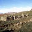
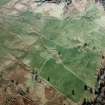
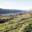
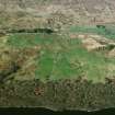
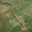
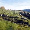
This township stands amongst improved fields on the SSE-facing slopes above Loch Tay, about 500m S of the A827 road. In its most recent configuration, probably dating to the late 1790s, the township has been divided into three farmsteads, though there are visible remains of at least three earlier buildings. A cup-marked boulder lying close to the centre of the site is described separately (NN63NW 248).
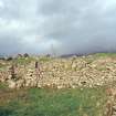
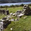
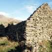
Each farmstead comprises at least two buildings - a house and a barn - and one or more stone-walled enclosures. The houses are built along the slope, facing SSE. They were all probably built as byre-dwellings, with cattle accommodated at one end, though only one (BL00 105) has a visible byre-drain. The barns, all of which have opposed entrances in their long sides, are built across the slope, at right angles to the houses and facing the prevailing wind. All these buildings are constructed of uncoursed rubble, with roughly squared quoins and stone gables, some of which survive to full height. Traces of clay bonding were found in one building (BL00 105), but all mortar has washed out of the others. Where the walls survive above the level of footings, features such as windows, doors and cruck-slots (the latter typically beginning about 0.5m above ground level) can often be seen, and there is occasionally evidence of structural repairs and alterations, some of which may reflect changes of use. The three farmsteads are described here from N to S, followed by descriptions of the earlier buildings.
1. The N farmstead.
The N farmstead comprises two buildings and four small enclosures. The house (BL00 100) stands at the back of a level terrace, and its rear (NNW) wall has been set into rising ground. It measures 13.5m from ENE to WSW by 3.3m transversely within walls up to 1.7m high at the sides. The ENE gable, measuring 2.8m in height, is nearly complete, but the WSW gable has collapsed. There is a pair of cruck-slots towards the WSW end, and traces of at least four other slots survive, demonstrating that the roof was supported on five pairs of crucks set between 2m and 2.5m apart. There are two entrances in the SSE wall; one is positioned just W of centre and has a splayed window opening to either side, which suggests that this was the dwelling end. The other entrance, now blocked, is towards the ENE end and probably led into the byre. An outshot, measuring internally 3.5m in length, has been constructed against the ENE gable, while along the front of the building, to the W of the W entrance, there are the remains of a cobbled terrace or walkway. Finally, there are two garden enclosures attached to this building. One, to the SW, measures about 18m by 12m within a rough stone dyke; the other, to the NW, is triangular, measuring about 20m by 16m.
The barn (BL00 101) stands to the SE of the house. It measures 6.2m from NNW to SSE by 3.7m transversely within walls that stand up to 1.8m high, except for the SSE gable, which still reaches its full height of 3.8m. Two stones project about 0.2m from the outer face of this gable, directly beneath the apex, at heights of 1.5m and 2.4m respectively; these may have been intended to secure thatch ropes. There is an entrance in the centre of each side. The N jamb of the W entrance has two holes running back into the wall core, each of which contains the remains of the timber peg that once secured the door frame. To either side of this entrance, against the outer face of the wall, there is a pair of stone plinths. Each plinth measures 0.3m in height and about 1.2m in length, and the plinths of each pair stand about 1m apart. Their purpose is not clear, but they may have supported wooden benches; a similar plinth projects from the SSE wall of the outshot attached to the house.
The remains of a small enclosure, measuring about 8m by 5m, abut the S side of the barn, while the fourth enclosure comprises a small yard formed in the angle between the two buildings.
2. The central farmstead.
The central farmstead comprises at least two main buildings, two roughly rectangular enclosures and slight traces of two other buildings, at least one of which probably belongs to an earlier phase of occupation. The house (BL00 102) stands on a low flat-topped knoll, from which the ground drops away sharply to the E, S and W. The ENE end of the house extends beyond the break of slope, so that its E corner is founded on a stone plinth 0.7m high. The building measures internally 13m in length by 4m in breadth at the WSW end, narrowing to 3.1m at the ENE end. The WSW gable, 3m high, is almost complete, but parts of the side walls have collapsed and only one cruck-slot can be identified, in the SSE wall 4.6m from the E corner. There are two entrances on the SSE; both have been blocked, but they formerly opened onto a raised stone terrace, 2m broad, which runs the length of the building. A third entrance in the NNW wall, which is approached by a worn pathway, may be a secondary feature. There is an outshot at each end; that to the ENE has been reduced to its footings, but that to the WSW is largely complete, and has a small window at attic level in its gable end.
The barn (BL00 103), standing to the S of the house, has been set into the slope at its NNW end and terraced up at the SSE end to provide a level interior. It measures internally 9.1m by 3.3m at the SSE end, narrowing to 2.8m at the NNW. The SSE gable is almost complete, and stands 3.8m high, while the opposite gable contains the remains of an attic window. There is an entrance in the centre of each side, though that on the WSW has been blocked. An outshot at the NNW end, with an entrance 1.8m wide, may have been a cart shed, and there may have been a second outshot N of that, now reduced to little more than a spread of rubble.
The remains of two other buildings lie to the E and W of the house. That to the W is probably earlier than the farmstead, and is described below with the other early structures. Only the SSE end of the building to the E (BL00 2034) can be traced, reduced to little more than a few earthfast grounders protruding from a grass-grown stony bank; the other end is obscured by a large heap of field-cleared stones, but the visible remains indicate a building measuring overall at least 6m in length, perhaps an outbuilding contemporary with the rest of the farmstead. Finally, to the SW and SE of the house there are two roughly rectangular enclosures, one to each side of the barn, bounded by drystone dykes standing up to 1.2m high. The W enclosure measures 36m by 26m, and the E enclosure measures about 28m by 22m. Traces of a stony bank around the edge of the knoll, and between the house and the barn, appear to subdivide the NW corner of the E enclosure, though this bank may be the remnants of an earlier enclosure.
3. The S farmstead.
The S farmstead is the most substantial of the three, comprising three buildings, a storage clamp and two enclosures. The house (BL00 105) is much larger than the other two houses, measuring internally 20.2m in length by 4.6m in breadth at the ENE end, narrowing to 3.5m at the WSW end. The WSW gable has collapsed, but much of the ENE gable survives, retaining part of a scarcement ledge to support an attic floor. The walls of this building, in which there are traces of clay bonding, have a noticeably rougher appearance than the houses of the other two farmsteads, and the outer face of the SSE wall has a more pronounced batter; the difference may be partly due to the extensive patching and alterations apparent in this building, but it may also suggest an earlier date (see below).
The interior has been divided into two intercommunicating compartments by a stone partition. This partition stops short of both side walls, leaving a passage between the two compartments at its N end, and a narrow gap (now blocked) at its S end. It is also pierced at its midpoint by a small rectangular light about 0.75m above floor level of the W compartment. The E compartment, which is the smaller of the two, has a floor level about 0.4m above that of the W, though this is at least partly due to a spread of collapsed rubble. This compartment has traces of two splayed windows in the SSE wall, immediately below one of which there is a thin slab, possibly a fallen lintel, which bears a row of five pecked 'cups' or sockets along one edge (BL00 2069). To the W of the windows, close to the partition, there has been an entrance, but this has been blocked and a third window has been inserted into the blocking masonry, thus leaving this compartment without any direct access from outside. The W compartment has three entrances, one of which (the westernmost) has also been blocked. There is a pair of cruck-slots towards the W end, and other breaks in the wall may also mark the positions of crucks. Finally, a stone-lined drain runs most of the length of this compartment, turning to run out through the central entrance.
The house opens onto a raised stone terrace, about 2m broad and 0.8m high, below which, at its W end, there is a subrectangular midden and, at its E end, a small outbuilding. The building (BL00 106) measures 8.2m by 2.7m within walls reduced to little more than footings except for the SSE side, which has been incorporated into the NNW wall of a roughly rectangular enclosure. The enclosure measures 30m from ENE to WSW by 16m transversely. A second enclosure, measuring about 18m by 16m within walls of loosely piled stones, lies behind the byre-dwelling, and overlies the remains of two earlier buildings (described below).
The barn (BL00 104) stands about 20m to the W of the house, from which it is now separated by a modern fence and a deep field drain. Originally it measured internally 10.8m in length by 4.3m in breadth, but it has been extended at the S end by the addition of an extra compartment. This may originally have been a self-contained outshot, but at some point the SSE gable of the original barn has been removed to create an interior 15.5m in length. The walls stand up to 1.8m high, except at the NNW end, where part of the gable survives; here, the building has been set into steeply rising ground and the remains of a loft door can be seen in the gable. There are opposed entrances halfway along the building's length, a wide entrance at the NNW end (possibly for a cart) and a fourth entrance leading into the extension at the SSE end. The remains of two pairs of cruck slots in the side walls of the original building indicate that it had three bays, each 3.3m to 4.1m in length. Immediately beyond the SSE end of the building there are the footings of another outshot, or possibly an earlier phase, partly obscured by a dump of field-cleared stones; this measures 7.8m in overall length.
The final component of the S farmstead (BL00 107) is a possible storage clamp set into the steep slope to the N of the barn. Its walls are reduced to grass-grown stony banks, but it has measured internally 4.5m in length by 3.4m in breadth. The entrance is in the SSE end and the rear wall, which has been quarried into bedrock, stands to a height of 1.5m.
4. The earlier buildings.
Amongst the structures described above there are traces of at least three earlier buildings. The first (BL00 2033) stood immediately to the W of the house of the central farmstead. It has been reduced to a level stance defined by shallow robber trenches representing its WSW end and part of its SSE side, and the W outshot of the later house probably stands over its ENE end, but it appears to have measured at least 7m by 3.8m internally. The other two early buildings are only slightly better preserved. They lie to the N of, and parallel to, the house of the S farmstead, and have been reduced by robbing to little more than levelled platforms, cut through by a trackway and overlain by a small enclosure. One (BL00 2009) measures about 21m by 6m over walls defined by a few earthfast grounders and shallow robber trenches. The other (BL00 2010) has measured at least 15m by 5m, but all that survives is a platform partly obscured by later dykes and heaps of field-cleared stones.
John Farquharson's 1769 Survey of the North Side of Loch Tay (National Archives of Scotland, RHP 973/1, Plan 7) depicts 'Marragdow' a township on the farm of Wester Carwhin comprising six buildings and two enclosures arranged in an informal layout. Five of Farquharson's buildings match very closely both the positions and the alignments of five of those described above; these are the three early building platforms (BL00 2009-10, 2033) and the two principal buildings of the S farmstead (BL00 104-5), while the house of the central farmstead overlies the site of the sixth. The reorganisation of the township into three separate farmsteads probably followed changes in the structure of landholding on Lochtayside introduced by the Breadalbane Estate in 1797, and most of the upstanding buildings probably date from that reorganisation. The house and barn of the S farmstead may be earlier, as they are shown on Farquharson's map, but it is not clear whether the standing masonry is as early as 1769, or whether these two have since been rebuilt on early foundations. It has been noted above that this house is considerably larger than the other two, and that its masonry is of poorer quality, which might suggest that it belongs to an earlier period; the masonry of the barn, however, is more like that of the N and central farmsteads, so it is more likely to have been rebuilt after 1797.
The 1st edition of the OS 6-inch map (Perthshire 1867, sheet lxix) shows as roofed the two principal buildings of each of these farmsteads, and also shows the larger enclosures. By the date of the 2nd edition of that map (Perthshire 1900, sheets lxix NW and lxix SW), however, only three buildings (the barn of the N farmstead and the house and barn of the S farmstead) and part of a fourth (the W end of the central house) were still roofed. This site now lies on Carie farm.
(BL00 100-7, 2009-10, 2033-4, 2069, 2609)
Visited by RCAHMS (MFTR) 4 April 2000 and (SDB), 5 June 2003.
S Boyle 2003.
Measured Survey (4 June 2003 - 5 June 2003)
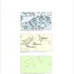
RCAHMS surveyed Margdow farmstead between 4-5 June 2003 with plane-table and self-reducing alidade at a scale of 1:250.


