Scheduled Maintenance
Please be advised that this website will undergo scheduled maintenance on the following dates: •
Tuesday 12th November from 11:00-15:00 & Thursday 14th November from 11:00-15:00
During these times, some services may be temporarily unavailable. We apologise for any inconvenience this may cause.
Allt An T-seillich
Pen(S) (Post Medieval), Sheepfold (19th Century), Shieling Hut(S) (Post Medieval)
Site Name Allt An T-seillich
Classification Pen(S) (Post Medieval), Sheepfold (19th Century), Shieling Hut(S) (Post Medieval)
Canmore ID 140148
Site Number NH60SE 13
NGR NH 6588 0314
Datum OSGB36 - NGR
Permalink http://canmore.org.uk/site/140148
- Council Highland
- Parish Kingussie And Insh
- Former Region Highland
- Former District Badenoch And Strathspey
- Former County Inverness-shire
Measured Survey (23 November 1995)
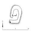
RCAHMS surveyed the shieling-hut at Allt an t-Seillich with alidade and plane-table on 23 November 1995 at a scale of 1:100. The resultant plan was redrawn in ink at a scale of 1:200.
Field Visit (27 September 1995)
NH60SE 13 6588 0314
There are thirty shieling-huts, three pens and a sheepfold scattered over a distance of about 400m from NNE to SSW along both banks of the Allt an t-Seillich.
The huts range in size from 1.4m to 5.75m in length by between 1.3m and 2.4m in breadth within stone footings. These are sometimes covered with turf, measuring 0.7m to 1m thick, and standing between 0.15m and 0.6m high where best-preserved. The huts generally have entrances in one side, except two (KING95 192, 307) which have access at one end, and three are sub-divided into two compartments (KING95 197, 319, 311). Four or possibly five have hearths defined by orthostatic stones, with the fire-back of the hearth usually to one side of the entrance (KING95 195, 196, 197, 197, 319). The best-preserved hearth measures 1.4m across the fire-back by about 0.7m in breadth (KING95 196, NH 6586 0302).
The three pens (KING95 198, 306, 315) are built of drystone-rubble and range in size between 3m and 3.8m in lenght by between 2.5m and 3.2m in breadth. The sheepfold is also drystone in construction, rectangular on plan, measuring about 18m from NE to SW by 15m transversely.
The sheepfold is depicted on the 1st edition of the OS 6-inch map (Inverness-shire 1872, sheet lxxxvi) and the shieling-huts are depicted on the Gordon Estate Map of 1771 (SRO RHP 1835/2). The latter shows five buildings on the S bank and three on the N and labels the settlement the 'bothies belonging to Glenbanchor'.
(KING95 191-9, 300-23)
Visited by RCAHMS (PJD) 27 September 1995


