
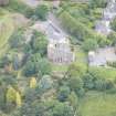
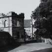
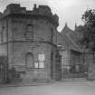
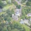
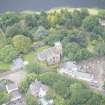
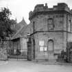
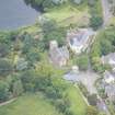
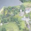
Edinburgh, Old Church Lane, Watch Tower


Watch House (19th Century)
Site Name Edinburgh, Old Church Lane, Watch Tower
Classification Watch House (19th Century)
Alternative Name(s) Session House; Duddingston; Vestry
Canmore ID 139100
Site Number NT27SE 3714
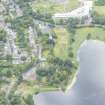
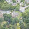
NGR NT 28349 72619
Datum OSGB36 - NGR
Permalink http://canmore.org.uk/site/139100


- Council Edinburgh, City Of
- Parish Edinburgh (Edinburgh, City Of)
- Former Region Lothian
- Former District City Of Edinburgh
- Former County Midlothian
See also: NT27SE 3720 Churchyard
NT27SE 3715 Loupin-an-Stane
NT27SE 198 Parish Church
NT27SE 105 Jougs
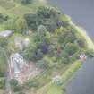
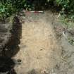
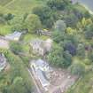
Watching Brief (4 August 2010 - 2 September 2010)
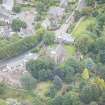
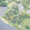
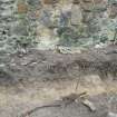
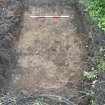
NT 28350 72616, NT 28376 72622, NT 28376 72617 and NT 28349 72612 Headland Archaeology Ltd conducted an evaluation and a level 1 programme of historic building recording at Duddingstone Manse, Duddingston. The work was undertaken to fulfil a planning condition imposed by the City of Edinburgh Council prior to a proposed redevelopment of the site. The evaluation comprised trial trenching (two trenches) to the rear of the upstanding frontage. Subsequently the City of Edinburgh Archaeological Service requested monitoring of a small additional area in order to clarify the results of the evaluation. This was carried out and is discussed below as trench three. The historic building assessment focused on a stretch of wall bordering the proposed development which contained traces of a pre-19th century building frontage. All three trenches were excavated in the north-west corner of the manse garden, within the ground plan of the proposed development. In the first two trenches undisturbed glacial till was uncovered within 0.30 m from the present ground surface and all layers of archaeological interest had been removed when the manse was relocated. The final trench which was undertaken during the monitoring phase revealed traces of wall foundations. No pottery was recovered from the overlying topsoil suggesting that the soil here may have been imported after the deposits associated with the manse were removed. The recording of the wall to the north showed that the frontage of pre-19th century buildings were preserved to a height of up to 2.5 m and that the wall had been raised by approximately 1 m in more recent times.
Archive: RCAHMS
Funder: Crichton Lang, Willis and Galloway (CLWG) Architects
Headland Archaeology 2010 (J. McCarthy) OASIS ID: headland1-85018

