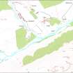
Glenbanchor
Head Dyke (Post Medieval), Township (Post Medieval)
Site Name Glenbanchor
Classification Head Dyke (Post Medieval), Township (Post Medieval)
Canmore ID 138416
Site Number NN69NE 3.02
NGR NN 6839 9951
Datum OSGB36 - NGR
Permalink http://canmore.org.uk/site/138416
- Council Highland
- Parish Kingussie And Insh
- Former Region Highland
- Former District Badenoch And Strathspey
- Former County Inverness-shire
Field Visit (20 November 1995 - 21 November 1995)
NN69NE 3.02 6839 9951
This township is situated in Glen Banchor between the Allt a' Chaorainn and the Allt Fionndrigh, to the N of the River Calder. It comprises the grass-grown stone footings of at least nineteen buildings and four enclosures, which are clustered around a derelict roofed cottage on the S side of the track along the glen.
The sizes of buildings cover a wide range, which are here divided into three loose groups. Four of the buildings (KING95 528, 730-1, 737) are small, measuring from 4.6m by 3.1m to 5.6m by 2.6m internally. Twelve (KING95 524-7, 727-9, 732, 736, 738, 740) measure from 8m by 3.1m to 12.7m by 3.4m internally, and one, the largest (KING95 725), measures 17.1m by 3.7m internally. Four of the buildings (KING95 725-7, 734) have been divided into two compartments. One end of the interior of four is slightly sunken, suggesting a byre (KING95 725, 729, 734-5). Where the position of the entrance is visible, it lies in a side wall; one building (KING95 732) has opposed entrances, one of which opens onto a midden. A subrectangular enclosure (KING95 730) with a sunken interior may also have been a midden. Some of the buildings are very poorly preserved (KING95 524-6), hinting at what may be an earlier phase of occupation in the township. More definite evidence of phasing is visible in two instances where fragmentary footings extend from under later buildings (KING95 526, 735).
There is a single hut (KING95 733), measuring 2.6m by 1.8m internally, inserted into the corner of an enclosure within the scatter of buildings. Beside the cottage and overlying the remains of an earlier stone founded building there is a rectangular concrete stance (KING95 728) for a timber building, which is shown as roofed on the current edition of the OS 1:10000 map (1971).
Three of the enclosures are attached to buildings (KING95 525, 527, 732) and may have been yards, while the fourth is free-standing (NN 6838 9955) and is depicted as a garden on the 1st edition of the OS 6-inch map (Inverness-shire 1872, sheet ci). Fragments of earthen banks enclose ground to the N and S of the township, also serving to define a trackway running into the township from the E, on the same line as the modern track.
The 1st edition map depicts eight of the buildings as roofed (KING95 527-8, 725-6, 728, 731, 734, 735), together with three unroofed structures (KING95 526, 727, 736). The roofed cottage appears to post-date the 1st edition map.
(KING95 524-8, 725-38, 740)
Visited by RCAHMS (DCC) 20 and 21 November 1995


