Scheduled Maintenance
Please be advised that this website will undergo scheduled maintenance on the following dates: •
Tuesday 12th November from 11:00-15:00 & Thursday 14th November from 11:00-15:00
During these times, some services may be temporarily unavailable. We apologise for any inconvenience this may cause.
Allt A' Chaorainn
Building(S) (19th Century), Enclosure (19th Century)
Site Name Allt A' Chaorainn
Classification Building(S) (19th Century), Enclosure (19th Century)
Canmore ID 138336
Site Number NN69NE 19
NGR NN 6925 9968
Datum OSGB36 - NGR
Permalink http://canmore.org.uk/site/138336
- Council Highland
- Parish Kingussie And Insh
- Former Region Highland
- Former District Badenoch And Strathspey
- Former County Inverness-shire
Field Visit (10 October 1995)
NN69NE 19 6925 9968
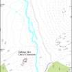
The grass-grown footings of two rectangular buildings and an enclosure are situated on terraces to the E of the Allt a' Chaorainn. The N building (KING95 401), which measures 10.3m from E to W by 4.4m internally, is situated at the N end of an enclosure which takes in the rest of the terrace. The E end of this building is depicted as roofed on the 1st edition of the OS 6-inch map (Inverness-shire 1872, sheet ci). The second building (KING95 402) has been reduced to little more than a platform levelled into the slope and measures 7.7m from NNE to SSW by 3.3m transversely overall.
(KING95 401, 402)
Visited by RCAHMS (DCC) 10 October 1995


