
Cullicudden Church


Burial Ground (Medieval) - (Post Medieval), Church (Medieval)
Site Name Cullicudden Church
Classification Burial Ground (Medieval) - (Post Medieval), Church (Medieval)
Canmore ID 13680
Site Number NH66NW 4
NGR NH 64968 65075
Datum OSGB36 - NGR
Permalink http://canmore.org.uk/site/13680


- Council Highland
- Parish Resolis
- Former Region Highland
- Former District Ross And Cromarty
- Former County Ross And Cromarty
NH66NW 4 64968 65075.
(NH 6496 6506) Cullicudden Church (NR) (Ruin)
OS 6" map, (1959)
The church was the successor to St Martin's (NH 66SW 7) as the parish church of Cullicudden and was built in 1609. A stone over the doorway bears the date.
This church continued in use after the union of Cullicudden and Kirkmichael church (NH76NW 1) became the parish church.
When a new church was built at Resolis in 1767, Cullicudden Church was allowed to fall into decay.
New Statistical Account (NSA) 1845; Name Book 1875; H Scott et al 1915-61.
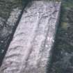
Cullicudden Church, the name being verified locally as such, is as described above. The date '1609' on the stone lintel of the doorway is still legible. The SE wall of the church survives to a height of 3.5m and is 5.0m in length, and 0.8m thick, with the doorway centrally placed in it. The SW and NE portions of wall are 0.7m wide but it is now impossible to say whether they are the original side walls of the church or not. Each survives to a maximum height of 1.3m and is 6.0m in length. The NE wall has been re faced, and three modern gravestones have been built into the outer face. The SW wall, which now appears to be original, has two gravestones set into its inside face, and is of the same construction as the SE wall. The graveyard, which is still in use, has many old grave-slabs in it.
Revised at 1/2500.
Visited by OS (R B) 1 January 1966.
It would seem more logical for this church to have been oriented NE-SW, rather than NW-SE as implied by Bruce. The masonry of the SW wall is of a poorer quality than that of the undoubtedly original SE wall, suggesting it is later. A rectangle of tightly packed, mainly early 18th century, graveslabs immediately beyond it suggests that the church extended at least another 12.0m to the SW, the graveslabs being placed either within the church or on the site of its SW half. Three mid 17th century graveslabs occur in a burial enclosure to the S of the church. The oldest stone seen is dated 1600, and this, together with the top section of a pointed trefoil window of red sandstone laid on the ground to the W of the church, suggests an earlier date than 1609, unless they were brought from elsewhere.
Visited by OS (A A) 18 June 1975.
Church; burial ground - outside survey area.
17th century Ad or earlier.
CFA/MORA Coastal Assessment Survey 1998.
Field Visit (June 1979)
Cullicudden, Old Parish Church NH 649 650 NH66NW 4
The S aisle, which dates from 1609, and two mounds of rubble are all that now remain of the church. The head of a 13th-century double lancet window lies on one of the mounds of rubble and there are at least two medieval grave-slabs in the burial-ground. See also NH66SW 7.
RCAHMS 1979, visited June 1979
OPS 1851-5, ii, 552-3; Cowan 1967, 41

