
Pricing Change
New pricing for orders of material from this site will come into place shortly. Charges for supply of digital images, digitisation on demand, prints and licensing will be altered.
Ferryton Point, The Old Store


Storehouse (Post Medieval)
Site Name Ferryton Point, The Old Store
Classification Storehouse (Post Medieval)
Alternative Name(s) Ferryton, Girnal; Ferryton, Granary; Storehouse
Canmore ID 13644
Site Number NH66NE 39
NGR NH 68013 66967
Datum OSGB36 - NGR
Permalink http://canmore.org.uk/site/13644


- Council Highland
- Parish Resolis
- Former Region Highland
- Former District Ross And Cromarty
- Former County Ross And Cromarty
NH66NE 39 68001 66962
Storehouse/girnal roofed on the 1st edition of the OS 6-inch map (Ross and Cromarty, sheet lxv;1881).
17th-18th century.
CFA/MORA Coastal Assessment Survey 1998.
Field Visit (June 1979)
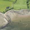
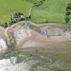
Ferryton Point NH 680 669 NH66NE
This long two-storeyed warehouse of late 18th-century date stands on the edge of the Cromarty Firth. It is built of sandstone rubble and lime mortar with dressed stone margins. The ground floor has been entered through three doors on the S and one on the N; against the W gable there is a forestair to the upper floor.
RCAHMS 1979, visited June 1979
Field Visit (2013 - 2014)
Girnal was a roofless ruin until 1990, when it was converted into a private house. It is believed to have been first built c. 1750.
Visited by Scotland's Coastal Heritage at Risk (SCHARP) 2013

