
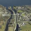
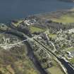
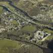
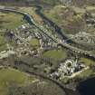
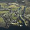
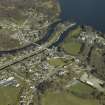
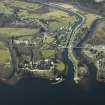
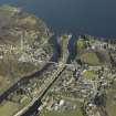
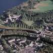
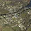
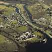
Fort Augustus, Fort Augustus Bridge


Road Bridge (Period Unassigned)
Site Name Fort Augustus, Fort Augustus Bridge
Classification Road Bridge (Period Unassigned)
Alternative Name(s) River Oich; New Bridge Of Oich; New Oich Bridge
Canmore ID 133383
Site Number NH30NE 46
NGR NH 37890 09273
Datum OSGB36 - NGR
Permalink http://canmore.org.uk/site/133383


- Council Highland
- Parish Boleskine And Abertarff
- Former Region Highland
- Former District Inverness
- Former County Inverness-shire
NH30NE 46 37890 09273
Fort Augustus Bridge [NAT]
OS 1:10,000 map, 1971.
For predecessor Old Bridge (NH 3807 0937), see NH30NE 18.
For description, see NH30NE 18.
(Undated) information in NMRS.
This bridge carries the present line of the A82 public road over the River Oich, and was apparently built as part of a by-pass scheme around Fort Augustus village (NH30NE 41).
Information from RCAHMS (RJCM), 28 August 1998.

