Leathad An Raidhrich
Corn Drying Kiln(S) (Post Medieval), Head Dyke (Post Medieval), Midden (Post Medieval), Township (Post Medieval)
Site Name Leathad An Raidhrich
Classification Corn Drying Kiln(S) (Post Medieval), Head Dyke (Post Medieval), Midden (Post Medieval), Township (Post Medieval)
Canmore ID 130219
Site Number NC60NE 34
NGR NC 6740 0775
Datum OSGB36 - NGR
Permalink http://canmore.org.uk/site/130219
- Council Highland
- Parish Rogart
- Former Region Highland
- Former District Sutherland
- Former County Sutherland
Field Visit (7 June 1995)
NC60NE 34 6740 0775
This township comprises four buildings, two corn-drying kilns, an enclosure, a pen, a midden-pit, some faint traces of rig, and a head-dyke, which encompasses all but one of the buildings (ROG95 556).
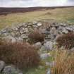
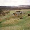
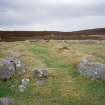
The three buildings within the head-dyke range in length from 10.7m to 22.2m in length by between 2.3m and 2.8m in breadth within faced-rubble walls, 0.7m to 0.8m thick, and up to 0.5m high, with an entrance in one side. The largest building (ROG95 559) is some 10m longer than any of the others and typifies the byre-houses that are found elsewhere in Sutherland. It is sub-divided into two unequal parts by a step down into the lower W end, in which there is a byre-drain that runs out of the SW corner. A wing (5m in length) is attached to the S end of the building. Both the other two buildings are divided into two unequal compartments; in one, the partition is marked by a step down (ROG95 558), while in the other it is marked by a wall that appears to shorten the available space in the building (ROG95 560). The hut to the S of the head-dyke (ROG95 556) measures 5.6m from WNW to ESE by 2.2m transversely within faced-rubble walls, 0.65m thick and up to 0.45m high, an entrance in the SSW, and an outshot on the SSW 2.2m long by 1.5m across
The pen, which stands to the W of the longest building (ROG95 559), tapers to towards the N end, measuring 14m from N to S by up to 3m transversely within a collapsed drystone wall. To the N of the pen, there is a slight hollow is about 5m square, which may have been the site of a midden.
The corn-drying kilns measure 2.1m and 1.7m in diameter respectively (ROG95 557 and 561) across a bowl, about 1m deep in each case, within faced-rubble walls about 0.7m thick. The flues of each open into a barn, of which the former is set side-on to the slope, whilst the other is set with the flue opening away from the slope.
The area of the head-dyke encompasses a roughly kidney-shaped area about 300m across on the S of an unnamed tributary of the Lettie River, within which there are traces of rig are visible in the grassy patches.
The 1st edition of the OS 6-inch map depicts a head-dyke, but no buildings at this location (Sutherland 1879, sheet xcv).
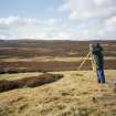
Visited by RCAHMS (PJD) 7 June 1995


