
Pricing Change
New pricing for orders of material from this site will come into place shortly. Charges for supply of digital images, digitisation on demand, prints and licensing will be altered.
Cnoc A'mhuilinn


Corn Drying Kiln (Period Unassigned)(Possible), Lade (Period Unassigned), Mill (Period Unassigned)
Site Name Cnoc A'mhuilinn
Classification Corn Drying Kiln (Period Unassigned)(Possible), Lade (Period Unassigned), Mill (Period Unassigned)
Canmore ID 12937
Site Number NH56SW 26
NGR NH 5168 6219
Datum OSGB36 - NGR
Permalink http://canmore.org.uk/site/12937


- Council Highland
- Parish Fodderty
- Former Region Highland
- Former District Ross And Cromarty
- Former County Ross And Cromarty
NH56SW 26 5168 6219
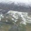
The natural knoll north of the river is named Cnoc a' Mhuillinn, 'hill of the mill' and contains evidence of milling. The hill has been shaped by the river and a meander (presently dry) on its north side.
Presumably during much of the year it is a virtual island. (The 1:10560 OS survey of 1875-6 shows it as an island.) The hill consists of two parts, a rounded upper area on the west and a lower level area to the east. The mill lade approaches the hill from the south and runs along side the level east end. At its widest point the lade is 3.25m wide by 1.25m deep. It has been constructed by throwing up a bank of earth and stone which varies between 1.5 - 2.5m in width and stands up to 2.0m high. At a point near the extreme SE tip of the hill the lade bank widens to 4.5m. If this mill was a horizontal mill, and this seems very likely, then it was here that the mill itself spanned the lade.
In addition to the lade, there is a msall circular structure on the upper western part of the hill. It is 7.0m in diameter with walls 2.0m thick and 1.0m high. It has no apparent entrance and its interior is lower than the surrounding ground surface outside. It does not appear to be a hut circle and in view of its location it is tentatively interpreted as a grain drying kiln.
Visited June 1979
Information from S T Driscoll and S M Foster (Mss, 3-4, No. 15) 1989.
Project (June 1989)
Pre-afforestation archaeological survey undertaken in Strath Sgitheach, funded by HBM SDD.
S T Driscoll and S M Foster, 1989.

