
Pricing Change
New pricing for orders of material from this site will come into place shortly. Charges for supply of digital images, digitisation on demand, prints and licensing will be altered.
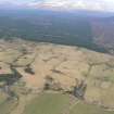
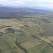
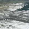
Heights Of Brae


Farmstead (Post Medieval)
Site Name Heights Of Brae
Classification Farmstead (Post Medieval)
Canmore ID 12934
Site Number NH56SW 23
NGR NH 51035 61275
Datum OSGB36 - NGR
Permalink http://canmore.org.uk/site/12934


- Council Highland
- Parish Fodderty
- Former Region Highland
- Former District Ross And Cromarty
- Former County Ross And Cromarty
Field Visit (September 1978)
Heights of Brae 2 NH 510 612 NH56SW
This deserted farm measures 25m from SW to NE by 5m transversely and has three rooms. An enclosure is visible to the NW and a quarry to the S.
RCAHMS 1979, visited September 1978

