
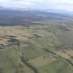
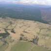
Heights Of Brae


Farmstead (Post Medieval)
Site Name Heights Of Brae
Classification Farmstead (Post Medieval)
Canmore ID 12934
Site Number NH56SW 23
NGR NH 51035 61275
Datum OSGB36 - NGR
Permalink http://canmore.org.uk/site/12934


- Council Highland
- Parish Fodderty
- Former Region Highland
- Former District Ross And Cromarty
- Former County Ross And Cromarty
Field Visit (September 1978)
Heights of Brae 2 NH 510 612 NH56SW
This deserted farm measures 25m from SW to NE by 5m transversely and has three rooms. An enclosure is visible to the NW and a quarry to the S.
RCAHMS 1979, visited September 1978

