Pricing Change
New pricing for orders of material from this site will come into place shortly. Charges for supply of digital images, digitisation on demand, prints and licensing will be altered.
Upcoming Maintenance
Please be advised that this website will undergo scheduled maintenance on the following dates:
Thursday, 9 January: 11:00 AM - 3:00 PM
Thursday, 23 January: 11:00 AM - 3:00 PM
Thursday, 30 January: 11:00 AM - 3:00 PM
During these times, some functionality such as image purchasing may be temporarily unavailable. We apologise for any inconvenience this may cause.
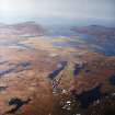
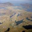
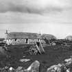
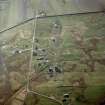
South Uist, Daliburgh
Chapel (Period Unassigned), Church (Period Unassigned), Manse (Period Unassigned), School (Period Unassigned), Township (Period Unassigned)
Site Name South Uist, Daliburgh
Classification Chapel (Period Unassigned), Church (Period Unassigned), Manse (Period Unassigned), School (Period Unassigned), Township (Period Unassigned)
Alternative Name(s) South Uist, Dalabrog
Canmore ID 126012
Site Number NF72SW 20
NGR NF 747 210
NGR Description centred on NF 747 210
Datum OSGB36 - NGR
Permalink http://canmore.org.uk/site/126012
- Council Western Isles
- Parish South Uist
- Former Region Western Isles Islands Area
- Former District Western Isles
- Former County Inverness-shire
Askernish House, 1835 Sturdy Georgian-style farmhouse in simple classical style, with stacks rising from internal walls in the Kintail/Lochalsh manner. Looking out to the Atlantic across a large, stonewalled garden, this was one of the three new farm houses noted by the NSA in 1837 as 'all substantially built of stone and lime, and slated'. Nearby range of steadings, 1846. Attendant T-plan estate office added later 19th century, when Askernish became the factor's house. Cladh Hallan Prehistoric village on Daliburgh Machair, one of at least 25 identified early settlements punctuating the island's west coast. Excavations here since 1994 have resulted in some extraordinary archaeological discoveries, including Scotland's earliest terraced row. Early Bronze Age beakerware has been unearthed from the great sand mound, along with evidence of a cremation cemetery of c.13 00 BC. The late Bronze Age settlement built on top of this (90 per cent of which has still to be excavated) flourished for about 1,000 years. Its dwellings mark the transition from U-shaped to round house. Three of the latter, forming part of a monumental east-facing terrace of about 1,100 bc, have been reconstructed in stone outline. Remarkably, prehistoric mummies were found interred in their foundations - corpses that had been preserved in peat and were already several hundred years old when buried. Archaeological evidence suggests that the passage of the sun dictated the siting of domestic activities within these roundhouses. The northern one appears to have had some special ritualistic association with death. The settlement was abandoned round c.400 bc. Daliburgh (Dalabrog) A scattered settlement, now the commercial hub of the island. South End Community Centre Neil & Hurd for North of Scotland Hydro Board, 1952/3 Former power station, one of few architectdesigned Modern buildings in the Uists, converted by Stuart Bagshaw & Assocs, 1982. Church of Scotland (formerly Free Church), 1863 Simple hall containing a panel-fronted pulpit and war memorial communion table, said to have been based upon Archibald Scott's abortive design of 1837 for the Howmore church; manse, completed 1880.
Taken from "Western Seaboard: An Illustrated Architectural Guide", by Mary Miers, 2008. Published by the Rutland Press http://www.rias.org.uk
NF72SW 20 centred on 747 210
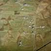
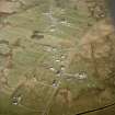
A crofting township comprising eighty-nine roofed buildings, which include a school, a church, a chapel and a manse, two partially roofed and seventeen unroofed buildings is depicted on the 1st edition of the OS 6-inch map (Inverness-shire, Hebrides, South Uist 1881, sheet lvii).
Eighty-eight roofed, six partially roofed and twenty-two unroofed buildings are shown on the current edition of the OS 1:10000 map (1971).
Information from RCAHMS (SAH) 22 May 1997.


