Scheduled Maintenance
Please be advised that this website will undergo scheduled maintenance on the following dates: •
Tuesday 3rd December 11:00-15:00
During these times, some services may be temporarily unavailable. We apologise for any inconvenience this may cause.
Fish Trap (19th Century)
Site Name Hill Of Ardmore, Old Fish Yair
Classification Fish Trap (19th Century)
Alternative Name(s) Firth Of Clyde; Inner Clyde Estuary
Canmore ID 125825
Site Number NS37NW 27
NGR NS 3170 7922
NGR Description NS 3161 7913 to NS 3187 7921
Datum OSGB36 - NGR
Permalink http://canmore.org.uk/site/125825
Ordnance Survey licence number AC0000807262. All rights reserved.
Canmore Disclaimer.
© Bluesky International Limited 2024. Public Sector Viewing Terms
- Correction
- Favourite

DP 191160
Oblique aerial view of the fish trap, looking SSW.
RCAHMS Aerial Photography Digital
16/6/2014
© Crown Copyright: HES

DP 191161
Oblique aerial view of the fish trap, looking SSW.
RCAHMS Aerial Photography Digital
16/6/2014
© Crown Copyright: HES

SC 1724493
Oblique aerial view centred on the remains of the fish trap with the remains of the tower adjacent, taken from the SSW.
RCAHMS Aerial Photography
12/5/2005
© Crown Copyright: HES

SC 2148819
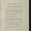
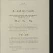
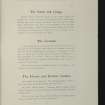
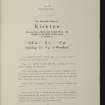
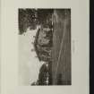
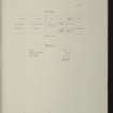
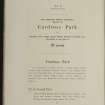
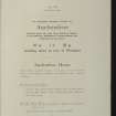
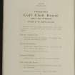
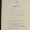
Estates Exchange, London. No.1494, Sale Brochure - map and photographs of Kilmahew Estate. Properties include Kilmahew House and Castle, Lodges, Farm and cottages together with Cairniedrouth Farm, Asker Farm, Kirkton Farm, Cardross Park, High and Low Milndovan Farms, Auchenfroe House, Golf Club House, Wallaceton Farm, Walton Farm, Craigend Farm and Auchensail Farm. Sepia photographs of Kilmahew House (2), Lodge, Cardross Park, Auchenfroe House, Kilmahew Golf House and Course. Also contains plan of Estate which identifies individual lots. November 1919
Collection of sale catalogues relating to Scottish estates
1919
© Courtesy of HES, Courtesy of HES (Estates Exchange collection)

SC 2148824
Estates Exchange, London. No.1494, Sale Brochure - map and photographs of Kilmahew Estate. Properties include Kilmahew House and Castle, Lodges, Farm and cottages together with Cairniedrouth Farm, Asker Farm, Kirkton Farm, Cardross Park, High and Low Milndovan Farms, Auchenfroe House, Golf Club House, Wallaceton Farm, Walton Farm, Craigend Farm and Auchensail Farm. Sepia photographs of Kilmahew House (2), Lodge, Cardross Park, Auchenfroe House, Kilmahew Golf House and Course. Also contains plan of Estate which identifies individual lots. November 1919
Collection of sale catalogues relating to Scottish estates
1919
© Courtesy of HES, Courtesy of HES (Estates Exchange collection)

SC 2148828
Estates Exchange, London. No.1494, Sale Brochure - map and photographs of Kilmahew Estate. Properties include Kilmahew House and Castle, Lodges, Farm and cottages together with Cairniedrouth Farm, Asker Farm, Kirkton Farm, Cardross Park, High and Low Milndovan Farms, Auchenfroe House, Golf Club House, Wallaceton Farm, Walton Farm, Craigend Farm and Auchensail Farm. Sepia photographs of Kilmahew House (2), Lodge, Cardross Park, Auchenfroe House, Kilmahew Golf House and Course. Also contains plan of Estate which identifies individual lots. November 1919
Collection of sale catalogues relating to Scottish estates
1919
© Courtesy of HES, Courtesy of HES (Estates Exchange collection)

SC 2148830
Estates Exchange, London. No.1494, Sale Brochure - map and photographs of Kilmahew Estate. Properties include Kilmahew House and Castle, Lodges, Farm and cottages together with Cairniedrouth Farm, Asker Farm, Kirkton Farm, Cardross Park, High and Low Milndovan Farms, Auchenfroe House, Golf Club House, Wallaceton Farm, Walton Farm, Craigend Farm and Auchensail Farm. Sepia photographs of Kilmahew House (2), Lodge, Cardross Park, Auchenfroe House, Kilmahew Golf House and Course. Also contains plan of Estate which identifies individual lots. November 1919
Collection of sale catalogues relating to Scottish estates
1919
© Courtesy of HES, Courtesy of HES (Estates Exchange collection)

SC 2148842
Estates Exchange, London. No.1494, Sale Brochure - map and photographs of Kilmahew Estate. Properties include Kilmahew House and Castle, Lodges, Farm and cottages together with Cairniedrouth Farm, Asker Farm, Kirkton Farm, Cardross Park, High and Low Milndovan Farms, Auchenfroe House, Golf Club House, Wallaceton Farm, Walton Farm, Craigend Farm and Auchensail Farm. Sepia photographs of Kilmahew House (2), Lodge, Cardross Park, Auchenfroe House, Kilmahew Golf House and Course. Also contains plan of Estate which identifies individual lots. November 1919
Collection of sale catalogues relating to Scottish estates
1919
© Courtesy of HES, Courtesy of HES (Estates Exchange collection)

SC 2148850
Estates Exchange, London. No.1494, Sale Brochure - map and photographs of Kilmahew Estate. Properties include Kilmahew House and Castle, Lodges, Farm and cottages together with Cairniedrouth Farm, Asker Farm, Kirkton Farm, Cardross Park, High and Low Milndovan Farms, Auchenfroe House, Golf Club House, Wallaceton Farm, Walton Farm, Craigend Farm and Auchensail Farm. Sepia photographs of Kilmahew House (2), Lodge, Cardross Park, Auchenfroe House, Kilmahew Golf House and Course. Also contains plan of Estate which identifies individual lots. November 1919
Collection of sale catalogues relating to Scottish estates
1919
© Courtesy of HES, Courtesy of HES (Estates Exchange collection)

SC 2148856
Estates Exchange, London. No.1494, Sale Brochure - map and photographs of Kilmahew Estate. Properties include Kilmahew House and Castle, Lodges, Farm and cottages together with Cairniedrouth Farm, Asker Farm, Kirkton Farm, Cardross Park, High and Low Milndovan Farms, Auchenfroe House, Golf Club House, Wallaceton Farm, Walton Farm, Craigend Farm and Auchensail Farm. Sepia photographs of Kilmahew House (2), Lodge, Cardross Park, Auchenfroe House, Kilmahew Golf House and Course. Also contains plan of Estate which identifies individual lots. November 1919
Collection of sale catalogues relating to Scottish estates
1919
© Courtesy of HES, Courtesy of HES (Estates Exchange collection)

SC 2148860
Estates Exchange, London. No.1494, Sale Brochure - map and photographs of Kilmahew Estate. Properties include Kilmahew House and Castle, Lodges, Farm and cottages together with Cairniedrouth Farm, Asker Farm, Kirkton Farm, Cardross Park, High and Low Milndovan Farms, Auchenfroe House, Golf Club House, Wallaceton Farm, Walton Farm, Craigend Farm and Auchensail Farm. Sepia photographs of Kilmahew House (2), Lodge, Cardross Park, Auchenfroe House, Kilmahew Golf House and Course. Also contains plan of Estate which identifies individual lots. November 1919
Collection of sale catalogues relating to Scottish estates
1919
© Courtesy of HES, Courtesy of HES (Estates Exchange collection)

SC 2148879
Estates Exchange, London. No.1494, Sale Brochure - map and photographs of Kilmahew Estate. Properties include Kilmahew House and Castle, Lodges, Farm and cottages together with Cairniedrouth Farm, Asker Farm, Kirkton Farm, Cardross Park, High and Low Milndovan Farms, Auchenfroe House, Golf Club House, Wallaceton Farm, Walton Farm, Craigend Farm and Auchensail Farm. Sepia photographs of Kilmahew House (2), Lodge, Cardross Park, Auchenfroe House, Kilmahew Golf House and Course. Also contains plan of Estate which identifies individual lots. November 1919
Collection of sale catalogues relating to Scottish estates
1919
© Courtesy of HES, Courtesy of HES (Estates Exchange collection)

DP 191166
Oblique aerial view of the fish trap, looking E.
RCAHMS Aerial Photography Digital
16/6/2014
© Crown Copyright: HES

SC 2148825
Estates Exchange, London. No.1494, Sale Brochure - map and photographs of Kilmahew Estate. Properties include Kilmahew House and Castle, Lodges, Farm and cottages together with Cairniedrouth Farm, Asker Farm, Kirkton Farm, Cardross Park, High and Low Milndovan Farms, Auchenfroe House, Golf Club House, Wallaceton Farm, Walton Farm, Craigend Farm and Auchensail Farm. Sepia photographs of Kilmahew House (2), Lodge, Cardross Park, Auchenfroe House, Kilmahew Golf House and Course. Also contains plan of Estate which identifies individual lots. November 1919
Collection of sale catalogues relating to Scottish estates
1919
© Courtesy of HES, Courtesy of HES (Estates Exchange collection)

SC 2148854
Estates Exchange, London. No.1494, Sale Brochure - map and photographs of Kilmahew Estate. Properties include Kilmahew House and Castle, Lodges, Farm and cottages together with Cairniedrouth Farm, Asker Farm, Kirkton Farm, Cardross Park, High and Low Milndovan Farms, Auchenfroe House, Golf Club House, Wallaceton Farm, Walton Farm, Craigend Farm and Auchensail Farm. Sepia photographs of Kilmahew House (2), Lodge, Cardross Park, Auchenfroe House, Kilmahew Golf House and Course. Also contains plan of Estate which identifies individual lots. November 1919
Collection of sale catalogues relating to Scottish estates
1919
© Courtesy of HES, Courtesy of HES (Estates Exchange collection)

SC 2148863
Estates Exchange, London. No.1494, Sale Brochure - map and photographs of Kilmahew Estate. Properties include Kilmahew House and Castle, Lodges, Farm and cottages together with Cairniedrouth Farm, Asker Farm, Kirkton Farm, Cardross Park, High and Low Milndovan Farms, Auchenfroe House, Golf Club House, Wallaceton Farm, Walton Farm, Craigend Farm and Auchensail Farm. Sepia photographs of Kilmahew House (2), Lodge, Cardross Park, Auchenfroe House, Kilmahew Golf House and Course. Also contains plan of Estate which identifies individual lots. November 1919
Collection of sale catalogues relating to Scottish estates
1919
© Courtesy of HES, Courtesy of HES (Estates Exchange collection)

SC 2148866
Estates Exchange, London. No.1494, Sale Brochure - map and photographs of Kilmahew Estate. Properties include Kilmahew House and Castle, Lodges, Farm and cottages together with Cairniedrouth Farm, Asker Farm, Kirkton Farm, Cardross Park, High and Low Milndovan Farms, Auchenfroe House, Golf Club House, Wallaceton Farm, Walton Farm, Craigend Farm and Auchensail Farm. Sepia photographs of Kilmahew House (2), Lodge, Cardross Park, Auchenfroe House, Kilmahew Golf House and Course. Also contains plan of Estate which identifies individual lots. November 1919
Collection of sale catalogues relating to Scottish estates
1919
© Courtesy of HES, Courtesy of HES (Estates Exchange collection)

SC 2148867
Estates Exchange, London. No.1494, Sale Brochure - map and photographs of Kilmahew Estate. Properties include Kilmahew House and Castle, Lodges, Farm and cottages together with Cairniedrouth Farm, Asker Farm, Kirkton Farm, Cardross Park, High and Low Milndovan Farms, Auchenfroe House, Golf Club House, Wallaceton Farm, Walton Farm, Craigend Farm and Auchensail Farm. Sepia photographs of Kilmahew House (2), Lodge, Cardross Park, Auchenfroe House, Kilmahew Golf House and Course. Also contains plan of Estate which identifies individual lots. November 1919
Collection of sale catalogues relating to Scottish estates
1919
© Courtesy of HES, Courtesy of HES (Estates Exchange collection)

SC 2148872
Estates Exchange, London. No.1494, Sale Brochure - map and photographs of Kilmahew Estate. Properties include Kilmahew House and Castle, Lodges, Farm and cottages together with Cairniedrouth Farm, Asker Farm, Kirkton Farm, Cardross Park, High and Low Milndovan Farms, Auchenfroe House, Golf Club House, Wallaceton Farm, Walton Farm, Craigend Farm and Auchensail Farm. Sepia photographs of Kilmahew House (2), Lodge, Cardross Park, Auchenfroe House, Kilmahew Golf House and Course. Also contains plan of Estate which identifies individual lots. November 1919
Collection of sale catalogues relating to Scottish estates
1919
© Courtesy of HES, Courtesy of HES (Estates Exchange collection)

SC 2148826
Estates Exchange, London. No.1494, Sale Brochure - map and photographs of Kilmahew Estate. Properties include Kilmahew House and Castle, Lodges, Farm and cottages together with Cairniedrouth Farm, Asker Farm, Kirkton Farm, Cardross Park, High and Low Milndovan Farms, Auchenfroe House, Golf Club House, Wallaceton Farm, Walton Farm, Craigend Farm and Auchensail Farm. Sepia photographs of Kilmahew House (2), Lodge, Cardross Park, Auchenfroe House, Kilmahew Golf House and Course. Also contains plan of Estate which identifies individual lots. November 1919
Collection of sale catalogues relating to Scottish estates
1919
© Courtesy of HES, Courtesy of HES (Estates Exchange collection)

SC 2148831
Estates Exchange, London. No.1494, Sale Brochure - map and photographs of Kilmahew Estate. Properties include Kilmahew House and Castle, Lodges, Farm and cottages together with Cairniedrouth Farm, Asker Farm, Kirkton Farm, Cardross Park, High and Low Milndovan Farms, Auchenfroe House, Golf Club House, Wallaceton Farm, Walton Farm, Craigend Farm and Auchensail Farm. Sepia photographs of Kilmahew House (2), Lodge, Cardross Park, Auchenfroe House, Kilmahew Golf House and Course. Also contains plan of Estate which identifies individual lots. November 1919
Collection of sale catalogues relating to Scottish estates
1919
© Courtesy of HES, Courtesy of HES (Estates Exchange collection)

SC 2148833
Estates Exchange, London. No.1494, Sale Brochure - map and photographs of Kilmahew Estate. Properties include Kilmahew House and Castle, Lodges, Farm and cottages together with Cairniedrouth Farm, Asker Farm, Kirkton Farm, Cardross Park, High and Low Milndovan Farms, Auchenfroe House, Golf Club House, Wallaceton Farm, Walton Farm, Craigend Farm and Auchensail Farm. Sepia photographs of Kilmahew House (2), Lodge, Cardross Park, Auchenfroe House, Kilmahew Golf House and Course. Also contains plan of Estate which identifies individual lots. November 1919
Collection of sale catalogues relating to Scottish estates
1919
© Courtesy of HES, Courtesy of HES (Estates Exchange collection)

SC 2148836
Estates Exchange, London. No.1494, Sale Brochure - map and photographs of Kilmahew Estate. Properties include Kilmahew House and Castle, Lodges, Farm and cottages together with Cairniedrouth Farm, Asker Farm, Kirkton Farm, Cardross Park, High and Low Milndovan Farms, Auchenfroe House, Golf Club House, Wallaceton Farm, Walton Farm, Craigend Farm and Auchensail Farm. Sepia photographs of Kilmahew House (2), Lodge, Cardross Park, Auchenfroe House, Kilmahew Golf House and Course. Also contains plan of Estate which identifies individual lots. November 1919
Collection of sale catalogues relating to Scottish estates
1919
© Courtesy of HES, Courtesy of HES (Estates Exchange collection)

SC 2148839
Estates Exchange, London. No.1494, Sale Brochure - map and photographs of Kilmahew Estate. Properties include Kilmahew House and Castle, Lodges, Farm and cottages together with Cairniedrouth Farm, Asker Farm, Kirkton Farm, Cardross Park, High and Low Milndovan Farms, Auchenfroe House, Golf Club House, Wallaceton Farm, Walton Farm, Craigend Farm and Auchensail Farm. Sepia photographs of Kilmahew House (2), Lodge, Cardross Park, Auchenfroe House, Kilmahew Golf House and Course. Also contains plan of Estate which identifies individual lots. November 1919
Collection of sale catalogues relating to Scottish estates
1919
© Courtesy of HES, Courtesy of HES (Estates Exchange collection)

SC 2148841
Estates Exchange, London. No.1494, Sale Brochure - map and photographs of Kilmahew Estate. Properties include Kilmahew House and Castle, Lodges, Farm and cottages together with Cairniedrouth Farm, Asker Farm, Kirkton Farm, Cardross Park, High and Low Milndovan Farms, Auchenfroe House, Golf Club House, Wallaceton Farm, Walton Farm, Craigend Farm and Auchensail Farm. Sepia photographs of Kilmahew House (2), Lodge, Cardross Park, Auchenfroe House, Kilmahew Golf House and Course. Also contains plan of Estate which identifies individual lots. November 1919
Collection of sale catalogues relating to Scottish estates
1919
© Courtesy of HES, Courtesy of HES (Estates Exchange collection)

SC 2148849
Estates Exchange, London. No.1494, Sale Brochure - map and photographs of Kilmahew Estate. Properties include Kilmahew House and Castle, Lodges, Farm and cottages together with Cairniedrouth Farm, Asker Farm, Kirkton Farm, Cardross Park, High and Low Milndovan Farms, Auchenfroe House, Golf Club House, Wallaceton Farm, Walton Farm, Craigend Farm and Auchensail Farm. Sepia photographs of Kilmahew House (2), Lodge, Cardross Park, Auchenfroe House, Kilmahew Golf House and Course. Also contains plan of Estate which identifies individual lots. November 1919
Collection of sale catalogues relating to Scottish estates
1919
© Courtesy of HES, Courtesy of HES (Estates Exchange collection)

SC 2148862
Estates Exchange, London. No.1494, Sale Brochure - map and photographs of Kilmahew Estate. Properties include Kilmahew House and Castle, Lodges, Farm and cottages together with Cairniedrouth Farm, Asker Farm, Kirkton Farm, Cardross Park, High and Low Milndovan Farms, Auchenfroe House, Golf Club House, Wallaceton Farm, Walton Farm, Craigend Farm and Auchensail Farm. Sepia photographs of Kilmahew House (2), Lodge, Cardross Park, Auchenfroe House, Kilmahew Golf House and Course. Also contains plan of Estate which identifies individual lots. November 1919
Collection of sale catalogues relating to Scottish estates
1919
© Courtesy of HES, Courtesy of HES (Estates Exchange collection)

SC 2148865
Estates Exchange, London. No.1494, Sale Brochure - map and photographs of Kilmahew Estate. Properties include Kilmahew House and Castle, Lodges, Farm and cottages together with Cairniedrouth Farm, Asker Farm, Kirkton Farm, Cardross Park, High and Low Milndovan Farms, Auchenfroe House, Golf Club House, Wallaceton Farm, Walton Farm, Craigend Farm and Auchensail Farm. Sepia photographs of Kilmahew House (2), Lodge, Cardross Park, Auchenfroe House, Kilmahew Golf House and Course. Also contains plan of Estate which identifies individual lots. November 1919
Collection of sale catalogues relating to Scottish estates
1919
© Courtesy of HES, Courtesy of HES (Estates Exchange collection)

SC 2148868
Estates Exchange, London. No.1494, Sale Brochure - map and photographs of Kilmahew Estate. Properties include Kilmahew House and Castle, Lodges, Farm and cottages together with Cairniedrouth Farm, Asker Farm, Kirkton Farm, Cardross Park, High and Low Milndovan Farms, Auchenfroe House, Golf Club House, Wallaceton Farm, Walton Farm, Craigend Farm and Auchensail Farm. Sepia photographs of Kilmahew House (2), Lodge, Cardross Park, Auchenfroe House, Kilmahew Golf House and Course. Also contains plan of Estate which identifies individual lots. November 1919
Collection of sale catalogues relating to Scottish estates
1919
© Courtesy of HES, Courtesy of HES (Estates Exchange collection)

SC 2148878
Estates Exchange, London. No.1494, Sale Brochure - map and photographs of Kilmahew Estate. Properties include Kilmahew House and Castle, Lodges, Farm and cottages together with Cairniedrouth Farm, Asker Farm, Kirkton Farm, Cardross Park, High and Low Milndovan Farms, Auchenfroe House, Golf Club House, Wallaceton Farm, Walton Farm, Craigend Farm and Auchensail Farm. Sepia photographs of Kilmahew House (2), Lodge, Cardross Park, Auchenfroe House, Kilmahew Golf House and Course. Also contains plan of Estate which identifies individual lots. November 1919
Collection of sale catalogues relating to Scottish estates
1919
© Courtesy of HES, Courtesy of HES (Estates Exchange collection)

DP 191162
Oblique aerial view of the fish trap, looking S.
RCAHMS Aerial Photography Digital
16/6/2014
© Crown Copyright: HES

SC 2148822
Estates Exchange, London. No.1494, Sale Brochure - map and photographs of Kilmahew Estate. Properties include Kilmahew House and Castle, Lodges, Farm and cottages together with Cairniedrouth Farm, Asker Farm, Kirkton Farm, Cardross Park, High and Low Milndovan Farms, Auchenfroe House, Golf Club House, Wallaceton Farm, Walton Farm, Craigend Farm and Auchensail Farm. Sepia photographs of Kilmahew House (2), Lodge, Cardross Park, Auchenfroe House, Kilmahew Golf House and Course. Also contains plan of Estate which identifies individual lots. November 1919
Collection of sale catalogues relating to Scottish estates
1919
© Courtesy of HES, Courtesy of HES (Estates Exchange collection)

SC 2148832
Estates Exchange, London. No.1494, Sale Brochure - map and photographs of Kilmahew Estate. Properties include Kilmahew House and Castle, Lodges, Farm and cottages together with Cairniedrouth Farm, Asker Farm, Kirkton Farm, Cardross Park, High and Low Milndovan Farms, Auchenfroe House, Golf Club House, Wallaceton Farm, Walton Farm, Craigend Farm and Auchensail Farm. Sepia photographs of Kilmahew House (2), Lodge, Cardross Park, Auchenfroe House, Kilmahew Golf House and Course. Also contains plan of Estate which identifies individual lots. November 1919
Collection of sale catalogues relating to Scottish estates
1919
© Courtesy of HES, Courtesy of HES (Estates Exchange collection)

SC 2148837
Estates Exchange, London. No.1494, Sale Brochure - map and photographs of Kilmahew Estate. Properties include Kilmahew House and Castle, Lodges, Farm and cottages together with Cairniedrouth Farm, Asker Farm, Kirkton Farm, Cardross Park, High and Low Milndovan Farms, Auchenfroe House, Golf Club House, Wallaceton Farm, Walton Farm, Craigend Farm and Auchensail Farm. Sepia photographs of Kilmahew House (2), Lodge, Cardross Park, Auchenfroe House, Kilmahew Golf House and Course. Also contains plan of Estate which identifies individual lots. November 1919
Collection of sale catalogues relating to Scottish estates
1919
© Courtesy of HES, Courtesy of HES (Estates Exchange collection)

SC 2148845
Estates Exchange, London. No.1494, Sale Brochure - map and photographs of Kilmahew Estate. Properties include Kilmahew House and Castle, Lodges, Farm and cottages together with Cairniedrouth Farm, Asker Farm, Kirkton Farm, Cardross Park, High and Low Milndovan Farms, Auchenfroe House, Golf Club House, Wallaceton Farm, Walton Farm, Craigend Farm and Auchensail Farm. Sepia photographs of Kilmahew House (2), Lodge, Cardross Park, Auchenfroe House, Kilmahew Golf House and Course. Also contains plan of Estate which identifies individual lots. November 1919
Collection of sale catalogues relating to Scottish estates
1919
© Courtesy of HES, Courtesy of HES (Estates Exchange collection)

SC 2148847
Estates Exchange, London. No.1494, Sale Brochure - map and photographs of Kilmahew Estate. Properties include Kilmahew House and Castle, Lodges, Farm and cottages together with Cairniedrouth Farm, Asker Farm, Kirkton Farm, Cardross Park, High and Low Milndovan Farms, Auchenfroe House, Golf Club House, Wallaceton Farm, Walton Farm, Craigend Farm and Auchensail Farm. Sepia photographs of Kilmahew House (2), Lodge, Cardross Park, Auchenfroe House, Kilmahew Golf House and Course. Also contains plan of Estate which identifies individual lots. November 1919
Collection of sale catalogues relating to Scottish estates
1919
© Courtesy of HES, Courtesy of HES (Estates Exchange collection)

SC 2148853
Estates Exchange, London. No.1494, Sale Brochure - map and photographs of Kilmahew Estate. Properties include Kilmahew House and Castle, Lodges, Farm and cottages together with Cairniedrouth Farm, Asker Farm, Kirkton Farm, Cardross Park, High and Low Milndovan Farms, Auchenfroe House, Golf Club House, Wallaceton Farm, Walton Farm, Craigend Farm and Auchensail Farm. Sepia photographs of Kilmahew House (2), Lodge, Cardross Park, Auchenfroe House, Kilmahew Golf House and Course. Also contains plan of Estate which identifies individual lots. November 1919
Collection of sale catalogues relating to Scottish estates
1919
© Courtesy of HES, Courtesy of HES (Estates Exchange collection)

SC 2148861
Estates Exchange, London. No.1494, Sale Brochure - map and photographs of Kilmahew Estate. Properties include Kilmahew House and Castle, Lodges, Farm and cottages together with Cairniedrouth Farm, Asker Farm, Kirkton Farm, Cardross Park, High and Low Milndovan Farms, Auchenfroe House, Golf Club House, Wallaceton Farm, Walton Farm, Craigend Farm and Auchensail Farm. Sepia photographs of Kilmahew House (2), Lodge, Cardross Park, Auchenfroe House, Kilmahew Golf House and Course. Also contains plan of Estate which identifies individual lots. November 1919
Collection of sale catalogues relating to Scottish estates
1919
© Courtesy of HES, Courtesy of HES (Estates Exchange collection)

SC 2148874
Estates Exchange, London. No.1494, Sale Brochure - map and photographs of Kilmahew Estate. Properties include Kilmahew House and Castle, Lodges, Farm and cottages together with Cairniedrouth Farm, Asker Farm, Kirkton Farm, Cardross Park, High and Low Milndovan Farms, Auchenfroe House, Golf Club House, Wallaceton Farm, Walton Farm, Craigend Farm and Auchensail Farm. Sepia photographs of Kilmahew House (2), Lodge, Cardross Park, Auchenfroe House, Kilmahew Golf House and Course. Also contains plan of Estate which identifies individual lots. November 1919
Collection of sale catalogues relating to Scottish estates
1919
© Courtesy of HES, Courtesy of HES (Estates Exchange collection)

SC 2148876
Estates Exchange, London. No.1494, Sale Brochure - map and photographs of Kilmahew Estate. Properties include Kilmahew House and Castle, Lodges, Farm and cottages together with Cairniedrouth Farm, Asker Farm, Kirkton Farm, Cardross Park, High and Low Milndovan Farms, Auchenfroe House, Golf Club House, Wallaceton Farm, Walton Farm, Craigend Farm and Auchensail Farm. Sepia photographs of Kilmahew House (2), Lodge, Cardross Park, Auchenfroe House, Kilmahew Golf House and Course. Also contains plan of Estate which identifies individual lots. November 1919
Collection of sale catalogues relating to Scottish estates
1919
© Courtesy of HES, Courtesy of HES (Estates Exchange collection)

DP 191164
Oblique aerial view of the fish trap, looking SE.
RCAHMS Aerial Photography Digital
16/6/2014
© Crown Copyright: HES

SC 2148823
Estates Exchange, London. No.1494, Sale Brochure - map and photographs of Kilmahew Estate. Properties include Kilmahew House and Castle, Lodges, Farm and cottages together with Cairniedrouth Farm, Asker Farm, Kirkton Farm, Cardross Park, High and Low Milndovan Farms, Auchenfroe House, Golf Club House, Wallaceton Farm, Walton Farm, Craigend Farm and Auchensail Farm. Sepia photographs of Kilmahew House (2), Lodge, Cardross Park, Auchenfroe House, Kilmahew Golf House and Course. Also contains plan of Estate which identifies individual lots. November 1919
Collection of sale catalogues relating to Scottish estates
1919
© Courtesy of HES, Courtesy of HES (Estates Exchange collection)

SC 2148829
Estates Exchange, London. No.1494, Sale Brochure - map and photographs of Kilmahew Estate. Properties include Kilmahew House and Castle, Lodges, Farm and cottages together with Cairniedrouth Farm, Asker Farm, Kirkton Farm, Cardross Park, High and Low Milndovan Farms, Auchenfroe House, Golf Club House, Wallaceton Farm, Walton Farm, Craigend Farm and Auchensail Farm. Sepia photographs of Kilmahew House (2), Lodge, Cardross Park, Auchenfroe House, Kilmahew Golf House and Course. Also contains plan of Estate which identifies individual lots. November 1919
Collection of sale catalogues relating to Scottish estates
1919
© Courtesy of HES, Courtesy of HES (Estates Exchange collection)

SC 2148859
Estates Exchange, London. No.1494, Sale Brochure - map and photographs of Kilmahew Estate. Properties include Kilmahew House and Castle, Lodges, Farm and cottages together with Cairniedrouth Farm, Asker Farm, Kirkton Farm, Cardross Park, High and Low Milndovan Farms, Auchenfroe House, Golf Club House, Wallaceton Farm, Walton Farm, Craigend Farm and Auchensail Farm. Sepia photographs of Kilmahew House (2), Lodge, Cardross Park, Auchenfroe House, Kilmahew Golf House and Course. Also contains plan of Estate which identifies individual lots. November 1919
Collection of sale catalogues relating to Scottish estates
1919
© Courtesy of HES, Courtesy of HES (Estates Exchange collection)

SC 2148864
Estates Exchange, London. No.1494, Sale Brochure - map and photographs of Kilmahew Estate. Properties include Kilmahew House and Castle, Lodges, Farm and cottages together with Cairniedrouth Farm, Asker Farm, Kirkton Farm, Cardross Park, High and Low Milndovan Farms, Auchenfroe House, Golf Club House, Wallaceton Farm, Walton Farm, Craigend Farm and Auchensail Farm. Sepia photographs of Kilmahew House (2), Lodge, Cardross Park, Auchenfroe House, Kilmahew Golf House and Course. Also contains plan of Estate which identifies individual lots. November 1919
Collection of sale catalogues relating to Scottish estates
1919
© Courtesy of HES, Courtesy of HES (Estates Exchange collection)

SC 2148869
Estates Exchange, London. No.1494, Sale Brochure - map and photographs of Kilmahew Estate. Properties include Kilmahew House and Castle, Lodges, Farm and cottages together with Cairniedrouth Farm, Asker Farm, Kirkton Farm, Cardross Park, High and Low Milndovan Farms, Auchenfroe House, Golf Club House, Wallaceton Farm, Walton Farm, Craigend Farm and Auchensail Farm. Sepia photographs of Kilmahew House (2), Lodge, Cardross Park, Auchenfroe House, Kilmahew Golf House and Course. Also contains plan of Estate which identifies individual lots. November 1919
Collection of sale catalogues relating to Scottish estates
1919
© Courtesy of HES, Courtesy of HES (Estates Exchange collection)

SC 983473
Oblique aerial view centred on the remains of the fish trap with the remains of the tower adjacent, taken from the SSW.
RCAHMS Aerial Photography
12/5/2005
© Crown Copyright: HES

SC 2148816
Estates Exchange, London. No.1494, Sale Brochure - map and photographs of Kilmahew Estate. Properties include Kilmahew House and Castle, Lodges, Farm and cottages together with Cairniedrouth Farm, Asker Farm, Kirkton Farm, Cardross Park, High and Low Milndovan Farms, Auchenfroe House, Golf Club House, Wallaceton Farm, Walton Farm, Craigend Farm and Auchensail Farm. Sepia photographs of Kilmahew House (2), Lodge, Cardross Park, Auchenfroe House, Kilmahew Golf House and Course. Also contains plan of Estate which identifies individual lots. November 1919
Collection of sale catalogues relating to Scottish estates
1919
© Courtesy of HES, Courtesy of HES (Estates Exchange collection)

SC 2148821
Estates Exchange, London. No.1494, Sale Brochure - map and photographs of Kilmahew Estate. Properties include Kilmahew House and Castle, Lodges, Farm and cottages together with Cairniedrouth Farm, Asker Farm, Kirkton Farm, Cardross Park, High and Low Milndovan Farms, Auchenfroe House, Golf Club House, Wallaceton Farm, Walton Farm, Craigend Farm and Auchensail Farm. Sepia photographs of Kilmahew House (2), Lodge, Cardross Park, Auchenfroe House, Kilmahew Golf House and Course. Also contains plan of Estate which identifies individual lots. November 1919
Collection of sale catalogues relating to Scottish estates
1919
© Courtesy of HES, Courtesy of HES (Estates Exchange collection)

SC 2148873
Estates Exchange, London. No.1494, Sale Brochure - map and photographs of Kilmahew Estate. Properties include Kilmahew House and Castle, Lodges, Farm and cottages together with Cairniedrouth Farm, Asker Farm, Kirkton Farm, Cardross Park, High and Low Milndovan Farms, Auchenfroe House, Golf Club House, Wallaceton Farm, Walton Farm, Craigend Farm and Auchensail Farm. Sepia photographs of Kilmahew House (2), Lodge, Cardross Park, Auchenfroe House, Kilmahew Golf House and Course. Also contains plan of Estate which identifies individual lots. November 1919
Collection of sale catalogues relating to Scottish estates
1919
© Courtesy of HES, Courtesy of HES (Estates Exchange collection)

DP 162482
Oblique aerial view of the fish trap, looking N.
RCAHMS Aerial Photography Digital
2/4/2013
© Crown Copyright: HES

DP 191165
Oblique aerial view of the fish trap, looking E.
RCAHMS Aerial Photography Digital
16/6/2014
© Crown Copyright: HES

DP 194929
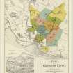
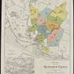
Plan of the Kilmahew Estate in 1919.
Collection of sale catalogues relating to Scottish estates
1919
© Courtesy of HES, Courtesy of HES (Estates Exchange collection)

SC 2148818
Estates Exchange, London. No.1494, Sale Brochure - map and photographs of Kilmahew Estate. Properties include Kilmahew House and Castle, Lodges, Farm and cottages together with Cairniedrouth Farm, Asker Farm, Kirkton Farm, Cardross Park, High and Low Milndovan Farms, Auchenfroe House, Golf Club House, Wallaceton Farm, Walton Farm, Craigend Farm and Auchensail Farm. Sepia photographs of Kilmahew House (2), Lodge, Cardross Park, Auchenfroe House, Kilmahew Golf House and Course. Also contains plan of Estate which identifies individual lots. November 1919
Collection of sale catalogues relating to Scottish estates
1919
© Courtesy of HES, Courtesy of HES (Estates Exchange collection)

SC 2148820
Estates Exchange, London. No.1494, Sale Brochure - map and photographs of Kilmahew Estate. Properties include Kilmahew House and Castle, Lodges, Farm and cottages together with Cairniedrouth Farm, Asker Farm, Kirkton Farm, Cardross Park, High and Low Milndovan Farms, Auchenfroe House, Golf Club House, Wallaceton Farm, Walton Farm, Craigend Farm and Auchensail Farm. Sepia photographs of Kilmahew House (2), Lodge, Cardross Park, Auchenfroe House, Kilmahew Golf House and Course. Also contains plan of Estate which identifies individual lots. November 1919
Collection of sale catalogues relating to Scottish estates
1919
© Courtesy of HES, Courtesy of HES (Estates Exchange collection)

SC 2148827
Estates Exchange, London. No.1494, Sale Brochure - map and photographs of Kilmahew Estate. Properties include Kilmahew House and Castle, Lodges, Farm and cottages together with Cairniedrouth Farm, Asker Farm, Kirkton Farm, Cardross Park, High and Low Milndovan Farms, Auchenfroe House, Golf Club House, Wallaceton Farm, Walton Farm, Craigend Farm and Auchensail Farm. Sepia photographs of Kilmahew House (2), Lodge, Cardross Park, Auchenfroe House, Kilmahew Golf House and Course. Also contains plan of Estate which identifies individual lots. November 1919
Collection of sale catalogues relating to Scottish estates
1919
© Courtesy of HES, Courtesy of HES (Estates Exchange collection)

SC 2148835
Estates Exchange, London. No.1494, Sale Brochure - map and photographs of Kilmahew Estate. Properties include Kilmahew House and Castle, Lodges, Farm and cottages together with Cairniedrouth Farm, Asker Farm, Kirkton Farm, Cardross Park, High and Low Milndovan Farms, Auchenfroe House, Golf Club House, Wallaceton Farm, Walton Farm, Craigend Farm and Auchensail Farm. Sepia photographs of Kilmahew House (2), Lodge, Cardross Park, Auchenfroe House, Kilmahew Golf House and Course. Also contains plan of Estate which identifies individual lots. November 1919
Collection of sale catalogues relating to Scottish estates
1919
© Courtesy of HES, Courtesy of HES (Estates Exchange collection)

SC 2148838
Estates Exchange, London. No.1494, Sale Brochure - map and photographs of Kilmahew Estate. Properties include Kilmahew House and Castle, Lodges, Farm and cottages together with Cairniedrouth Farm, Asker Farm, Kirkton Farm, Cardross Park, High and Low Milndovan Farms, Auchenfroe House, Golf Club House, Wallaceton Farm, Walton Farm, Craigend Farm and Auchensail Farm. Sepia photographs of Kilmahew House (2), Lodge, Cardross Park, Auchenfroe House, Kilmahew Golf House and Course. Also contains plan of Estate which identifies individual lots. November 1919
Collection of sale catalogues relating to Scottish estates
1919
© Courtesy of HES, Courtesy of HES (Estates Exchange collection)

SC 2148840
Estates Exchange, London. No.1494, Sale Brochure - map and photographs of Kilmahew Estate. Properties include Kilmahew House and Castle, Lodges, Farm and cottages together with Cairniedrouth Farm, Asker Farm, Kirkton Farm, Cardross Park, High and Low Milndovan Farms, Auchenfroe House, Golf Club House, Wallaceton Farm, Walton Farm, Craigend Farm and Auchensail Farm. Sepia photographs of Kilmahew House (2), Lodge, Cardross Park, Auchenfroe House, Kilmahew Golf House and Course. Also contains plan of Estate which identifies individual lots. November 1919
Collection of sale catalogues relating to Scottish estates
1919
© Courtesy of HES, Courtesy of HES (Estates Exchange collection)

SC 2148843
Estates Exchange, London. No.1494, Sale Brochure - map and photographs of Kilmahew Estate. Properties include Kilmahew House and Castle, Lodges, Farm and cottages together with Cairniedrouth Farm, Asker Farm, Kirkton Farm, Cardross Park, High and Low Milndovan Farms, Auchenfroe House, Golf Club House, Wallaceton Farm, Walton Farm, Craigend Farm and Auchensail Farm. Sepia photographs of Kilmahew House (2), Lodge, Cardross Park, Auchenfroe House, Kilmahew Golf House and Course. Also contains plan of Estate which identifies individual lots. November 1919
Collection of sale catalogues relating to Scottish estates
1919
© Courtesy of HES, Courtesy of HES (Estates Exchange collection)

SC 2148844
Estates Exchange, London. No.1494, Sale Brochure - map and photographs of Kilmahew Estate. Properties include Kilmahew House and Castle, Lodges, Farm and cottages together with Cairniedrouth Farm, Asker Farm, Kirkton Farm, Cardross Park, High and Low Milndovan Farms, Auchenfroe House, Golf Club House, Wallaceton Farm, Walton Farm, Craigend Farm and Auchensail Farm. Sepia photographs of Kilmahew House (2), Lodge, Cardross Park, Auchenfroe House, Kilmahew Golf House and Course. Also contains plan of Estate which identifies individual lots. November 1919
Collection of sale catalogues relating to Scottish estates
1919
© Courtesy of HES, Courtesy of HES (Estates Exchange collection)

SC 2148852
Estates Exchange, London. No.1494, Sale Brochure - map and photographs of Kilmahew Estate. Properties include Kilmahew House and Castle, Lodges, Farm and cottages together with Cairniedrouth Farm, Asker Farm, Kirkton Farm, Cardross Park, High and Low Milndovan Farms, Auchenfroe House, Golf Club House, Wallaceton Farm, Walton Farm, Craigend Farm and Auchensail Farm. Sepia photographs of Kilmahew House (2), Lodge, Cardross Park, Auchenfroe House, Kilmahew Golf House and Course. Also contains plan of Estate which identifies individual lots. November 1919
Collection of sale catalogues relating to Scottish estates
1919
© Courtesy of HES, Courtesy of HES (Estates Exchange collection)

SC 2148855
Estates Exchange, London. No.1494, Sale Brochure - map and photographs of Kilmahew Estate. Properties include Kilmahew House and Castle, Lodges, Farm and cottages together with Cairniedrouth Farm, Asker Farm, Kirkton Farm, Cardross Park, High and Low Milndovan Farms, Auchenfroe House, Golf Club House, Wallaceton Farm, Walton Farm, Craigend Farm and Auchensail Farm. Sepia photographs of Kilmahew House (2), Lodge, Cardross Park, Auchenfroe House, Kilmahew Golf House and Course. Also contains plan of Estate which identifies individual lots. November 1919
Collection of sale catalogues relating to Scottish estates
1919
© Courtesy of HES, Courtesy of HES (Estates Exchange collection)

SC 2148858
Estates Exchange, London. No.1494, Sale Brochure - map and photographs of Kilmahew Estate. Properties include Kilmahew House and Castle, Lodges, Farm and cottages together with Cairniedrouth Farm, Asker Farm, Kirkton Farm, Cardross Park, High and Low Milndovan Farms, Auchenfroe House, Golf Club House, Wallaceton Farm, Walton Farm, Craigend Farm and Auchensail Farm. Sepia photographs of Kilmahew House (2), Lodge, Cardross Park, Auchenfroe House, Kilmahew Golf House and Course. Also contains plan of Estate which identifies individual lots. November 1919
Collection of sale catalogues relating to Scottish estates
1919
© Courtesy of HES, Courtesy of HES (Estates Exchange collection)

SC 2148877
Estates Exchange, London. No.1494, Sale Brochure - map and photographs of Kilmahew Estate. Properties include Kilmahew House and Castle, Lodges, Farm and cottages together with Cairniedrouth Farm, Asker Farm, Kirkton Farm, Cardross Park, High and Low Milndovan Farms, Auchenfroe House, Golf Club House, Wallaceton Farm, Walton Farm, Craigend Farm and Auchensail Farm. Sepia photographs of Kilmahew House (2), Lodge, Cardross Park, Auchenfroe House, Kilmahew Golf House and Course. Also contains plan of Estate which identifies individual lots. November 1919
Collection of sale catalogues relating to Scottish estates
1919
© Courtesy of HES, Courtesy of HES (Estates Exchange collection)

SC 2148880
Estates Exchange, London. No.1494, Sale Brochure - map and photographs of Kilmahew Estate. Properties include Kilmahew House and Castle, Lodges, Farm and cottages together with Cairniedrouth Farm, Asker Farm, Kirkton Farm, Cardross Park, High and Low Milndovan Farms, Auchenfroe House, Golf Club House, Wallaceton Farm, Walton Farm, Craigend Farm and Auchensail Farm. Sepia photographs of Kilmahew House (2), Lodge, Cardross Park, Auchenfroe House, Kilmahew Golf House and Course. Also contains plan of Estate which identifies individual lots. November 1919
Collection of sale catalogues relating to Scottish estates
1919
© Courtesy of HES, Courtesy of HES (Estates Exchange collection)

DP 191163
Oblique aerial view of the fish trap, looking SSE.
RCAHMS Aerial Photography Digital
16/6/2014
© Crown Copyright: HES

SC 2148817
Estates Exchange, London. No.1494, Sale Brochure - map and photographs of Kilmahew Estate. Properties include Kilmahew House and Castle, Lodges, Farm and cottages together with Cairniedrouth Farm, Asker Farm, Kirkton Farm, Cardross Park, High and Low Milndovan Farms, Auchenfroe House, Golf Club House, Wallaceton Farm, Walton Farm, Craigend Farm and Auchensail Farm. Sepia photographs of Kilmahew House (2), Lodge, Cardross Park, Auchenfroe House, Kilmahew Golf House and Course. Also contains plan of Estate which identifies individual lots. November 1919
Collection of sale catalogues relating to Scottish estates
1919
© Courtesy of HES, Courtesy of HES (Estates Exchange collection)

SC 2148834
Estates Exchange, London. No.1494, Sale Brochure - map and photographs of Kilmahew Estate. Properties include Kilmahew House and Castle, Lodges, Farm and cottages together with Cairniedrouth Farm, Asker Farm, Kirkton Farm, Cardross Park, High and Low Milndovan Farms, Auchenfroe House, Golf Club House, Wallaceton Farm, Walton Farm, Craigend Farm and Auchensail Farm. Sepia photographs of Kilmahew House (2), Lodge, Cardross Park, Auchenfroe House, Kilmahew Golf House and Course. Also contains plan of Estate which identifies individual lots. November 1919
Collection of sale catalogues relating to Scottish estates
1919
© Courtesy of HES, Courtesy of HES (Estates Exchange collection)

SC 2148846
Estates Exchange, London. No.1494, Sale Brochure - map and photographs of Kilmahew Estate. Properties include Kilmahew House and Castle, Lodges, Farm and cottages together with Cairniedrouth Farm, Asker Farm, Kirkton Farm, Cardross Park, High and Low Milndovan Farms, Auchenfroe House, Golf Club House, Wallaceton Farm, Walton Farm, Craigend Farm and Auchensail Farm. Sepia photographs of Kilmahew House (2), Lodge, Cardross Park, Auchenfroe House, Kilmahew Golf House and Course. Also contains plan of Estate which identifies individual lots. November 1919
Collection of sale catalogues relating to Scottish estates
1919
© Courtesy of HES, Courtesy of HES (Estates Exchange collection)

SC 2148848
Estates Exchange, London. No.1494, Sale Brochure - map and photographs of Kilmahew Estate. Properties include Kilmahew House and Castle, Lodges, Farm and cottages together with Cairniedrouth Farm, Asker Farm, Kirkton Farm, Cardross Park, High and Low Milndovan Farms, Auchenfroe House, Golf Club House, Wallaceton Farm, Walton Farm, Craigend Farm and Auchensail Farm. Sepia photographs of Kilmahew House (2), Lodge, Cardross Park, Auchenfroe House, Kilmahew Golf House and Course. Also contains plan of Estate which identifies individual lots. November 1919
Collection of sale catalogues relating to Scottish estates
1919
© Courtesy of HES, Courtesy of HES (Estates Exchange collection)

SC 2148851
Estates Exchange, London. No.1494, Sale Brochure - map and photographs of Kilmahew Estate. Properties include Kilmahew House and Castle, Lodges, Farm and cottages together with Cairniedrouth Farm, Asker Farm, Kirkton Farm, Cardross Park, High and Low Milndovan Farms, Auchenfroe House, Golf Club House, Wallaceton Farm, Walton Farm, Craigend Farm and Auchensail Farm. Sepia photographs of Kilmahew House (2), Lodge, Cardross Park, Auchenfroe House, Kilmahew Golf House and Course. Also contains plan of Estate which identifies individual lots. November 1919
Collection of sale catalogues relating to Scottish estates
1919
© Courtesy of HES, Courtesy of HES (Estates Exchange collection)

SC 2148857
Estates Exchange, London. No.1494, Sale Brochure - map and photographs of Kilmahew Estate. Properties include Kilmahew House and Castle, Lodges, Farm and cottages together with Cairniedrouth Farm, Asker Farm, Kirkton Farm, Cardross Park, High and Low Milndovan Farms, Auchenfroe House, Golf Club House, Wallaceton Farm, Walton Farm, Craigend Farm and Auchensail Farm. Sepia photographs of Kilmahew House (2), Lodge, Cardross Park, Auchenfroe House, Kilmahew Golf House and Course. Also contains plan of Estate which identifies individual lots. November 1919
Collection of sale catalogues relating to Scottish estates
1919
© Courtesy of HES, Courtesy of HES (Estates Exchange collection)

SC 2148870
Estates Exchange, London. No.1494, Sale Brochure - map and photographs of Kilmahew Estate. Properties include Kilmahew House and Castle, Lodges, Farm and cottages together with Cairniedrouth Farm, Asker Farm, Kirkton Farm, Cardross Park, High and Low Milndovan Farms, Auchenfroe House, Golf Club House, Wallaceton Farm, Walton Farm, Craigend Farm and Auchensail Farm. Sepia photographs of Kilmahew House (2), Lodge, Cardross Park, Auchenfroe House, Kilmahew Golf House and Course. Also contains plan of Estate which identifies individual lots. November 1919
Collection of sale catalogues relating to Scottish estates
1919
© Courtesy of HES, Courtesy of HES (Estates Exchange collection)

SC 2148871
Estates Exchange, London. No.1494, Sale Brochure - map and photographs of Kilmahew Estate. Properties include Kilmahew House and Castle, Lodges, Farm and cottages together with Cairniedrouth Farm, Asker Farm, Kirkton Farm, Cardross Park, High and Low Milndovan Farms, Auchenfroe House, Golf Club House, Wallaceton Farm, Walton Farm, Craigend Farm and Auchensail Farm. Sepia photographs of Kilmahew House (2), Lodge, Cardross Park, Auchenfroe House, Kilmahew Golf House and Course. Also contains plan of Estate which identifies individual lots. November 1919
Collection of sale catalogues relating to Scottish estates
1919
© Courtesy of HES, Courtesy of HES (Estates Exchange collection)

SC 2148875
Estates Exchange, London. No.1494, Sale Brochure - map and photographs of Kilmahew Estate. Properties include Kilmahew House and Castle, Lodges, Farm and cottages together with Cairniedrouth Farm, Asker Farm, Kirkton Farm, Cardross Park, High and Low Milndovan Farms, Auchenfroe House, Golf Club House, Wallaceton Farm, Walton Farm, Craigend Farm and Auchensail Farm. Sepia photographs of Kilmahew House (2), Lodge, Cardross Park, Auchenfroe House, Kilmahew Golf House and Course. Also contains plan of Estate which identifies individual lots. November 1919
Collection of sale catalogues relating to Scottish estates
1919
© Courtesy of HES, Courtesy of HES (Estates Exchange collection)

SC 2148881
Estates Exchange, London. No.1494, Sale Brochure - map and photographs of Kilmahew Estate. Properties include Kilmahew House and Castle, Lodges, Farm and cottages together with Cairniedrouth Farm, Asker Farm, Kirkton Farm, Cardross Park, High and Low Milndovan Farms, Auchenfroe House, Golf Club House, Wallaceton Farm, Walton Farm, Craigend Farm and Auchensail Farm. Sepia photographs of Kilmahew House (2), Lodge, Cardross Park, Auchenfroe House, Kilmahew Golf House and Course. Also contains plan of Estate which identifies individual lots. November 1919
Collection of sale catalogues relating to Scottish estates
1919
© Courtesy of HES, Courtesy of HES (Estates Exchange collection)

SC 2148882
Estates Exchange, London. No.1494, Sale Brochure - map and photographs of Kilmahew Estate. Properties include Kilmahew House and Castle, Lodges, Farm and cottages together with Cairniedrouth Farm, Asker Farm, Kirkton Farm, Cardross Park, High and Low Milndovan Farms, Auchenfroe House, Golf Club House, Wallaceton Farm, Walton Farm, Craigend Farm and Auchensail Farm. Sepia photographs of Kilmahew House (2), Lodge, Cardross Park, Auchenfroe House, Kilmahew Golf House and Course. Also contains plan of Estate which identifies individual lots. November 1919
Collection of sale catalogues relating to Scottish estates
1919
© Courtesy of HES, Courtesy of HES (Estates Exchange collection)














- Council Argyll And Bute
- Parish Cardross (Argyll And Bute)
- Former Region Strathclyde
- Former District Dumbarton
- Former County Dunbartonshire
NS37NW 27 3161 7913 to 3187 7921
Formerly entered in error as NT37NW 27 (Auchinfroe House) which duplicated NS37NW 22
NS 3170 7922. An old fish yair is depicted on the current edition of the OS 1:10000 scale map (1991), running in a NE direction from the shore below the Hill of Ardmore above the mean low water springs.
Information from RCAHMS (DE) March 1999.
Note (March 1999)
Formerly entered in error as NT37NW 27 (Auchinfroe House) which duplicated NS37NW 22
NS 3170 7922. An old fish yair is depicted on the current edition of the OS 1:10000 scale map (1991), running in a NE direction from the shore below the Hill of Ardmore above the mean low water springs.
Information from RCAHMS (DE) March 1999.
Desk Based Assessment (19 June 2017)
This L-shaped fish trap comprises a low spread of rubble up to 8m in thickness that extends 210m NE from the inter-tidal shore below the Hill of Ardmore before turning and running a further 110m to the SE. The trap is depicted on the 1st edition of the OS 25-inch map (Dumbartonshire 1865, Sheet XVII.14), at which time it may have still been in use. However, the 2nd edition of the map (1898, Sheet 017.1) annotates it ‘Old Fish Yair’, indicating that by that time it was no longer in use.
Information from HES Survey and Recording (AMcC) 19 June 2017.


