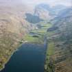
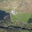
Cairndow, River Fyne Bridge
Graffiti(S) (Post Medieval), Road Bridge (18th Century)
Site Name Cairndow, River Fyne Bridge
Classification Graffiti(S) (Post Medieval), Road Bridge (18th Century)
Alternative Name(s) Loch Fyne; Achadunan, Cairndow Bridge
Canmore ID 125384
Site Number NN11SE 11
NGR NN 19471 12713
Datum OSGB36 - NGR
Permalink http://canmore.org.uk/site/125384
- Council Argyll And Bute
- Parish Lochgoilhead And Kilmorich
- Former Region Strathclyde
- Former District Argyll And Bute
- Former County Argyll
NN11SE 11 19447 12713
This fine old bridge carries the old road over the River Fyne.
W Taylor 1976.
This bridge carries the former line of the A83 (T) public road (the successor to military road MR 7) across the River Fyne at the head of Loch Fyne. It has been supersed by a new bridge immediately to the SW.
Information from RCAHMS (RJCM), 29 July 1998.
NN11SE 11 1945 1271
River Fyne Bridge, c.1745.
Visited and photographed by J R Hume, Strathclyde University, 10 May 1976.
Information from NMRS MS/749/79.
NMRS REFERENCE
NMRS Inventory to John Warren drawings - typescript (R6P46).
Field Visit (July 1988)
This four-arched bridge, which carried the Military Road from Dumbarton to Inveraray (No. 264) across the River Fyne about 400m from the head of Loch Fyne, has recently been bypassed by a new bridge 150m downstream carrying the A83, but is still used for access to estate roads in GlenFyne (en.1*).
The siting of the river-crossing was the subject of disagreement with the local proprietor, Sir James Campbell of Ardkinglas, in 1747, and he insisted on a site on or close to the present one, where a bridge was probably built in the following year. An undated drawing of 'Loch Fine-head Bridge' shows a causeway 180m long incorporating, at the centre and one end, bridges of 7.3m span, and at the other end a bridge with segmental arch 18.3m in span and about6.8m high (en.2). The existing bridge, however, is probably that build in 1754 by John Brown, the master mason who was subsequently contractor for the 'King's Bridge' over the Aray (No. 255) and the bridge at Kilblaan (No. 272) (en.3). It was reported following the great storm of 1772 (see No. 255) that 'both the great bridges at the head of Loch Fine were greatly damaged', and Robert Mylne surveyed the Garron Bridge(No. 268) and 'one at the head of Loch Fine' a few days later (en.4). In contrast to the Aray Bridge (No. 255), however, no major expenditure is recorded in the Commons' Journals.
The bridge is 83m in overall length, including a SE approach with curving revetment-walls, and is of four segmental arches 9.8m in span and 3.3m above water-level, the height to the parapet being 5.2m; the roadway is 4.2mwide within parapets O.4m thick. The three freestanding piers have triangular cutwaters, bevelled at the fronts and sides to form buttresses carrying rectangular refuges. The masonry is of rubble, but the cutwaters and arch-ingoes up to springing-level are of sandstone ashlar, and polished schist ashlar bearing masons' marks is used for the arch-voussoirs and their enclosing bands, and the bevelled tops of the cutwaters.
The schist coping-slabs bear a remarkable number of graffiti, including the dates 1766 and 1805 and a long series of later dates and initials. Other motifs are: numerous hands, both outlined and sunk, usually left hands and often in pairs(cf. No. 279); feet, all shod; hearts; boats; a hammer; horseshoes; a horse; a thistle, and a human head in pointed cap.
RCAHMS 1992, visited July 1988


