
Bute, Cat Craig


Bloomery Mound (Post Medieval), Pen (19th Century)
Site Name Bute, Cat Craig
Classification Bloomery Mound (Post Medieval), Pen (19th Century)
Alternative Name(s) Corval 2
Canmore ID 124797
Site Number NR97SE 38
NGR NR 99556 72531
Datum OSGB36 - NGR
Permalink http://canmore.org.uk/site/124797


- Council Argyll And Bute
- Parish North Bute
- Former Region Strathclyde
- Former District Argyll And Bute
- Former County Buteshire
NR97SE 38 99556 72531
Corval 1: mound, enclosure, Corval 2: hut circle.
Sponsor: Buteshire Natural History Society
A C Hannah and E V W Proudfoot 1995
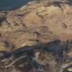
NR 995 725 Mound: Located 100m SE of wooden sheepfold between Barlia and Corval Hill. Rather amorphous sub-circular mound just inside the stone and turf dyke that encloses a sub-circular area of former arable land E of site. This is possibly a large clearance cairn. There is also a small stone structure against rock face 100m ENE of mound (lambing pen, probably 19th century).
Information from Bute Natural History Society Deserted Settlement Survey (1991-9)
(RCAHMS WP000273)
Field Visit (1991 - 1999)
Corval 1: mound, enclosure, Corval 2: hut circle.
Sponsor: Buteshire Natural History Society
A C Hannah and E V W Proudfoot 1995
NR 995 725 Mound: Located 100m SE of wooden sheepfold between Barlia and Corval Hill. Rather amorphous sub-circular mound just inside the stone and turf dyke that encloses a sub-circular area of former arable land E of site. This is possibly a large clearance cairn. There is also a small stone structure against rock face 100m ENE of mound (lambing pen, probably 19th century).
Information from Bute Natural History Society Deserted Settlement Survey (1991-9)
(RCAHMS WP000273)
Field Visit (16 June 2009)
NR97SE 38 99556 72531
This bloomery mound is situated in rough ground at the edge of a formerly cultivated field, some 110m SE of a modern sheepfold and 45m NE of a burnt mound (NR97SE 77). It measures about 6m in diameter by 0.5m in height and the removal of a turf from its top revealed a core containing slag. The small pen referred in the previous account is situated 60m to the NE at NR 99598 72573.
Visited by RCAHMS (AGCH, GB, DM) 16 June 2009.

