 |
On-line Digital Images |
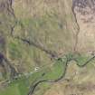
DP 111890 |
RCAHMS Aerial Photography Digital |
General oblique aerial view of the remains of field systems, head dykes, a sheepfold and township in Glen More, E of Glenelg, taken from the SSW. |
1/5/2011 |
Item Level |
|
 |
On-line Digital Images |
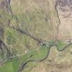
DP 111891 |
RCAHMS Aerial Photography Digital |
General oblique aerial view of the remains of field systems, head dykes, a sheepfold and township in Glen More, E of Glenelg, taken from the SSW. |
1/5/2011 |
Item Level |
|
 |
On-line Digital Images |
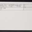
SC 2360670 |
Records of the Ordnance Survey, Southampton, Hampshire, England |
Glen More, NG82SW 8, Ordnance Survey index card, Recto |
c. 1958 |
Item Level |
|
 |
On-line Digital Images |
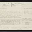
SC 2360671 |
Records of the Ordnance Survey, Southampton, Hampshire, England |
Glen More, NG82SW 8, Ordnance Survey index card, page number 1, Recto |
c. 1958 |
Item Level |
|
 |
On-line Digital Images |
SC 2360672 |
Records of the Ordnance Survey, Southampton, Hampshire, England |
Glen More, NG82SW 8, Ordnance Survey index card, page number 2, Verso |
c. 1958 |
Item Level |
|
|
All Other |
551 166/1/1 |
Records of the Ordnance Survey, Southampton, Hampshire, England |
Archaeological site card index ('495' cards) |
1947 |
Sub-Group Level |
|


