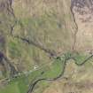
Glen More
Cairn (Period Unassigned)
Site Name Glen More
Classification Cairn (Period Unassigned)
Canmore ID 11879
Site Number NG82SW 8
NGR NG 8467 2012
Datum OSGB36 - NGR
Permalink http://canmore.org.uk/site/11879
- Council Highland
- Parish Glenelg (Skye And Lochalsh)
- Former Region Highland
- Former District Skye And Lochalsh
- Former County Inverness-shire
NG82SW 8 8467 2012.
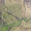
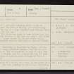
Traces of a circular building about 13 yds in diameter lie near the farm of Beolary (now Scallascaig - NG 8420), on the top of a high alluvial bank through which the river has cut its way.
Half of the structure seems to have fallen into the river due to the erosion of the bank and only a few stones remain on top. Large stones lie in the stream below. (APs indicate that NG 8467 2012 is the most likely site).(Visible on RAF air photograph CPE.Scot.UK 288: 4062-3)
L Bogle 1895.
NG 8467 2012: Generally as described by Bogle. At the site are a few large earthfast stones - too few to give any indication of size of structure or what it was. The site is quite a logical one for a small dun and the bank or ridge on which it lies is known locally as "Cnoc a' Chaisteil".(A MacKenzie. Allt-Mhor, Glenelg)
Visited by OS (W D J) 6 October 1966.
The remains of a cairn, not a dun on the point of a glacial spur. All that survives is the W arc, consisting of a grassy mound 0.5m high with one or two boulders of a kerb, mostly displaced, suggesting an original diameter of 12.5m.
Surveyed at 1:2500 scale.
Visited by OS (A A) 19 June 1974.


