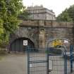
Edinburgh, Canonmills, Scotland Street Station
Railway Station (19th Century), Railway Tunnel (19th Century)
Site Name Edinburgh, Canonmills, Scotland Street Station
Classification Railway Station (19th Century), Railway Tunnel (19th Century)
Alternative Name(s) Royal Crescent; Caledonia Street; Leith And Newhaven Railway; Scotland Street Goods Depot; Station
Canmore ID 116874
Site Number NT27SE 1297
NGR NT 25473 74841
Datum OSGB36 - NGR
Permalink http://canmore.org.uk/site/116874
- Council Edinburgh, City Of
- Parish Edinburgh (Edinburgh, City Of)
- Former Region Lothian
- Former District City Of Edinburgh
- Former County Midlothian
NT27SE 1297.00 25473 74841
For Rodney Street Tunnel (NT27SE 4862.00: essentially a continuation to the N), see NT27SE 4862.00.
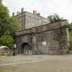
NT27SE 1297.01 NT 25463 74825 North Portal
Leith and Newhaven Railway, Scotland Street Tunnel - line between Edinburgh and Newhaven opened 1846.
(Undated) information in NMRS.
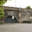
(Location cited as NT 254 748 to NT 257 740). Scotland Street Tunnel, Canonmills, opened 1847 by the Edinburgh, Leith and Granton Rly: engineers Grainger and Miller. Constructed on a gradient of 1 in 27 and worked by cable haulage. Closed since 1968, but still intact. The southern entrance is obscured, but the monumental northern portal is still visible.
J R Hume 1976.
The location assigned to this record is an interpolated estimate of the midpoint of the length. The N portal (NT27SE 1297.01) survives intact, but the S end is represented by a grated entrance opposite platform 19 within the NW part of Waverley Station (NT27SE 221.00). A prominent sign-plate records the significance of this feature, which need not be the original portal. In the absence of a verified location or appropriate map evidence, a location at NT c. 2570 7387 is assigned.
Information from RCAHMS (RJCM), 16 May 2006.
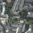
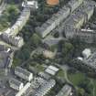
The remains of the station are situated below the N end of Scotland Street. The platforms and former goods depot are now incorporated into the Scotland Street Childrens playground.
A further section of tunnel running under Rodney Street, now partially blocked by earth and rubbish, continued through to Heriothill where a footpath/cycleway using the former trackbed starts. Both portals of this tunnel survive.
There are plans to extend the parthway through the tunnel by clearing the rubble.
Visited by RCAHMS (DE), December 2006


