Scheduled Maintenance
Please be advised that this website will undergo scheduled maintenance on the following dates: •
Tuesday 12th November from 11:00-15:00 & Thursday 14th November from 11:00-15:00
During these times, some services may be temporarily unavailable. We apologise for any inconvenience this may cause.
Keiss
Pillbox (20th Century)
Site Name Keiss
Classification Pillbox (20th Century)
Alternative Name(s) Wic 102; Keiss Harbour, Pillbox
Canmore ID 115450
Site Number ND36SE 43
NGR ND 35367 61089
Datum OSGB36 - NGR
Permalink http://canmore.org.uk/site/115450
- Council Highland
- Parish Wick
- Former Region Highland
- Former District Caithness
- Former County Caithness
ND36SE 43 35367 61089
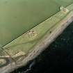
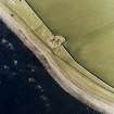
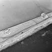
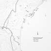
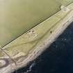
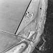
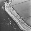
ND 3540 6115. Pillbox, Keiss. Dimensions: hexagonal, N-S side 4.95m, E-W sides c 3m, height 1.25-2.3m. Complete, but with some superficial damage. Located at the beach head. SE aspect.
C E Batey, Caithness Coastal Survey, 1981
A type 24 brick and concrete pillbox is situated on the shore N of Keiss Harbour.
J Guy 2000; NMRS MS 810/10, Vol.1, 20, Vol.3, 22
This type 24 pillbox is visible on RAF vertical air photographs (106G/Scot/UK 75, 3003-3004, flown 9 May 1946), situated just above the high water mark about 56m ENE of Keiss Broch (ND36SE 2)
Information from RCAHMS (DE), October 2004
Project (1980 - 1982)
Field Visit (1981)
ND 3540 6115. Pillbox, Keiss. Dimensions: hexagonal, N-S side 4.95m, E-W sides c 3m, height 1.25-2.3m. Complete, but with some superficial damage. Located at the beach head. SE aspect.
C E Batey, Caithness Coastal Survey, 1981


