
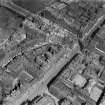
Edinburgh, 215 High Street


Shop (19th Century), Tenement (18th Century)
Site Name Edinburgh, 215 High Street
Classification Shop (19th Century), Tenement (18th Century)
Alternative Name(s) Lyon's Close; Old Stamp House Close
Canmore ID 115336
Site Number NT27SE 1135
NGR NT 25851 73676
Datum OSGB36 - NGR
Permalink http://canmore.org.uk/site/115336

- Council Edinburgh, City Of
- Parish Edinburgh (Edinburgh, City Of)
- Former Region Lothian
- Former District City Of Edinburgh
- Former County Midlothian
Lyon's Close is shown on Edgar 1742 and was also known as Stalker's Close before 1756; but the derivations of both names are abscure. In 1581, at the King's request, his master cook John Lyoun was admitted burgess and gild brother; and in 1695 a mariner, Patrick Lyon, was likewise admitted, this having been made one of the conditions of a gift of five thousand pounds to Heriot's Hospital by Robert Sandilands. (from Stuart Harris, "Place Names of Edinburgh", 1996, page 412)
Watching Brief (October 2018 - November 2018)
NT 2584 7367 A watching brief was undertaken during repairs to a retaining wall. The remains of two buildings that once occupied the site, and part of North Foulis Close which ran between them, were identified buried below the current courtyard. It appears that after the buildings were demolished the walls were used to form foundations for retaining walls. This area was filled by made ground, thus creating the current courtyard.
The buildings are likely to be 17/18th century in date. They were present as depicted on the 1896 OS map, and buildings are shown on earlier maps, such as Rothiemay’s plan. They were gone by the 1908 OS map, so the buildings were clearly demolished and the courtyard created in the short period between the publication of the two OS maps.
No internal surfaces were identified in the buildings and no deposits relating to the occupation or use of these structures were identified. All finds recovered on site came from 20th century made ground.
Archive: NRHE (intended)
Funder: Maxi Construction Limited
Infomration from Bethan Gray (CFA Archaeology Ltd) January 2019. OASIS ID: cfaarcha1-335013
(Source: DES Vol 20)

