Aberdeen, Seaton, St Ninian's Place
Point Block(S) (20th Century)
Site Name Aberdeen, Seaton, St Ninian's Place
Classification Point Block(S) (20th Century)
Alternative Name(s) Aberdeen, Seaton 'a'
Canmore ID 115228
Site Number NJ90NW 338
NGR NJ 94499 09000
Datum OSGB36 - NGR
Permalink http://canmore.org.uk/site/115228
- Council Aberdeen, City Of
- Parish Aberdeen
- Former Region Grampian
- Former District City Of Aberdeen
- Former County Aberdeenshire
NJ90NW 338 9450 0900.
Previously recorded as .
(Location cited [incorrectly] as NJ 944 909). High-rise flats. Air photographs: AAS/97/97/CT.
NMRS, MS/712/29.
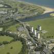
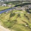
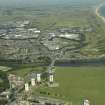
Four residential tower blocks have been recorded from aerial photographs (RCAHMSAP 1994, 1996) at St Ninian's Place just N of Seaton, Aberdeen. The housing development is also depicted on the current edition of the OS 1:10 000 map (no date).
Information from RCAHMS (JH) 18 June 1998
Construction (1969 - 5 February 1971)
A public housing development of four seventeen-storey point blocks at Seaton for Aberdeen Borough Council. One of several similar developments in this area, the contract for this grouping was known as Seaton 'A'. The blocks contain 296 dwellings in total. The Bison industiralised building system was used for construction.The contractor for the development was Bett.
Glendinning and Methusius 1994
Photographic Record (January 1983)
Photo taken by Dr Miles Glendinning for research purposes.
Photographic Record (1985)
Photo taken by Dr Miles Glendinning for research purposes.
Change Of Classification (5 March 2009)
A more specific classification has been used.


