Scheduled Maintenance
Please be advised that this website will undergo scheduled maintenance on the following dates: •
Tuesday 3rd December 11:00-15:00
During these times, some services may be temporarily unavailable. We apologise for any inconvenience this may cause.
Fearn Airfield, Operations Block
Operations Block (20th Century)
Site Name Fearn Airfield, Operations Block
Classification Operations Block (20th Century)
Alternative Name(s) Hms Owl; Loans Of Rarichie
Canmore ID 114475
Site Number NH87NW 21.10
NGR NH 85235 76303
Datum OSGB36 - NGR
Permalink http://canmore.org.uk/site/114475
- Council Highland
- Parish Fearn
- Former Region Highland
- Former District Ross And Cromarty
- Former County Ross And Cromarty
NH87NW 21.10 85235 76303
N.B. Site falls on sheet NH87NE
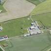
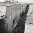
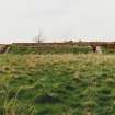
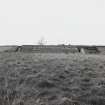
Some 50m to the NW of the junction of the entrance to the airfield with the public B 9166 road to Balintore is the operations block. Built of brick and concrete, it is set into the ground with two external corriders , one to the rear and the other at the front, created in the space between a revetted bank and the sunken building. Internally there is a central corridor with a series of offices and rooms set off at right angles. Toilets were noted at each end of the corridor.
The operations block at Fearn is similar to one found at Arbroath Airfield (NO64SW 29).
Visited by RCAHMS (DE) January and May 1997


