
Following the launch of trove.scot in February 2025 we are now planning the retiral of some of our webservices. Canmore will be switched off on 24th June 2025. Information about the closure can be found on the HES website: Retiral of HES web services | Historic Environment Scotland
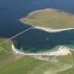
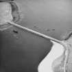
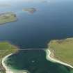
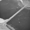
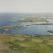
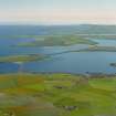
Churchill Barrier No. 3, Glimps Holm To Burray


Causeway (20th Century)
Site Name Churchill Barrier No. 3, Glimps Holm To Burray
Classification Causeway (20th Century)
Alternative Name(s) Scapa Flow; Churchill Causeway; Weddell Sound
Canmore ID 112588
Site Number ND49NE 16
NGR ND 4738 9848
NGR Description ND 4730 9870 to ND 4744 9833
Datum OSGB36 - NGR
Permalink http://canmore.org.uk/site/112588


- Council Orkney Islands
- Parish South Ronaldsay
- Former Region Orkney Islands Area
- Former District Orkney
- Former County Orkney
ND49NE 16 4738 9848 (ND 4730 9870 to ND 4744 9833)
See also:
ND49NW 2 ND 4412 9670 to ND 4452 9641 Hunda Reef Barrier
HY40SE 25 HY 4840 0126 to HY 4848 0069 Churchill Barrier No. 1, Mainland to Lamb Holm (Kirk Sound)
ND49NE 15 ND 4822 9999 to ND 4785 9952 Churchill Barrier No. 2, Lamb Holm to Glimps Holm (Holm Sound)
ND49NE 17 ND 4802 9543 to ND 4770 9495 Churchill Barrier No. 4, Burray To South Ronaldsay (Water Sound)
See also corresponding (predecessor) blockships:
ND49NE 8010 Reginald
ND49NE 8011 Martis
ND49NE 8012 Gartshore
ND49NE 8013 Lapland
ND49NE 8001 Empire Seamen
Churchill Causeway No 3 [NAT]
OS 1:10,000 map, 1985.
ND 474 983 WWI and II sea defences: Churchill barrier No 3 and block ships (Gartshore, Empire Seaman, Lapland, Martis, Reginald).
Sponsors: Historic Scotland, Orkney Archaeological Trust
G Wilson and H Moore 1997.
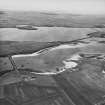
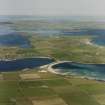
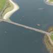
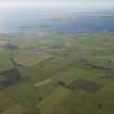
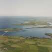
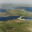
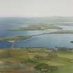
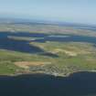
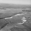
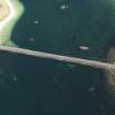
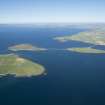
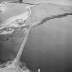
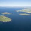
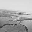
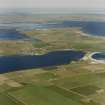
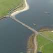
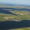
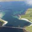
This causeway carries the A961 public road across Weddell Sound, between Glimps Holm and Burray. Weddell Sound is the second most southerly of the four sounds on the E side of Scapa Flow.
Information from RCAHMS (RJCM), 10 May 2006.
Field Visit (August 1997)
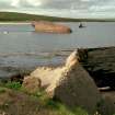
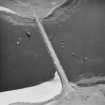
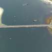
Barrier # 3 joins Glimps Holm to Burray, forming one link in the chain of artificial coastal defences which connects Orkney Mainland to the islands of Lamb Holm, Glimps Holm, Burray and South Ronaldsay. These barriers were built during WWII to block off the eastern approaches to Scapa Flow which served as the base of the British Home Fleet. The barriers were constructed by Italian prisoners of war from numerous five to ten ton concrete blocks set on rubble foundations, laid onto the sea bed. After the war, a road surface was laid over the barriers, creating a causeway which forms part of the A961 road between St. Mary's Holm (Mainland) and St. Margaret's Hope (South Ronaldsay).
Moore and Wilson, 1997
Coastal Zone Assessment Survey
Field Visit (August 1997)
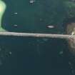
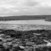
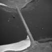
Parts of four containers lie strewn about the foreshore, at the HWM, to the E side of Churchill Barrier #3. They each measure 1.5m3 and are constructed from railway sleepers with a sheet metal lining - some have metal chains at their corners. They appear to be fragments of the moulds which were used in the construction of the concrete blocks for the Churchill Barriers.
Moore and Wilson, 1997
Coastal Zone Assessment Survey

