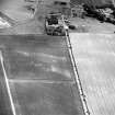
|
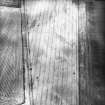
Photographs and Off-line Digital Images |
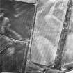
C 10737 |
RCAHMS Aerial Photography |
Oblique aerial view. |
1993 |
Item Level |
|
|
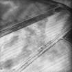
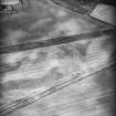
Photographs and Off-line Digital Images |
C 10738 |
RCAHMS Aerial Photography |
Oblique aerial view. |
1993 |
Item Level |
|
|
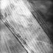
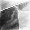
Photographs and Off-line Digital Images |
C 10739 |
RCAHMS Aerial Photography |
Oblique aerial view. |
1993 |
Item Level |
|
|
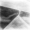
Photographs and Off-line Digital Images |
C 10740 |
RCAHMS Aerial Photography |
Oblique aerial view. |
1993 |
Item Level |
|
|
Photographs and Off-line Digital Images |
C 27358 |
RCAHMS Aerial Photography |
Oblique aerial view. |
28/6/1994 |
Item Level |
|
|
Photographs and Off-line Digital Images |
C 27359 |
RCAHMS Aerial Photography |
Oblique aerial view. |
28/6/1994 |
Item Level |
|
|
Photographs and Off-line Digital Images |
C 27360 |
RCAHMS Aerial Photography |
Oblique aerial view. |
28/6/1994 |
Item Level |
|
|
Photographs and Off-line Digital Images |
C 27361 |
RCAHMS Aerial Photography |
Oblique aerial view. |
28/6/1994 |
Item Level |
|
|
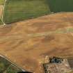
Photographs and Off-line Digital Images |
C 52033 |
RCAHMS Aerial Photography |
Inverpeffer and East Haven Airfield, oblique aerial view, taken from the E, centred on various linear cropmarks. A possible rectilinear enclosure is visible in the bottom left-hand corner of the photograph, and a disused runway runs across the top half. |
7/7/1995 |
Item Level |
|
|
Photographs and Off-line Digital Images |
C 52034 |
RCAHMS Aerial Photography |
Inverpeffer and East Haven Airfield, oblique aerial view, taken from the NNE, centred on various linear cropmarks. Cropmarks of a possible rectilinear enclosure and rig are visible in the centre left of the photograph, and a disused runway runs up the right half. |
7/7/1995 |
Item Level |
|
|
Photographs and Off-line Digital Images |
C 46853 |
RCAHMS Aerial Photography |
Inverpeffer, oblique aerial view, taken from the SSE, centred on linear cropmarks and the cropmarks of a farmsteading and rig. |
4/7/1995 |
Item Level |
|
 |
On-line Digital Images |
DP 091468 |
RCAHMS Aerial Photography Digital |
Oblique aerial view of the cropmarks of the buildings at the former airfield, looking to the SSE. |
18/7/2010 |
Item Level |
|
 |
On-line Digital Images |
SC 1719638 |
RCAHMS Aerial Photography |
Oblique aerial view. |
28/6/1994 |
Item Level |
|
 |
On-line Digital Images |
SC 1859272 |
RCAHMS Aerial Photography |
Oblique aerial view. |
1993 |
Item Level |
|
 |
On-line Digital Images |
SC 1859273 |
RCAHMS Aerial Photography |
Oblique aerial view. |
1993 |
Item Level |
|
 |
On-line Digital Images |
SC 1859274 |
RCAHMS Aerial Photography |
Oblique aerial view. |
1993 |
Item Level |
|
 |
On-line Digital Images |
SC 1859275 |
RCAHMS Aerial Photography |
Oblique aerial view. |
1993 |
Item Level |
|
 |
On-line Digital Images |
SC 1859323 |
RCAHMS Aerial Photography |
Oblique aerial view. |
28/6/1994 |
Item Level |
|
 |
On-line Digital Images |
SC 1859324 |
RCAHMS Aerial Photography |
Oblique aerial view. |
28/6/1994 |
Item Level |
|
 |
On-line Digital Images |
SC 1859325 |
RCAHMS Aerial Photography |
Oblique aerial view. |
28/6/1994 |
Item Level |
|
 |
On-line Digital Images |
SC 1859326 |
RCAHMS Aerial Photography |
Oblique aerial view. |
28/6/1994 |
Item Level |
|
 |
On-line Digital Images |
SC 1859358 |
RCAHMS Aerial Photography |
Inverpeffer, oblique aerial view, taken from the SSE, centred on linear cropmarks and the cropmarks of a farmsteading and rig. |
4/7/1995 |
Item Level |
|
 |
On-line Digital Images |
SC 1859361 |
RCAHMS Aerial Photography |
Inverpeffer and East Haven Airfield, oblique aerial view, taken from the E, centred on various linear cropmarks. A possible rectilinear enclosure is visible in the bottom left-hand corner of the photograph, and a disused runway runs across the top half. |
7/7/1995 |
Item Level |
|
 |
On-line Digital Images |
SC 1859362 |
RCAHMS Aerial Photography |
Inverpeffer and East Haven Airfield, oblique aerial view, taken from the NNE, centred on various linear cropmarks. Cropmarks of a possible rectilinear enclosure and rig are visible in the centre left of the photograph, and a disused runway runs up the right half. |
7/7/1995 |
Item Level |
|


