
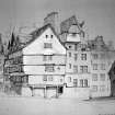
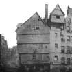
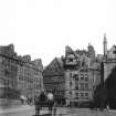
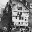
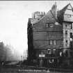
Edinburgh, 332 - 334 Lawnmarket


Shop (19th Century), Tenement (19th Century)
Site Name Edinburgh, 332 - 334 Lawnmarket
Classification Shop (19th Century), Tenement (19th Century)
Canmore ID 112302
Site Number NT27SE 664
NGR NT 25535 73537
Datum OSGB36 - NGR
Permalink http://canmore.org.uk/site/112302


- Council Edinburgh, City Of
- Parish Edinburgh (Edinburgh, City Of)
- Former Region Lothian
- Former District City Of Edinburgh
- Former County Midlothian

