Scheduled Maintenance
Please be advised that this website will undergo scheduled maintenance on the following dates: •
Tuesday 3rd December 11:00-15:00
During these times, some services may be temporarily unavailable. We apologise for any inconvenience this may cause.
Skye, Dun Garsin
Broch (Iron Age)(Possible)
Site Name Skye, Dun Garsin
Classification Broch (Iron Age)(Possible)
Canmore ID 11047
Site Number NG33NE 1
NGR NG 3609 3878
Datum OSGB36 - NGR
Permalink http://canmore.org.uk/site/11047
- Council Highland
- Parish Bracadale
- Former Region Highland
- Former District Skye And Lochalsh
- Former County Inverness-shire
NG33NE 1 3609 3878.
(NG 3609 3878) Dun Garsin (NAT) Fort (NR) (Remains of)
OS 6"map, Inverness-shire, 2nd ed., (1904)
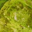
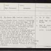
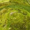
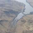
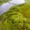
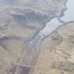
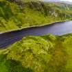
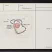
Dun Garsin, a probable broch, occupies a commanding position on a table-topped hill above Loch Beag. On the NNW, from which direction it is accessible, it rises in rocky escarpments and terraces about 35' above a narrow valley with higher ground beyond. Destruction has been thorough, the stones being removed to build the revetment on the side of the road to Sligachan many years ago. Faint traces of the outer wall or parapet which enclosed the summit can be detected in places, forming an irregular oval some 150' NE-SW and some 105' NW-SE. In the NNE sector are the remains of what was probably a broch some 55' in diameter externally, now showing as a shapeless bank of stones and earth about 14' broad and 3' high, enclosing a circular space; on the SSE some 6' of walling with one or two courses in position seems to be the inner face of the inner wall of a gallery. Listed as an uncertain example of a Broch (A Graham 1949).
RCAHMS 1928; A Graham 1949.
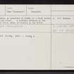
Dun Garsin, as described by RCAHMS, is a broch within an outwork. A probable entrance to the broch, about 2.0m wide, is visible in the ENE.
Visited by OS (C F W) 31 May 1961.
Field Visit (20 May 1915)
Dun Garsin, Bracadale.
Dun Garsin occupies a commanding position on a table topped hill rising in an inaccessible rocky slope to a height of over 100 feet above the north-western shore of Loch Beag, about 600 yards east of the parish church at Bracadale. On the north-north-west, from which direction it is accessible, it rises in rocky escarpments and terraces about 35 feet above a narrow valley with higher ground beyond. The destruction of the dun has been thorough. The stones were removed to build the revetment on the side of the road to Sligachan many years ago. An outer wall or parapet encircled the summit, but only the faintest traces of it can be detected in places. The area enclosed by it is an irregular oval measuring some 150 feet from north-east to south-west and some 105 feet from north-west to south-east. In the north-north-eastern sector are the remains of the chief building, now showing as a shapeless bank of stones an dearth about 14 feet broad and 3 feet high, enclosing a circular space. The external diameter of the building has been about 55 feet. In all probability it has been a broch, as the plan and dimensions suggest this, and there is a length of 6 feet of building with one or two courses in position lying on the south-south-east, which seems to be the inner face of the inner wall of a gallery built in the interior of the wall.
RCAHMS 1928, visited 20 May 1915.
OS map: Skye xxviii.
Publication Account (2007)
NG33 5 DUN GARSIN
NG/3609 3878
This probable broch, perhaps ground-galleried, in Bracadale, Skye, stands on the summit of a flat-topped crag; most of its stones were removed to build a revetment on the side of the road to Sligachan “many years” before 1915 [2]. There are faint traces of an outer wall around the summit but the main building is nothing but a mass of stones. The overall diameter has been about 16.78m (55 ft) and on the south-south-east there is a trace of what may be the face of the inner wall of a ground level mural gallery. There may be an entrance on the east-north-east [1].
Dimensions: a recent survey [1] gives an internal diameter north-south of 8.0m and a wall thickness of 3.1m in the north and 3.5m in the south [1]. However Swanson's 1985 plan does not show enough of the wallfaces to measure [4, plan].
Sources: 1. NMRS site no. NG 33 NE 1: 2. RCAHMS 1928, no. 482, p. 143: 3. MacSween 1984-85, 41, no. 3: 4. Swanson (ms) 1985, 884 and plan.
E W MacKie 2007
Note (26 January 2015 - 1 November 2016)
This heavily-robbed broch, from which stones were thrown down to build the revetment beside the public road, stands within the remains of a larger enclosure on a rocky hillock that rises some 10m above the more accessible approach from the NW and 30m above the shore on the SE. The wall of the irregular outer enclosure forms little more than a thin band of rubble extending around the margin of the summit to take in an area measuring about 45m from NE to SW by up to 32m transversely (0.13ha). The position of the entrance is not known, though that of the broch faces E. The relationship between the broch and the outer enclosure cannot be determined without excavation; either the outer wall sprang from the foot of the broch, or else it underlies it.
Information from An Atlas of Hillforts of Great Britain and Ireland – 01 November 2016. Atlas of Hillforts SC2753


