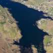
Skye, Dun Chaich
Dun (Prehistoric)
Site Name Skye, Dun Chaich
Classification Dun (Prehistoric)
Canmore ID 10836
Site Number NG24NW 8
NGR NG 2431 4773
Datum OSGB36 - NGR
Permalink http://canmore.org.uk/site/10836
- Council Highland
- Parish Duirinish
- Former Region Highland
- Former District Skye And Lochalsh
- Former County Inverness-shire
Field Visit (6 May 1915)
Dun Chaich, Uiginish.
Some 600 yards south of Uiginish Lodge is a plateau slightly more than 100 feet above sea-level, presenting a line of cliffs some 20 to 30 feet high on its eastern side, below which the ground falls away rapidly to the western shore of Loch Dunvegan about 350 yards distant. The northern extremity of the plateau terminates in a narrow projection bounded on all sides except the south-east, from which the approach is nearly level, by cliffs which rise to a height of about 30 feet. This part is the site of Dun Chaich. It has been a stone walled fort, the rampart having been built round the edge of the cliff and straight across the ridge at the south-east. The enceinte, which is roughly oval, measures 100 feet in length externally along the major axis from north-west to south-east and 50 feet in width. The walling has been thoroughly cleared away, leaving only the outer foundation course across the south-eastern end, and here and there on the south-western flank some short sections of the outer face showing a height of about 3 feet. There are indications of a hut circle some 9 feet in diameter internally near the southern corner of the dun. The entrance cannot be identified.
In the vicinity of the dun is a number of ruins of old houses, the name of the place being Bal-an-Chaich. One house nestling under the cliff on the north-east is pointed out as the dwelling of one of the Macrimmons, the famous pipers. Within the house near the south-western end is a large block of stone, 6 feet 6 inches by 4 feet 3 inches by 2 feet 3 inches, lying slanting on edge. It is said that it was incorporated intentionally in the house.
RCAHMS 1928, visited 6 May 1915.
OS map: Skye xxi (unnoted).
Field Visit (13 October 1971)
NG24NW 8 2431 4773.
(NG 2431 4773) Dun Chaich (NR)
OS 6"map, (1968)
Dun Chaich, a robbed dun on a rocky spur. An elongated D on plan it measures overall 33.2m NW to SE by 15.6m transversely with the outer wall face visible for much of the periphery and surviving to a maximum height of 1.8m in the SW. No inner face is visible but the extent of the wall core visible suggests the wall width was in the region of 3.5m to 4.0m. The entrance is midway along the near straight SE side where two stones, probably indicating the outer corner stones of the passage, indicate a width of 1.5m. Halfway along the SW side of the passage another set stone off line with the outer one suggests that the entrance has been checked for a door. An alleged hut circle (RCAHMS 1928) near the S corner inside the dun appears to be fortuitous tumble.
Visited by OS (R L) 13 October 1971.


