Accessibility

Font Size

100% 150% 200%

Background Colour

Default Contrast
Close Reset

Glasgow, Prince's Dock, 'four Winds' Hydraulic Power Station

Hydraulic Accumulator Tower (19th Century), Hydraulic Power Station (19th Century)

Site Name Glasgow, Prince's Dock, 'four Winds' Hydraulic Power Station

Classification Hydraulic Accumulator Tower (19th Century), Hydraulic Power Station (19th Century)

Alternative Name(s) Prince's Dock, Pumping Station; Govan Road, Mavisbank Road; River Clyde; Tower Of The Winds

Canmore ID 107759

Site Number NS56NE 208

NGR NS 56908 65009

Datum OSGB36 - NGR

Permalink http://canmore.org.uk/site/107759

Ordnance Survey licence number AC0000807262. All rights reserved.
Canmore Disclaimer. © Bluesky International Limited 2025. Public Sector Viewing Terms

Toggle Aerial | View on large map

Digital Images

View from SSE
View from SSEDetail of North Tower, 'Four Winds' hydraulic power station, Prince's Dock, Glasgow.Glasgow, Mavisbank Road, Princes Dock 'Four Winds' Power Station.
General view from West.Glasgow, Mavisbank Road, Princes Dock 'Four Winds' Power Station.
Detail of accumulator tower.Glasgow, Mavisbank Road, Princes Dock 'Four Winds' Power Station.
Detail of South and East Wind plaques on chimney.Glasgow, Mavisbank Road, Princes Dock 'Four Winds' Power Station.
Detail of North and East Wind plaques on chimney.General view from WSW showing WNW front
Chimney. DetailView from SGeneral view from SEOblique aerial view of the 'Four Winds' Hydraulic Power Statiom, looking NE.Oblique aerial view of the 'Four Winds' Hydraulic Power Statiom, looking NNE.Glasgow, Mavisbank Road, Princes Dock 'Four Winds' Power Station.
General view from North-East of accumulator tower.Glasgow, Mavisbank Road, Princes Dock 'Four Winds' Power Station.
General view from South.Glasgow, Mavisbank Road, Princes Dock 'Four Winds' Power Station.
Detail of 'Clyde Navigation Trust' plaque on West wall of accumulator tower.General view from S, showing Clyde Navigation Trust plaqueGlasgow, Mavisbank Road, Prince's Dock Hydraulic Power Station
View from SSE showing accumulator tower and part of ESE frontGlasgow, Mavisbank Road, Prince's Dock Hydraulic Power Station
View from N showing accumulator tower and NNE frontDetail of chimney, 'Four Winds' hydraulic power station, Prince's Dock, Glasgow.Glasgow, Princes Dock and Queen's Dock with part of Govan Plantation area adjacent, oblique aerial view showing , taken from the SE.Glasgow, Mavisbank Road, Princes Dock 'Four Winds' Power Station.
View of chimney from SSW.Glasgow, Mavisbank Road, Princes Dock 'Four Winds' Power Station.
Detail of 'Clyde Navigation Trust' plaque on East wall.Glasgow, Mavisbank Road, Princes Dock 'Four Winds' Power Station.
Detail of West and South Wind plaques on chimney.Glasgow, Mavisbank Road, Princes Dock 'Four Winds' Power Station.
Detail of 1894 datestone on accumulator tower.Glasgow, Mavisbank Road, Princes Dock 'Four Winds' Power Station.
Detail of 'Clyde Navigation Trust' plaque on West wall of accumulator tower.Glasgow, Mavisbank Road, Princes Dock 'Four Winds' Power Station
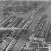
View of accumulator tower, from SView from SE showing ESE and SSW fronts of accumulator towerChimney. DetailChimney.  View from EChimney. DetailPrince's and Queen's Docks, Glasgow.  Oblique aerial photograph taken facing north-west.  This image has been produced from a print.Glasgow, Mavisbank Road, Princes Dock 'Four Winds' Power Station.
General view from South.Glasgow, Mavisbank Road, Princes Dock 'Four Winds' Power Station.
Detail of West and South Wind plaques on chimney.Glasgow, Mavisbank Road, Princes Dock 'Four Winds' Power Station.
Detail of 1894 datestone on accumulator tower.E side. View from SSEChimney. View from EOblique aerial view of the 'Four Winds' Hydraulic Power Statiom, looking N.Glasgow, Mavisbank Road, Princes Dock 'Four Winds' Power Station.
Detail of 'Clyde Navigation Trust' plaque on East wall.Glasgow, Mavisbank Road, Princes Dock 'Four Winds' Power Station.
Detail of top of accumulator tower.Chimney. DetailPrince's Dock and Queen's Dock, Glasgow.  Oblique aerial photograph taken facing west.Prince's Dock, Glasgow.  Oblique aerial photograph taken facing north-west.Prince's Dock, Glasgow.  Oblique aerial photograph taken facing north-west.Glasgow, Mavisbank Road, Princes Dock 'Four Winds' Power Station.
View of chimney from SSW.General view from S, showing Clyde Navigation Trust plaqueGlasgow, Mavisbank Road, Princes Dock 'Four Winds' Power Station.
General view from West.Glasgow, Mavisbank Road, Princes Dock 'Four Winds' Power Station.
Detail of accumulator tower.Glasgow, Mavisbank Road, Princes Dock 'Four Winds' Power Station.
Detail of South and East Wind plaques on chimney.Glasgow, Mavisbank Road, Princes Dock 'Four Winds' Power Station.
Detail of North and East Wind plaques on chimney.Glasgow, Mavisbank Road, Princes Dock 'Four Winds' Power Station.
Detail of terracotta brickwork and round-headed window arch.Glasgow, Mavisbank Road, Prince's Dock Hydraulic Power Station
View from SSE showing SSW and ESE frontsGlasgow, Mavisbank Road, Princes Dock 'Four Winds' Power Station
View from SW, chimney in foreground, accumulator tower in backgroundView from WNW showing WNW front of accumulator towerGeneral view.General view from ESEGeneral view from ESEQueen's Dock and Prince's Dock, Glasgow.  Oblique aerial photograph taken facing north-east.Prince's Dock and Queen's Dock, Glasgow.  Oblique aerial photograph taken facing north.Glasgow, Mavisbank Road, Princes Dock 'Four Winds' Power Station.
General view from NNE.Glasgow, Mavisbank Road, Princes Dock 'Four Winds' Power Station.
Detail of top of accumulator tower.Glasgow, Mavisbank Road, Princes Dock 'Four Winds' Power Station.
Detail of terracotta brickwork and round-headed window arch.

Administrative Areas

  • Council Glasgow, City Of
  • Parish Govan (City Of Glasgow)
  • Former Region Strathclyde
  • Former District City Of Glasgow
  • Former County Lanarkshire

Recording Your Heritage Online

Tower of the Winds, Govan Road, Mavisbank Road, 1894, John Burnet, Son & Campbell

Hydraulic Pump House, the former Prince's Dock Hydraulic Power Station. Romanesque corbelled cornice atop tall pump room. Castellated tower, another water accumulator, with original hydraulic equipment. Stump, a mere third, of the octagonal brick chimney, crowned with red ashlar sculpted frieze of the 'Four Winds'. Converted to office use, c.2005.

Taken from "Greater Glasgow: An Illustrated Architectural Guide", by Sam Small, 2008. Published by the Rutland Press http://www.rias.org.uk

Archaeology Notes

NS56NE 208 56908 65009

For Prince's Dock (NS 5620 6493 to NS 5684 6503) and subsidiary buildings, see NS56SE 87.00.

Hydraulic Pumping Station, Prince's Dock, built 1894 for the Clyde Navigation Trust to designs by Burnet, Son and Campbell. The pump-house itself is a high, single storey, 6-bay red-brick building, with a plain frontage to the dock, and a decorated front to Mavisbank Road. At the N end, is a slendid accumulator tower, with elaborate corbelling, in the style of an Italian campanile. At the S end, there is the stump of an octagonal chimney in the form of 'Tower of the Winds', with sculptured panels forming a frieze. SDD category B.

J R Hume 1975

This building was used as a bar during the Garden Festival. It is now disused.

(RCAHMS photographic survey 1996).

Visited by RCAHMS (MKO) 25 September 1996.

This building extends over the grid line between OS 1:1250 map sheets NS5665SE and NS5664NE. The former (in an edition of 1951) notes it as El Sub-sta [NAT]; the latter (in an edition of 1962) notes a Chy [NAT] at NS 56903 64976.

Information from RCAHMS (RJCM), 15 February 2006.

Activities

Project (2007)

This project was undertaken to input site information listed in 'Civil engineering heritage: Scotland - Lowlands and Borders' by R Paxton and J Shipway, 2007.

Publication Account (2007)

The hydraulic pumping station designed by J. J. Burnett and J. A. Campbell in 1894, which operated numerous

hydraulic cranes, lifts and pumps, at a pressure of 750 psi obtained from an accumulator with a 20 in. diameter ram and 20 ft stroke has been conserved and serves as a welcome reminder of the project’s grandeur. This station, the dock’s main architectural feature, has at its north end the massive water tower providing the hydraulic head of water to the accumulator, designed in the style of an Italian campanile with ornamental corbelling. At its south end is an octagonal brickwork chimney with eight sculptured panels representing winds, inspired by the Tower of the Winds at Athens.

R Paxton and J Shipway

Reproduced from 'Civil Engineering heritage: Scotland - Lowlands and Borders' with kind permission of Thomas Telford Publishers.

References

MyCanmore Image Contributions


Contribute an Image

MyCanmore Text Contributions