
Pricing Change
New pricing for orders of material from this site will come into place shortly. Charges for supply of digital images, digitisation on demand, prints and licensing will be altered.
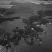
Bowduns


Enclosure (Period Unassigned)
Site Name Bowduns
Classification Enclosure (Period Unassigned)
Canmore ID 107591
Site Number NO88SE 45
NGR NO 8809 8453
Datum OSGB36 - NGR
Permalink http://canmore.org.uk/site/107591

- Council Aberdeenshire
- Parish Dunnottar
- Former Region Grampian
- Former District Kincardine And Deeside
- Former County Kincardineshire
NO88SE 45 8809 8453
Air photography (Jasair NO88 50288162, dated 6 May 1988) has recorded the cropmark of a rectangular enclosure, with a possible rectangular feature within it, in arable ground on this promontory.
NMRS, MS/712/10.
Field Visit (30 April 1957)
This site was included within the RCAHMS Marginal Land Survey (1950-1962), an unpublished rescue project. Site descriptions, organised by county, are available to view online - see the searchable PDF in 'Digital Items'. These vary from short notes, to lengthy and full descriptions. Contemporary plane-table surveys and inked drawings, where available, can be viewed online in most cases - see 'Digital Images'. The original typecripts, notebooks and drawings can also be viewed in the RCAHMS search room.
Information from RCAHMS (GFG) 19 July 2013.

