Pricing Change
New pricing for orders of material from this site will come into place shortly. Charges for supply of digital images, digitisation on demand, prints and licensing will be altered.
Sanday, Greod
Cultivation Remains (Period Unassigned), Township (Period Unassigned)
Site Name Sanday, Greod
Classification Cultivation Remains (Period Unassigned), Township (Period Unassigned)
Alternative Name(s) Canna
Canmore ID 10756
Site Number NG20SE 24
NGR NG 2741 0454
NGR Description NG 2741 0454 to NG 2749 0460
Datum OSGB36 - NGR
Permalink http://canmore.org.uk/site/10756
- Council Highland
- Parish Small Isles
- Former Region Highland
- Former District Lochaber
- Former County Inverness-shire
NG20SE 24 2741 0454 to 2749 0460
(Classified as deserted township and location cited as NG 2745 0455). Seven houses shown on a map of 1805 to the south of Creag Liath may well be those of the crofters of Lag a' Bhaile (NG20NE 20) who were moved to Sanday to make kelp or fish.
J L Campbell 1984.
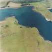
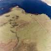
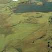
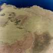
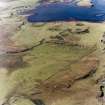
(Reclassified as township and cultivation remains at NG 2741 0454 to NG 2749 0460). The grass-grown remains of up to twelve buildings are situated along the foot of the SE flank of the rocky knoll of Creag Liath, at the edge of an area of improved ground. Seven roofed buildings are shown at this location on an estate map of 1805, disposed in an irregular scatter, and a group of four buildings and an L-shaped range are also shown to the SW; Campbell suggests that these buildings may belong to the crofters who were moved to Sanday from Lag a? Bhaile on Canna (see also NG20NE 20).
Traces of what may be a few of these buildings can be seen at the SW end of the township, partly overlain by a row of later buildings, all of which are oriented from NW to SE along the foot of the knoll. Although reduced to their grass-grown footings, these buildings are all similar in size, measuring on average 10m by 4m within faced rubble walls with square ends.
The township was abandoned by the late 19th century and nothing is depicted here on the 1st edition of the OS 6-inch map (Argyllshire, 1881, sheet lix). Traces of an enclosure containing rig-and-furrow cultivation can still be seen to NE.
(Canna 110-23).
Visited by RCAHMS (ARG,IMS), 3 May 1994.
J L Campbell 1984.
Observation (1984)
(Classified as deserted township and location cited as NG 2745 0455). Seven houses shown on a map of 1805 to the south of Creag Liath may well be those of the crofters of Lag a' Bhaile (NG20NE 20) who were moved to Sanday to make kelp or fish.
J L Campbell 1984.
Field Visit (3 May 1994)
(Reclassified as township and cultivation remains at NG 2741 0454 to NG 2749 0460). The grass-grown remains of up to twelve buildings are situated along the foot of the SE flank of the rocky knoll of Creag Liath, at the edge of an area of improved ground. Seven roofed buildings are shown at this location on an estate map of 1805, disposed in an irregular scatter, and a group of four buildings and an L-shaped range are also shown to the SW; Campbell suggests that these buildings may belong to the crofters who were moved to Sanday from Lag a? Bhaile on Canna (see also NG20NE 20).
Traces of what may be a few of these buildings can be seen at the SW end of the township, partly overlain by a row of later buildings, all of which are oriented from NW to SE along the foot of the knoll. Although reduced to their grass-grown footings, these buildings are all similar in size, measuring on average 10m by 4m within faced rubble walls with square ends.
The township was abandoned by the late 19th century and nothing is depicted here on the 1st edition of the OS 6-inch map (Argyllshire, 1881, sheet lix). Traces of an enclosure containing rig-and-furrow cultivation can still be seen to NE.
(Canna 110-23).
Visited by RCAHMS (ARG,IMS), 3 May 1994.
J L Campbell 1984.


