
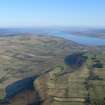
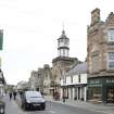
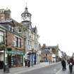
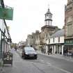
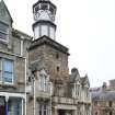
Dingwall, High Street, General


General View (Period Unassigned)
Site Name Dingwall, High Street, General
Classification General View (Period Unassigned)
Canmore ID 106081
Site Number NH55NW 90
NGR NH 549 587
Datum OSGB36 - NGR
Permalink http://canmore.org.uk/site/106081


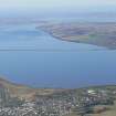


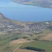
- Council Highland
- Parish Dingwall
- Former Region Highland
- Former District Ross And Cromarty
- Former County Ross And Cromarty
NMRS REFERENCE:
Dingwall, 84 High Street, Bridaig House which was Category B Listed was demolished in the 1960s. Information from Demolitions catalogue held in RCAHMS library.

