Following the launch of trove.scot in February 2025 we are now planning the retiral of some of our webservices. Canmore will be switched off on 24th June 2025. Information about the closure can be found on the HES website: Retiral of HES web services | Historic Environment Scotland
Cadder
Barrage Balloon Centre (20th Century), Prison (19th Century) - (20th Century)
Site Name Cadder
Classification Barrage Balloon Centre (20th Century), Prison (19th Century) - (20th Century)
Alternative Name(s) Clyde Aa Defences; Hm Prison Low Moss
Canmore ID 105796
Site Number NS67SW 50
NGR NS 630 722
Datum OSGB36 - NGR
Permalink http://canmore.org.uk/site/105796
- Council East Dunbartonshire
- Parish Cadder (Strathkelvin-du)
- Former Region Strathclyde
- Former District Strathkelvin
- Former County Lanarkshire
NS67SW 50 630 722
A barrage balloon depot and barracks are visible on a Luftwaffe aerial photograph taken in 1939.
Information from RCAHMS (KM) 8 August 1996.
This World War II barrage balloon depot and repair yard is situated to the E of Cadder Cemetery. The site is now occupied by a Prison and Driving Test Centre. Some original brick, concrete and wood structures survive although many new buildings have been constructed on site since the 1939-1945 war.
J Guy 2001; NMRS MS 810/11, Part 3, 237-8
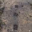
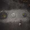
The barrage balloon depot is visible on a wartime oblique air photograph (RAF No.1 CAM, x862, flown 21 October 1941). Visible as a series of sheds with rows of smaller huts and one large shed or hangar in the area now occupied by HM Prison, Low Moss. In the area to the E, across Crosshill Road, were a further four sheds with four circular barrage balloon mooring areas. This area is now occupied by the driving test centre.
The circular mooring pads are depicted on the current OS 1:10000 and 1:2500 maps.
Information from RCAHMS (DE), February 2003
NS 6300 7220 A programme of historic building recording was undertaken in August on the site of the former Low Moss
prison at Crosshill Road, Bishopbriggs, prior to its demolition for the proposed construction of a new prison. The site was
important as the former RAF Bishopbriggs barrage balloon depot, representing the largest remaining collection of original World War II buildings in existence in Scotland outside the property of Defence Estates (Ministry of Defence). The RAF buildings at Bishopriggs were built during the expansion period which began in 1935, a period when many new stations were built and First World War stations upgraded. The building recording provided a written, drawn and detailed photographic record of the structures before development began.
Archive to be deposited with RCAHMS.
Funder: Scottish Prison Service.
Diana Sproat, 2007.
Standing Building Recording (1 August 2007 - 30 August 2007)
NS 6300 7220 A programme of historic building recording was undertaken in August on the site of the former Low Moss prison at Crosshill Road, Bishopbriggs, prior to its demolition for the proposed construction of a new prison. The site was important as the former RAF Bishopbriggs barrage balloon depot, representing the largest remaining collection of original World War II buildings in existence in Scotland outside the property of Defence Estates (Ministry of Defence). The RAF buildings at Bishopriggs were built during the expansion period which began in 1935, a period when many new stations were built and First World War stations upgraded. The building recording provided a written, drawn and detailed photographic record of the structures before development began.
Archive to be deposited with RCAHMS.
Funder: Scottish Prison Service.
AOC Archaeology were commissioned to undertake a programme of historic building recording belonging to the former RAF Bishopbriggs barrage balloon repair depot which was later converted into prison accommodation in the 1960s. The work was commissioned by the Scottish Prison Service prior to the development of the site which would lead to the demolition of the buildings for the construction of a new prison complex. The building recording identified various structures belonging to the period of airfield expansion during the latter part of the 1930s. These structures included Barrack Blocks, Dining Halls, Institute Buildings, Sergeants Messes, Offices, Stores, Education and Lecture Huts, a Guardroom and Station Sick Quarters. All of the buildings that had been part of the former Low Moss Prison had been modified to perform the role required of them. This included the addition of modular sheet metal roofing which replaced the original corrugated asbestos; the removal of original plaster board walling within the interiors and replacement with modern Gyproc boarding; the addition of a low ceiling and the dividing up of some internal spaces into cells. On the whole, the exterior walls and location of windows and doors had remained in the original locations with only minor alterations, however, the original cast-iron window frames and solid wood doors had been replaced with modern double glazed units and modern security doors. Because of this re-use, the condition of the exterior elements of the buildings and the internal ceilings remain in a very good and almost 'as new' condition. However, the buildings to the east of the site and outside the Low Moss Prison boundary are in original condition but have been neglected the same level of care as those within the prison, and are now near dereliction.
Information from Oasis (aocarcha1-51310) 23 April 2009
Field Visit (14 November 2017)
The military depot at Cadder, known as RAF Bishopbriggs, was established to store, maintain and repair barrage balloons, to test them before deployment and to undertake the training of balloon crews. Constructed in 1938-39, it housed No. 18 (Balloon) Squadron and part of No. 15 Maintenance Unit immediately before and during WW2. During that time, however, it also carried out other functions including acting as a stopover for pilots flying between the south of England and the north of Scotland, and it continued playing a military role up to the mid-1960s. The site covered an area of about 91 acres (37ha), comprising an area to the west of Crosshill road 38 acres (15ha) devoted to administration, accommodation, storage, etc., and an area to the east of the road 43 acres (17.5ha) which was given over to training in the handling of balloons. All traces of any military remains in that part of the base which lay west of Crosshill Road have been removed and this description is limited to detailing the surviving visible remains east of that road. It makes use of a Luftwaffe aerial photograph dated 2 October 1939 (HES: SC797410), which shows the site under construction, and another taken by the RAF in 1941 (RAF No.1 CAM, x862), which probably shows the balloon depot at or near its most complete.
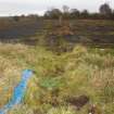
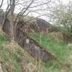
The eastern part of the depot is now derelict and largely unused. Access was originally by way of two gates (NS 62928 72342 and NS 62966 72250). The northerly of these has been removed, though access to the site is still provided through a farm gate in a fence set back from the original line of the boundary. The southerly gate (wrought iron hanging on cast iron pillars) remains in situ but is locked and no longer in use, the area behind being piled high with dumped material.
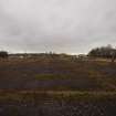
Within the area are the remains of four balloon hangars arranged in two pairs standing about 90m on the WSW side of open training ground. The hangars in each pair stood only 5.75m apart and each pair was accompanied in front and to the rear by broad concrete aprons. The training ground contained a metalled road circuit linking the hangars to four barrage balloon cradle-beds and a part-sunken building that is labelled as a ‘Bomb Store’ on an Air Ministry Drawing (4551/45).
The hangars (NS 62984 72398, NS 62987 72369, NS 63018 72262 and NS 63029 72237), which have been reduced to their concrete floors, all measure 32.5m from WSW to ENE by 22.8m transversely and in each the five pairs of I-sectioned steel columns, which provided the framework that supported the roof and walls, have been cut-off at ground level. The walls, which would have comprised steel corrugated sheeting, stood immediately outside these columns, supported on dwarf concrete walls only 0.13m thick. The concrete floors of all the hangars, which were each designed to house a single balloon, have been covered with a thin veneer of bitumen, most probably laid down when the site was a vehicle test centre. However, in both of the NNW pair of hangars this has eroded sufficiently to reveal the positions of the central anchorage eye-bolt, eight snatch-blocks of the octogon, 24 bolts of the mooring circle, or the four hauling bolts on the ENE, all of which have been infilled with concrete plugs. These are not visible in the SSE pair of hangars as the layer of bitumen there is thicker.
An extension of the concrete apron N of the SSE pair of hangars indicates the former position of a rectangular building (NS 63029 72297) that is visible on the 1941 aerial photograph. The concrete floor of at least one other building (NS 63036 72218), measuring 9m from WSW to ENE by 5m transversely and rising 0.3m above the present ground surface, is visible immediately SSE of the hangars, standing on an island of grass bordered by a concrete kerb. A contemporary plan of the site (noted above) labels this building as a ‘Boiler House’.
The cradle-beds were originally little more than circular areas of grass about 80ft (24.5m) in diameter around which were steel eye-bolts set into large concrete anchor blocks. Three of these grass cradle-beds were subsequently replaced in concrete and all that remains to be seen of earlier versions are several of the anchor blocks which have been dug up and cast aside. The fourth cradle-bed, which was the northwesterly of the group, was not upgraded. However, its WSW half has been destroyed by cultivation and its remaining part is now barely discernible in rough grass. Except for several of its concrete anchor blocks, which lie discarded close-by, nothing is now visible of a fifth, much larger grass cradle-bed, which lay east of the northerly pair of hangars to which it was linked by a track. It is not visible on the 1939 Luftwaffe aerial photograph but is present on the 1941 RAF image.
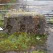
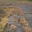
The road circuit linking the cradle beds in the testing ground has been carefully engineered with embankments introduced to mitigate the effect of the broken and poorly drained terrain and the fact that the land drops gently from W to E. The road measures about 3.8m between kerbs and is made entirely of laid concrete. Of the three cradle-beds that were remodelled in concrete, the two on the NNE and E (NS 63127 72547 and NS 63271 72403) lie immediately adjacent to the road, with the road passing its front and looping around its rear. However, the S cradle-bed (NS 63131 72277) lies astride the main axis of the road and here the road splits on the WSW of the cradle-bed and combines on the ENE. The surface of each cradle-bed now comprises shuttered concrete segments radiating and the whole is carefully domed to a height of about 0.16m to aid drainage. All retain their central snatch block, a complete set of octogon blocks and their mooring circles, which measure 24.5m (80ft) in diameter. Although an anchorage eye bolt was observed only in the central snatch block of the E cradle bed, the three tethering rings in each of the octogon blocks are well-preserved in all three cradle beds, while some fragmentary bolts in the mooring circles were also noted. In addition, one of the hauling blocks connected with the NNE cradle-bed remains in place to its SE, set into the embankment on the NE side of the road.
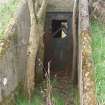
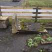
The road branching from the circuit between the NE and E cradle-beds, extends 80m NE to the bomb store (NS 63251 72550), where it bifurcates to provide access to each side of the building. This part-sunken, earth-embanked, flat concrete-roofed structure, measuring 8.5m square within brick walls 0.3m thick and 2.3m high, contains two compartments (8.5m by 4m) both of which have opposed entrances on the ENE and WSW respectively and a partition wall containing a wide opening. Each entrance was formerly closed with a sheet metal door containing a rectangular widow, but only that closest to the SE corner remains in place. The interior walls, which bear graffiti, are cement rendered and the corners are chamfered to reduce the risk of damage leading to an explosion. All four ‘rooms’ have a single electric lamp attached to the centre of the ceiling.
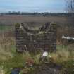
Only one building (NS 63004 72462) is shown within the road circuit on the 1941 aerial photograph and this is situated about 50m NE of the hangars. It is an earth-embanked structure measuring 7.8m from WSW to ENE by 2.4m transversely within brick walls 0.3m thick and at least 1.3m high. The interior is divided into two compartments with entrances at each end protected by baffles, but there is no evidence that it was roofed. The structure is not depicted on the 1945 Air Ministry plan.
Nothing is now visible of a group of buildings (NS 62903 72558) which stood 150m NNW of the hangars and included an officer’s mess, two officer’s accommodation blocks and a sewage pumphouse. However, a section of the concrete road that serviced the buildings is still in use immediately W of the offices of a golf driving range.
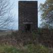
The surviving remains of buildings within the road circuit probably represent a period of construction after 1960. The water tower (NS 63030 72407), which is situated about 30m E of the hangars, measures 1.45m square within concrete brick walls 0.22m thick and rising to a height of at least 3.5m. There is a central doorway on the W. A fuel tank cradle (NS 63032 72364) of the same build and comprising two supports, is situated about 40m to the S. It measures 2.5m from WNW to ESE by 1.8m transversely and up to 1.3m high. The other buildings are difficult to characterise as they have all been demolished. They are situated E of and below the level of the two northern hangars, and they have been reached by way of a broad ramp that is retained within two brick walls. That on the N runs roughly E and W for a distance of 80m, its W end having been spliced into the N side of the road embankment N of the hangars. That on the S is shorter, lying 9m from the other wall at its W end and extending downslope to the E for a distance of about 20m before turning in a sharp arc to the SSE and extending a further 25m. The buildings that this ramp led down to have, for the most part, been reduced to heaps of rubble. However, these piles are likely to represent the above-ground elements of those buildings and there is evidence that their underground components survive relatively intact. Four structures can be identified - (NS 63104 72437, NS 63111 724111, NS 63090 72436 and NS 63093 72456). The dumps of building material to the W (NS 63034 72395 and NS 63055 72386) probably derive from the demolition of the hangars.
Visited by HES, Survey and Recording (ATW, AKK, GFG) 14 November 2017.
Archaeological Evaluation (June 2022)
NS 63243 72435 An evaluation was undertaken, in June 2022, ahead of the proposed development of a new crematorium near Bishopbriggs.
The evaluation uncovered a significant depth of made ground across the site, therefore trial pits were excavated instead of trenches. The evaluation determined that the site comprised a made ground levelling deposit that had been used to landscape the site ahead of the construction of a Second World War barrage balloon depot. This material sits on top of an original buried topsoil at the southern end of the site, whereas the topsoil has been stripped at the northern end of the site.
There are remaining elements of the Second World War barrage balloon depot, consisting of concrete pads with connecting concrete paths. These have become significantly overgrown following the facility falling into disuse.
The made ground deposits and lack of significant archaeological material found during this evaluation suggest that the site has very limited potential in archaeological survivability. The made ground deposits are of a depth that the proposed development would have negligible impact on any surviving archaeological material below it.
Archive: NRHE (intended)
Funder: East Dunbartonshire Council
Leonie Teufel and Craig Stewart – AOC Archaeology Group
(Source: DES Volume 23)


