Harris, Toe Head, Rudh'an Teampuill
Broch (Iron Age)(Possible), Chapel (Medieval)
Site Name Harris, Toe Head, Rudh'an Teampuill
Classification Broch (Iron Age)(Possible), Chapel (Medieval)
Alternative Name(s) St Rufus's Church; St Luke's Church
Canmore ID 10506
Site Number NF99SE 6
NGR NF 97005 91341
Datum OSGB36 - NGR
Permalink http://canmore.org.uk/site/10506
- Council Western Isles
- Parish Harris
- Former Region Western Isles Islands Area
- Former District Western Isles
- Former County Inverness-shire
NF99SE 6 97005 91341
(NF 9700 9134) Chapel (NR) (Ruins of).
OS 6" map, Inverness-shire, 2nd ed., (1903)
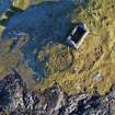
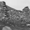
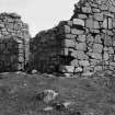
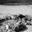
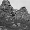
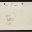
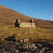
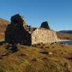
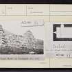
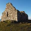
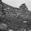
A single-chambered chapel measuring 21' by 10' with walls about 2 3/4' thick. The masonry is of random rubble brought to courses and the walls remain to a height of 6 1/2'. Both gables are intaken. A high-level window and some corbelling at the west end suggest that there has been a gallery, while at the east end, part of the altar seating, a corbel or image bracket and two small aumbries remain. Both ends of the building are raised one step.
A broch was discovered by Simpson, in September 1965, underlying the chapel. The turf was stripped from the outer and inner faces to reveal the plan which gave a diameter of 54' over walls9' thick. The entrance was on the east.
RCAHMS 1928; D D A Simpson 1965.
Muir suggests that this chapel may be either St Rufus's Church or St Luke's Church mentioned by OPS (which quotes from MacLeod's list of the dedicated churches in Harris, all of which, according to MacLeod, were dependant upon St Clement's Church (NG08SW 7). Since the Rufus dedication probably refers to St. Mulruhha's Chapel on Berneray (NF98SW 8) only the dedication to St. Luke remains.
OSA 1794; Orig Paroch Scot 1854; T S Muir 1885.
A chapel, as described and planned by RCAHM. The dedication is not known locally. The broch appears to have been reduced to its base course, and Simpson's exploratory excavation has revealed the entrance, and inner and outer wall faces, giving an overall diameter of 16.6m with a wall thickness of 3.7m. No other details are exposed. Vague traces of settlement on this headland may be partly associated with the broch (but see also NF99SE 4).
Revised at 1/10,000.
Visited by OS (A A) 3 July 1969.
Field Visit (27 June 1914)
Chapel, Rudh' an Teampuill, Toe Head.
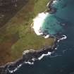
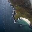
The ruin of this building stands on a little promontory ¾ mile south-west of Northtown and rather more than 2 miles south-south-east of Toe Head. It is a single chambered oblong structure, measuring 21 feet by 10 feet, with walls about 2 ¾ feet thick. The masonry is random rubble brought to courses built of granite and schist. Both gables are intaken. The walls stand to a height of over 6 ½ feet. The entrance is from the north. There is a single narrow window in each side wall and one in either gable, the western being at a high level, where there seems to have been a gallery, the corbels of which remain. Both ends of the building are raised one step. On the east step is part of the altar seating, and beside it a corbel or image bracket. Beside the altar are two small aumbries. (Fig. 94.)
RCAHMS 1928, visited 27 July 1923.
Harris xvii.
Publication Account (2007)
NF99 1 TOE HEAD ('Rubh’ an Team-puill')
NF/9700 9134
This probable broch in Harris was discovered in 1965 projecting from below the foundations of the chapel on the site [2] (the Gaelic name means 'point of the temple'). Stripping of turf revealed the broch, which seems to have been reduced to its base course; the inner and outer wallfaces were found, suggesting an overall diameter of 16.5m (54 ft) with a wall thickness of 2.75m (9 ft). The entrance was also found. The similarity with Dùn na Cille is marked (NF60 4).
Sources: 1. NMRS site no. NF 99 SE 6: 2. RCAHMS 1928, 31, no. 108: 3. D D A Simpson in Discovery and Excavation in Scotland, 1965. 20.
E W MacKie 2007
Standing Building Recording (March 2009)
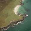
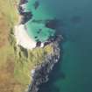
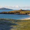
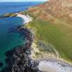
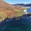
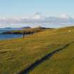
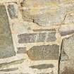
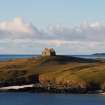
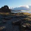
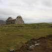
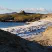
NF 97000 91341 A small roofless late medieval chapel stands on the exposed headland of Rubh’ an Teampaill overlooking the Sound of Harris, about 2.5km to the NW of the township of Taobh Tuath (Northton). A survey was undertaken in March 2009 prior to the consolidation of the structure. Elevations of each of the interior and exterior faces were produced using rectified photography, together with a ground plan. The structure proved to be largely of a single period, but contained re-used masonry from earlier builds.
Report: Western Isles SMR
Funder: Heritage Lottery Fund and Historic Scotland
CM Knott
Standing Building Recording (7 December 2011)
NF 97000 91341 Following consolidation work (DES 2011, 187) an assessment was undertaken on 7 December 2011 of the interior floor area of the chapel prior to possible access work. The chapel provides a rare and important example of a surviving altar setting. The altar was constructed using lime mortar, is 2-3 courses high and stands to a maximum of 260mm above the interior ground surface. It abuts the fragmentary plaster layer which survives on the internal wall of the E elevation, and is secondary to it. Although the form of the altar is unknown it is probable that it was lime plastered and built of lime bonded stone masonry.
A stone revetment occupies the internal W end of the chapel and encroaches slightly upon the entrance doorway. This feature is a double-skinned L-shaped unmortared stone-built enclosure of up to 2 surviving courses, the outer eastern face of which runs across the full width of the chapel, enclosing a 2.2 x 1.1m soil filled area in the NW corner of the building. The structure is secondary to the primary chapel walls and plaster which it abuts. This structure is now re-interpreted as a probable secondary burial enclosure, possibly extending use of the site (which is not surrounded by the usual 18th- and 19th-century headstones) for burial into the post-medieval period, probably when the chapel was roofless. This evidence also allows the western corbelled loft a more viable medieval use, as before the putative burial enclosures construction this would be comfortably above head height. The disturbed and fragmentary remains of a possibly similar unmortared stone structure also abut the N internal elevation of the chapel. This feature also encroaches upon the entrance doorway.
Archive: RCAHMS (intended). Report: CNES SMR and RCAHMS
Funder: Heritage Lottery Fund and Historic Scotland
Carol Knott and Mark Thacker, 2012
(Source: DES)
Excavation (June 2011 - July 2011)
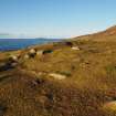
NF 97000 91340 The site at Rubh’ an Teampuill represents one of the key archaeological sites on Harris, with evidence for human occupation ranging from the Mesolithic to post-medieval and beyond. The site is set within a landscape showing evidence of human activity over several millennia demonstrated as earthworks, possible platforms and collapsed ancillary structures, cultivation, possible graves, and more ritualistic monuments such as standing stones.
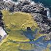
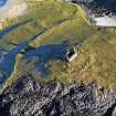
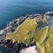
The site of a broch on the promontory at Toe Head is well known locally and survives as a grass-covered ruin partly superimposed by an early 16th-century chapel. The chapel itself is recorded in the RCAHMS volume of 1928, although the broch is not mentioned. It was the subject of surface stripping but has otherwise not been investigated further (Simpson 1965). The monument is visible on the ground as a turf-covered mound with evidence for both external and internal facing edges. The external diameter is c16m and the internal diameter c8m. The aim of the current investigations, undertaken June–July 2011, was to examine a sample of the monument with respect to understanding its constructional method, the nature of its survival, and its vulnerability to coastal and wind erosion.
The outer face of the broch had been laid directly on to bedrock (Lewisian gneiss; and had been levelled by underpinning. These outer facing stones were the most substantial encountered: the largest was c1.2m wide and 0.8m deep and sat against the highest point of bedrock exposure. The bedrock slopes away down to the N and suggests that the sea-facing aspect of the structure was deliberately positioned on the highest available point on the headland.
The outer facing stones formed part of a ring wall c1.2m thick with less substantial stones lining the inner face and with a wall fill of dark soil and small angular stones. This ring wall may have been used in order to define the footprint of the overall building. The inner face of the broch proper was also of less substantial facings and confirmed that the overall thickness of the broch wall was c4m.
In the area excavated the core of this walling contained part of a small curved chamber accessed from the interior of the broch through a narrow c0.55m wide faced passage c1.4m in length (Figure 1). Lewisian gneiss does not lend itself well to building and throughout the broch the stone faces were only roughly coursed, uneven and levelled as appropriate with small rubble. That said, there was some evidence in both the chamber and the passage to suggest that part-corbelling of the walling may have occurred. A small recess c0.1 x 0.1m had been constructed in the W wall of the passageway near the entrance, presumably to provide some form of securing mechanism against a door by way of a cross beam. A less formal angular arrangement of coursing provided a similar feature on the E face. The finds from Northton consisted of a small assemblage with a restricted range of artefacts, dominated by animal bone and handmade, decorated ceramic vessels. The form of the vessels and their applied decoration is widely paralleled in Iron Age Western Isles contexts and is typical of roundhouse-associated pottery in the area. All of the artefacts appear to have been produced from locally-sourced raw materials.
To the N of the broch, fragments of human remains were recovered during the excavation of a stone cist. Dating of this feature is difficult, although Iron Age or Norse is most likely.
Archive: University of Birmingham (currently) and Stornoway Museum (intended)
Funder: HLF via Landscape Partnership and HDL Ltd
University of Birminham, 2011
Watching Brief (June 2011 - September 2011)
NF 97000 91341 A watching brief was carried out as required during consolidation of the small roofless late medieval chapel on the Rubh’ an Teampaill headland, by Hebridean Building Conservation. The work undertaken June–September 2011 provided the opportunity for an examination of the exposed wall heads and gables. Evidence for the form of the roof was provided principally by the exposure of a well preserved rafter slot set into the edge of the western gable, and by a possible mid rafter setting on the S wall. Window fixings were recorded in the N and S wall openings, along with further details of secondary stone settings on the interior. It was demonstrated that the basal course of W wall of the chapel sits directly on the stonework of the Iron Age broch underlying it, except in the area of the broch doorway, where the chapel wall was built without foundation on the layers infilling the doorway.
Archive: RCAHMS (intended). Report: RCAHMS and CNES SMR
Funder: Heritage Lottery Fund and Historic Scotland
Carol M Knott, 2011


