
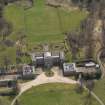
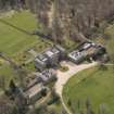
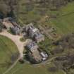
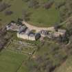
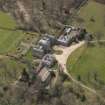
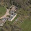
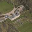
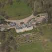
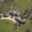
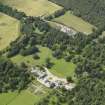
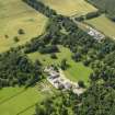
Mellerstain House, Stables And Cottages


Stable(S) (18th Century)
Site Name Mellerstain House, Stables And Cottages
Classification Stable(S) (18th Century)
Alternative Name(s) Mellerstain House Policies
Canmore ID 104343
Site Number NT63NW 18.05
NGR NT 64719 39101
NGR Description Centred NT 64719 39101
Datum OSGB36 - NGR
Permalink http://canmore.org.uk/site/104343


- Council Scottish Borders, The
- Parish Earlston
- Former Region Borders
- Former District Ettrick And Lauderdale
- Former County Berwickshire
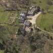
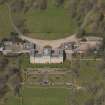
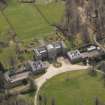
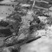
Most of the ancillary buildings attached to Mellerstain House were built in the mid-nineteenth century, but some are of eighteenth-century date. One such structure is the former stable block, now converted into cottages.
It is two-storeyed and rubble-built, with crow-stepped gables. A small wooden dovecot surmounts the roof.
A one-handed clock, dated 1735, has been placed in the gable wall. It was made by John Kirkwood and, until 1859 was located in the steeple of Lauder town hall.
Text prepared by RCAHMS as part of the Accessing Scotland's Past project
NT63NW 18.05 centred 64719 39101
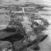
Photographic Survey (1955)
Photographic survey of the exterior of the Hirsel, Berwickshire, by the Scottish National Buildings Record in 1955.
Sbc Note
Visibility: This is an upstanding building.
Information from Scottish Borders Council.

