
Boreray, Cladh Manach


Burial Ground (Medieval), Cup Marked Rock (Prehistoric)
Site Name Boreray, Cladh Manach
Classification Burial Ground (Medieval), Cup Marked Rock (Prehistoric)
Canmore ID 10395
Site Number NF88SE 3
NGR NF 8558 8050
NGR Description NF 8558 8050 and NF 8552 8051
Datum OSGB36 - NGR
Permalink http://canmore.org.uk/site/10395


- Council Western Isles
- Parish North Uist
- Former Region Western Isles Islands Area
- Former District Western Isles
- Former County Inverness-shire
Field Visit (11 August 1915)
Cross-marked Slab and Cup-marked Rock, Cladh Manach, Boreray.
In an ancient burying ground on the summit of a small hill at A'Yeoie, near the south-east corner of the island of Boreray, is a small, rough slab almost entirely buried, on which a simple Latin cross, measuring 7 ½ inches in length and 3 ½ inches across the arms, is incised.
About 50 yards to the west, on a small rocky outcrop, is an oval hollow measuring about 17 inches in length and 11 inches in width at the lip, and about 6 inches in depth at the deepest part, which is in the western half.
A few yards to the north-west of this hollow is another small outcrop of rock just appearing above ground, on which four cup-marks a recut; the largest is about 5 ½ inches in diameter and 3 ¼ inches deep and the smallest 3 inches in diameter and 5/8 inch deep.
RCAHSM 1928, visited 11 August 1915
OS map: North Uist xxvi (unnoted).
Field Visit (29 June 1965)
There is now little trace of Cladh Manach, but the two grave-markers survive.
At NF 8552 8051 there is a small outcrop rock with 5 well-defined cup-marks 1.0m to the S there is a small area of exposed rock with one small cup-mark.
Visited by OS (WDJ) 29 June 1965.
Field Visit (19 May 1988)
A small exposure of bed-rock 1m x 0.80m is marked with 5-6 cups, the largest of which is 140mm diameter x 80mm deep.
Visited by RCAHMS (IGS) 19 May 1988.
Reference (2001)
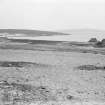
This island is situated in the Sound of Harris, about 4km W of Berneray and 1.5km NE of Aird a' Mhorain. It measures about 2.2km from N to S by 1.6km, and is divided into two unequal parts by the Loch Mor, which on the W is separated from the Atlantic only by a narrow strip of storm-beach. Although now deserted, the island formerly maintained a considerable population and there are a number of house ruins with associated steadings and corn-drying kilns, mainly on the E coast and to the NE of the loch. A chambered cairn, Na Cailleacha Dubha ('the black hags'), is situated on the slope above the N end of the sandy beach that runs along much of the E coast and forms the main landing-area. Part of the beach is backed by high sand-dunes, and at the S end these have produced remains of structures as well as midden-material, pottery and bronze pins, some of them of early medieval types (i).
On the E slope of a low (23m) grassy summit at the SE corner of the island there is the traditional site of a burial-ground known as Cladh Manach ('the monks' burial-place'). According to Martin, 'all the Monks that dyed in the Islands that lye Northward from Egg, were buried in this little Plot, each grave hath a Stone at both ends' (ii). Until the early 20th century the site was marked by an uncultivated area in arable ground (iii), but there are no remains except for the cross-marked stone described below. A few clearance-cairns are visible to the W of the site, and a slab bearing five or six cup-marks lies about 80m to the WNW (iv).
The cross-marked stone is an irregular earthfast slab measuring 0.44m in visible height by 0.72m in width and 0.12m in thickness. On the W face there is a much-worn sunken cross, 200mm high and having at mid-height a transom 100mm in span. The terminals are expanded and may originally have been barred.
(i) NMRS database NF88SE, nos.1 and 5.
(ii) M Martin 1934, 68.
(iii) E Beveridge 1911, 301. It was recorded in 1877 that the greater part of the disused burial-ground was under cultivation, and that there were two gravemarkers with crosses (Name Book, Inverness-shire (Hebrides), No.6, p.6).
(iv) J D Lyford-Pike 1941, 128, fig.2 on p.130.
RCAHMS 1928, No.168.
I Fisher 2001, 112.
Desk Based Assessment
NF88SE 3 8558 8050.
(NF 8558 8050) Cladh Manach (NR) Burial Ground (Disused): Sculptured Stones (NR) (Site of)
OS 6"map, Inverness-shire, 2nd ed., (1904)
Cladh Manach, a burial ground called the 'Monks Field' where, it is alleged, were buried 'all the monks that died in the islands that lie northward of Eigg.' The graves are marked with stones at both ends (M Martin 1934) In 1877 the Name Book records (i) that this very ancient burial ground is disused and the greater part under cultivation, and (ii) there are two stones, 1ft high, with crosses cut on them, apparently at the head of graves. The Name Book (1877) also notes a cup-marked rock about 3 chains west of the burial ground, with 3 cup-marks, but RCAHMS (1928) and Lyford-Pike (1941) say there are 4 and 5 respectively. (The incised cross-slabs and the cup-marked rock are together described as 'sculptured stones' in the Name Book 1877).
When Beveridge (E Beveridge 1911) visited the site he saw the two 'narrow oblong slabs', one bearing an incised cross (NF88SE 3.01). He suggested the graveyard was attached to a chapel, if not a monastery.
(For a discussion of small grave-markers which he dates 6-7th cent., see C Thomas, 'Ardwall Isle: The Excavation of an Early Christian Site': Trans Dumfries Galloway Natur Hist Soc 1966, vol. 43, 101-2)
Information from OS Card Index.
M Martin 1934; Name Book 1877; E Beveridge 1911; RCAHMS 1928; Lyford-Pike 1941.

