|
Photographs and Off-line Digital Images |
IN 3354 |
Papers of Dr Mary Harman, archaeologist, Edinburgh, Scotland |
Internal view of building, |
1976 |
Item Level |
|
|
Photographs and Off-line Digital Images |
IN 3355 |
Papers of Dr Mary Harman, archaeologist, Edinburgh, Scotland |
Internal view of building, |
1976 |
Item Level |
|
|
Photographs and Off-line Digital Images |
IN 3356 |
Papers of Dr Mary Harman, archaeologist, Edinburgh, Scotland |
External view of building, |
1976 |
Item Level |
|
|
Photographs and Off-line Digital Images |
IN 3357 |
Papers of Dr Mary Harman, archaeologist, Edinburgh, Scotland |
General view taken from the northern part of the township (cNF 8938 8785) facing S. |
1976 |
Item Level |
|
|
Photographs and Off-line Digital Images |
IN 3358 |
Papers of Dr Mary Harman, archaeologist, Edinburgh, Scotland |
General view facing S, taken from the northern area of the township (cNF 8929 8785). |
1976 |
Item Level |
|
|
Photographs and Off-line Digital Images |
IN 3359 |
Papers of Dr Mary Harman, archaeologist, Edinburgh, Scotland |
General view of the northern (foreground) and southern parts of the township, taken from cNF 8936 8794. |
1976 |
Item Level |
|
|
Photographs and Off-line Digital Images |
IN 3384 |
Papers of Dr Mary Harman, archaeologist, Edinburgh, Scotland |
View of corn drying kiln in interior of building, |
1976 |
Item Level |
|
|
Photographs and Off-line Digital Images |
H 92238 PO |
Cambridge University Collection for Aerial Photography |
Oblique aerial view centred on the remains of the township; head-dyke and farmstead, taken from SE. |
25/7/1964 |
Item Level |
|
|
Photographs and Off-line Digital Images |
H 92239 PO |
Cambridge University Collection for Aerial Photography |
Oblique aerial view centred on the remains of the township; head-dyke and farmstead, taken from SE. |
25/7/1964 |
Item Level |
|
|
Photographs and Off-line Digital Images |
H 92240 PO |
Cambridge University Collection for Aerial Photography |
Oblique aerial view centred on the remains of the township; head-dyke and farmstead, taken from SSW. |
25/7/1964 |
Item Level |
|
 |
On-line Digital Images |
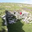
DP 137923 |
RCAHMS Field Survey Digital Photography |
North Lingay. View of the interior if the building at NF 89362 87813, taken from the S (Miss KM Geddes in shot). |
27/6/2011 |
Item Level |
|
 |
On-line Digital Images |
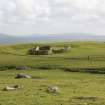
DP 137924 |
RCAHMS Field Survey Digital Photography |
West Lingay. General shot of the building and enclosure at NF 8914 8752, taken from the NE. |
27/6/2011 |
Item Level |
|
 |
On-line Digital Images |
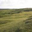
DP 137931 |
RCAHMS Field Survey Digital Photography |
Cultivation remains highlighted by low sunlight at cNF 891 873, taken from the E. |
27/6/2011 |
Item Level |
|
 |
On-line Digital Images |
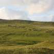
DP 137932 |
RCAHMS Field Survey Digital Photography |
South Lingay. General view of the township and cultivation remains, taken from the S. |
27/6/2011 |
Item Level |
|
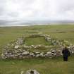 |
On-line Digital Images |
DP 138219 |
RCAHMS Field Survey Digital Photography |
South Lingay. View of building at NF 89425 87623, from the N, |
25/6/2011 |
Item Level |
|
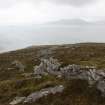 |
On-line Digital Images |
DP 138223 |
RCAHMS Field Survey Digital Photography |
General view of boundary dyke at NF 89 88, with Toe Head in the background. |
25/6/2011 |
Item Level |
|
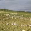 |
On-line Digital Images |
DP 138273 |
RCAHMS Field Survey Digital Photography |
General view looking towards the northern part of Baile Lingay, taken from the SW, |
26/6/2011 |
Item Level |
|
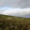 |
On-line Digital Images |
DP 138275 |
RCAHMS Field Survey Digital Photography |
General view of the northern part of Baile Lingay, taken from the W, |
26/6/2011 |
Item Level |
|
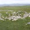 |
On-line Digital Images |
DP 138276 |
RCAHMS Field Survey Digital Photography |
North Lingay. General view of modified building at NF 89319 87831, taken from the NW. |
26/6/2011 |
Item Level |
|
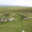 |
On-line Digital Images |
DP 138277 |
RCAHMS Field Survey Digital Photography |
North Lingay. General view of one building superimposed on the remains of another at NF 89336 87835, taken from the NE. |
26/6/2011 |
Item Level |
|
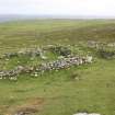 |
On-line Digital Images |
DP 138278 |
RCAHMS Field Survey Digital Photography |
North Lingay. General view of the group of three buildings at NF 89340 87832. |
26/6/2011 |
Item Level |
|
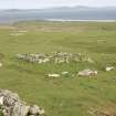 |
On-line Digital Images |
DP 138279 |
RCAHMS Field Survey Digital Photography |
General view of building, |
26/6/2011 |
Item Level |
|
 |
On-line Digital Images |
DP 138280 |
RCAHMS Field Survey Digital Photography |
General view of building, |
26/6/2011 |
Item Level |
|
 |
On-line Digital Images |
DP 138281 |
RCAHMS Field Survey Digital Photography |
North Lingay. General view of group at NF 89384 87822, taken from the N. |
26/6/2011 |
Item Level |
|


