Following the launch of trove.scot in February 2025 we are now planning the retiral of some of our webservices. Canmore will be switched off on 24th June 2025. Information about the closure can be found on the HES website: Retiral of HES web services | Historic Environment Scotland
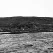
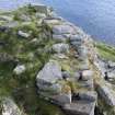
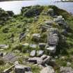
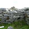
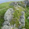
North Uist, Dun An Sticer
Broch (Iron Age), Building(S) (Medieval)
Site Name North Uist, Dun An Sticer
Classification Broch (Iron Age), Building(S) (Medieval)
Alternative Name(s) Sticir
Canmore ID 10294
Site Number NF87NE 1
NGR NF 89717 77675
Datum OSGB36 - NGR
Permalink http://canmore.org.uk/site/10294
First 100 images shown. See the Collections panel (below) for a link to all digital images.
- Council Western Isles
- Parish North Uist
- Former Region Western Isles Islands Area
- Former District Western Isles
- Former County Inverness-shire
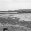
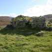
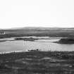
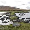
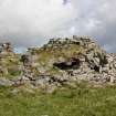
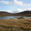
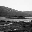
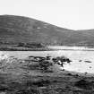
Dun an Sticir (fort of the skulker), probably 16th century Remains of a small tower or hall raised on the foundations of an Iron Age broch. It stands on an island in Loch an Sticir, reached by a causeway via two other islets. Here lurked the riever Hugh Macdonald (Uisdean Macghilleasbuig Chleirich), factor to North Uist in the 1580s. In 1586 he hatched a treacherous plot to murder his cousin, Donald Gorm, 8th Chief of the Macdonalds of Sleat, but was captured and perished in the dungeon of Duntulm Castle on Skye.
Taken from "Western Seaboard: An Illustrated Architectural Guide", by Mary Miers, 2008. Published by the Rutland Press http://www.rias.org.uk
Reference (1877)
Extract from OS Name Book, Inverness Hebrides Book 6, North Uist 1/2500, 78. Dated to 1877 by notes within the book.
This name is applied to the remains of an ancient building resembling very much in construction the Pictish towers of Sutherlandshire. The outer wall is circular in shape and appears to have been of great strength, being built of heavy flattish moor stones, a great portion of which have been taken to build walls and houses in the surrounding district; there is........of the outer wall still standing , which appear to have had a passage running round the inside of it.
It stands on a small island (which has the appearance of being artificial) in the loch of the same name, and is approached by a foot way formed of stones.
Hugh Macdonald, a relation of Macdonald of Sleat, fled from Skye to escape from his chief (against whom he had conspired) to this Dun. He was captured by the treachery of the woman who brought him food, carried to Skye, and thrown into the dungeon of Duntulm Castle, where he died of thirst.
Authorities: Mr Morrison, AA Carmichael, J Macdonald
Field Visit (13 August 1914)
Dun an Sticer, Loch an Sticer, Port nan Long.
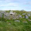
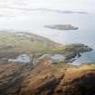
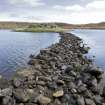
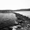
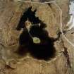
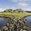
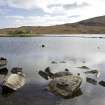
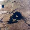
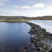
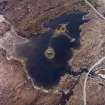
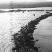
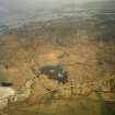
Barely ½ mile SSE of Port nan Long is a shallow, tidal loch with the remains of a broch occupying an islet near its centre. Access to the broch is obtained by a well-built causeway 9 feet in width, which extends from the northern shore of the loch over intervening rocks to an island about the centre of the western arm of the loch. From this island, which is also connected with a promontory on the south shore by a short narrow causeway formed of massive blocks of stone, a causeway 9 feet broad and 180 feet long is carried in a north-easterly direction with a gentle curve to the north to the islet occupied by the fort, terminating 24 feet from the building. (Fig. 109.).
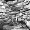
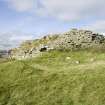
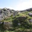
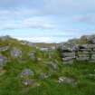
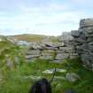
The broch is hardly a true circle on plan, varying from 60 to 61 feet in diameter all over, but it has been much destroyed to provide material for a later structure erected in the interior, and for building the stone dyke on the side of the road, some 300 yards to the west. The interior area of the broch is for the greater part occupied by the later building, but apparently it must have measured about 40 feet in diameter internally, the wall varying from about 9 feet to 12 feet in thickness. The best preserved portion of the wall is to the east, where, built with a slight batter, it rises 8 feet above some recent enclosures built at its base; to the south the outer face of the main wall reaches a height of about 5 feet, and the inner wall of a gallery rises about 6 feet higher; on the north-west, though the outline can be traced, the wall is completely broken down. Within the wall on the south-western arc at the floor level is an oval vaulted chamber measuring 8 feet in length and 4 feet 9 inches in breadth on the surface of the debris, which covers the floor to within 3 feet 6 inches of the roof. Low down in the western end of this chamber there is a lintelled opening resting on well-built jambs, 1 foot 6 inches apart, apparently the entrance, though now blocked up with rubbish. The roof of the oval chamber forms the floor of an upper gallery within the wall, which is traceable for more than half the circumference of the building and is best preserved on the east, where it shows a width of 2 feet 6 inches, with the outer wall 3 feet 9 inches thick and the inner wall 2 feet 9 inches thick. The inner wall of the gallery towards the south-west is pierced by a window looking into the interior of the broch and measuring 2 feet 3 inches in width. An entrance passage runs out towards the north and measures 2 feet 7 inches in width, apparently having a sill raised above the outside level by about 1 foot 3 inches. Access from the gallery to the later building in the centre of the broch has been by this passage.
The late structure built within the broch consists of a rectangular chamber with all the corners slightly rounded except that to the east, which is square. From roughly east to west it measures 33 feet 3 inches and from north to south 16 feet 3 inches, the wall on the south side measuring 3 feet 7 inches in thickness and on the north side from 5 feet to 8 feet. Near the western end of the north side is a window, widely splayed towards the inside, 7 inches wide at the outside and 3 feet inside. The door, which is near the east end of this wall, is 3 feet 6 inches wide. The wall of the broch at this part seems to have been purposely removed, as a returning wall is built across it to the west of the window. In the west wall at the south-west corner is another entrance, 2 ft 7 inches wide, and beside it is a large lintel, 7 feet long, 2 feet broad, and 1 foot 1 inch thick.
RCAHMS 1928, visited 13 August 1914.
OS map: North Uist xxxi
Measured Survey (24 July 1924)
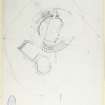
A plane-table survey of the broch and later buildings at Dun an Sticer was undertaken by RCAHMS on 24 July 1924. The resultant plan was redrawn in ink to show only the broch, and published at a reduced size (RCAHMS 1928 fig. 111).
Field Visit (22 June 1965)
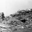
Dun an Sticer (name confirmed locally) survives to a height externally of 3.6m and is a galleried dun, not a broch as claimed above. It is sub-circular, the wall-thickness is uneven and not more than 3.5m, its position on an islet is typical of a dun, and there appears to be no batter on the outside wall-face. It has been greatly mutilated in the NW and around the entrance in the west but the gallery, 1.0m wide, can still be traced in places.
The secondary drystone building, measuring 10.0m by 4.6m internally and 1.7m below the present top of the dun, must have been a fortified structure as ther is an emdrasure in the NW wall. It is entered from the NW and SW through passages 1.1m wide. The wall at the SW entrance is 2.5m thick.
Vague traces of a possible small building can be seen between the SE wall of the inner building and the inner wall of the dun: adjoining the outer wall-face of the dun on the east are two stock enclosures, measuring 7.8 x 5.0m and 9.0 x 5.5m over grass-covered walls 0.8 m. high.
A causeway connects the dun to Eilean na Mi-chomhairle, and from there to the north shore of the loch. It is 3.0m wide, bordered by large stones and suitable for wheeled traffic, which suggests that it may be contemporary with the secondary structure or the stock enclosures. Another causeway, from Eilean na Mi-chomhairle to the south shore of the loch, is much smaller, and is typical of those associated with duns. Resurveyed at 1/2500.
Visited by OS (N K B) 22 June 1965.
Desk Based Assessment (1965)
Dun an Sticer: circular fort, 60ft diameter, broken by a gap in the north. The massive outer wall and evidence of a gallery, together with other details, suggest that it was a broch. It is approached by a causeway. Finds include pottery.
A secondary rectangular structure has been erected inside, which may be associated with the traditional occupation of the site by Hugh, son of Archibald the Clerk, c. 1601-2 (RCAHMS 1928)
Broch - full description.
Information from OS c1965
Sources: E Beveridge 1911; RCAHMS 1928.
Publication Account (2007)
NF87 2 DUN AN STICIR
NF/897777
This unexcavated but well preserved broch in North Uist stands on an islet near the centre of a shallow, tidal loch and barely a quarter of a mile from Port nan Long from which a foot ferry has long run northwards across the Sound to Harris (visited in 1971, 14/8/85 and 24/6/88). Regrettably no large scale plan seems to have been made of this interesting site, nor of Dun Torcuill, below (NF87 4) (however the Ordnance Survey investigators made a small-scale plan [1]). The Archaeology Division of the Ordnance Survey was abolished in about 1974 and its Scottish records were handed over to the Royal Commission AHMS in Edinburgh. The OS card index, and its site numbering system based on the 10km grid squares, forms the basis of the data on the modern RCAHMS 'Canmore' web site. If one is staying in Harris both this broch and Dun Torcuill (below) can easily be visited on foot from the southern terminal of the ferry.
Description
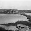
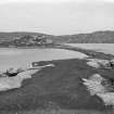
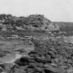
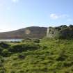
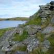
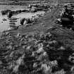
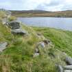
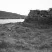
The broch is reached by a stone causeway from another islet near the north shore (where there is a shallow bay) which is itself reached by two further causeways – from the east and west ends of the bay. The causeway to the broch island is 3.0m wide and resembles a flat road just above water level, with kerbs of heavier stones; it terminates 7.3m (24 ft) from the broch and there is a flat, grass-covered platform between [2, fig. 109]. It has been suggested that, since the road is suitable for wheeled vehicles (much of it is still turf-covered), it could be a late medieval modification of the original causeway, constructed at the time of the late building inside the broch (below). The more massive first causeway (the shorter one on the west) is of huge slabs, is 2.75m (9 ft) wide and runs from the north shore of the loch to the intermediate Eilean na Mi-chomhairle. Intriguingly the name of this small island is very similar to Eilean na Comhairle, the 'Council Isle', in Loch Finlaggan in Islay – the headquarters of the Lordship of The Isles from the 13th to the 15th centuries. One wonders whether the construction of the medieval building inside Dun an Sticir had something to do with the Lordship. If so one would expect the broch island to bear this name, since it has an appropriate building. On the other hand a local legend associates the house with a later time, at the beginning of the 17th century [2].
The broch sits on one side of a flat islet somewhat larger than itself so that there is a broad, grassy platform on the side away from the causeway. The building was reclassified as a “galleried dun” [1, 4] rather than as a broch [3] but without any explanation of what the difference is, except that the building is sub-circular and that the wall appears to be of uneven thickness. Since the structure is unexcavated, still stands quite high and is partly concealed by a later building this last point is perhaps not proven. Much of its stone was presumably taken for the medieval building on top of it, and probably for a nearby road dyke.
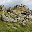
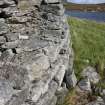
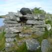
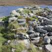
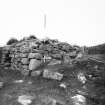
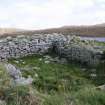
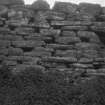
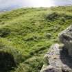
The outer wallface is strongly battered and is preserved best on the eastern side where it rises to about 2.4m (8 ft) above some recent buildings at its base. The main entrance is on the south-west, facing along the causeway and a massive lintel in the form of a truncated triangle lies on the ground in front of it; it must once have roofed the outer end. The wallface on the left above the passage lintels may be the side of the chamber over the entrance, reused in later times as the medieval entrance passage (below).
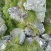
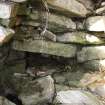
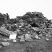
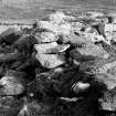
The guard cell on the right has been broken into from the front (this is the shadowed area that can be seen from the shore) and is filled with debris to within 1.07m (3.5 ft) of the part of the roof that remains. The lintel of the passageway leading from this cell into the main entrance is clearly visible, as are the upper sides of at least one of the lintels of the passage itself at a slightly higher level. It is clear that the roof of the cell is not the remains of a corbelled dome but has been made of stepped lintels; the floor of the Level 2 gallery must therefore rise slightly to cross over the cell below. In this sense Dun an Sticir could be described as an architecturally more primitive broch, like Midhowe (HY33 1) and Dun Telve (NG81 2), rather than a more sophisticated one with an elegantly corbelled, beehive dome over its guard cell like Dun Mor Vaul, Tiree (NM04 4).
The upper gallery can be seen running round for more than half the circumference of the broch and a void from it to the interior can be seen on the south-west. At 4 o'clock on the south side the outer face is about 1.5m (5 ft) high and the inner face of a mural gallery there rises 1.8m (6 ft) higher; this must therefore also be part of the Level 2 gallery and indeed one lintel of the lower gallery is visible in situ here.
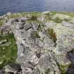
The late medieval house. A rectangular stone house of mortared masonry has been erected on top of the central court of the broch (see Dun Ringill, Skye – NG51 4) and it measures 10.0m by 4.6m internally; its level floor is 1.7m below the present wallhead of the broch. The entrance in the south-west is on top of the broch entrance and aligned in the same direction; it seems likely that the lintels of the latter were used as its floor. This passage is 1.1m wide and runs through a wall 2.5m thick.
There is another doorway on the north-north-west, also 1.1m wide and the outer end of which is raised into a sill 38cm (15 in) high, formed by the outer wallface of the broch appearing above the debris. A splayed window is the west wall of the house, near the south-west corner. The site is traditionally associated with Hugh, son of Archibald the Clerk, in about 1601-02 [2] and the rectangular house may well be his.
There are outbuildings of uncertain date between the broch and its outer wall.
Discussion
The fact that the site is unexcavated and covered by a late building makes it difficult to infer the architectural details of the primary structure with any confidence. The design of Level 1 is obscure; only the entrance passage and the right-hand guard cell are visible. Level 2 is sufficiently well preserved for two diagnostic features of the broch tower design – the chamber over the entrance and an upper gallery – to be revealed. No doubt the scarcement is still intact on the inside wallface but buried under rubble. The site would surely repay systematic exploration.
Finds?
Several glass beads, some probably from this site, are in the National Museums of Scotland collection [5]. They wre described as coming from “Caolais, Newton” (where Beveridge found some cists) and from “Dun Torquil at Newton.” However this broch is some way away from Newton whereas Dun an Sticir is close by. The author has not seen the beads.
Dimensions
External diameter 18.3 - 18.6m (60 - 61 ft), internal diameter (obviously well above floor level, and probably above the scarcement) about 12.2m (40 ft); the wall proportion at the wallhead is thus about 35% but must be greater lower down.
Sources: 1. NMRS site no. NF 87 NE 1: 2. Beveridge 2001, 138-44: 3. RCAHMS 1928, 51-2, no. 171: 4. Feachem 1963: 5. NMRS site no. NF 87 NE 24.
E W MacKie 2007
Field Visit (12 September 2010)
NF 8972 7768
This unexcavated broch was visited on 12 September 2010. A precise survey of the inner wall face, by the angle-and-distance method, confirmed that the central
court is exactly elliptical. The court is so similar in situation, size, shape and state of preservation to its neighbour Dun Torcuill that it may reasonably be assumed also to have had a high scarcement, now vanished.
Archive: RCAHMS (intended)
E W MacKie 2010
Field Visit (20 September 2012)
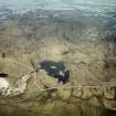
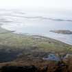
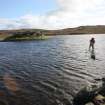
This broch, which stands on an islet in an occasionally tidal loch, is connected to another islet (Eilean na Mi-chomhairle) 60m to the WSW, by a substantial causeway. In turn, Eilean na Mi-chomhairle is connected to the N shore by a second causeway that incorporates another (very small) islet, and to the S shore by a series of stepping stones. Four later buildings have been built in and around the broch.
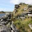
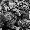
Roughly circular in plan, with a notable bulge in the outer wall-face on the W caused by subsidence, the broch measures 12m in diameter within a wall up to 3.7m in thickness and best preserved on the E, where it stands to a visible height of 2.4m. The outer face of the wall has a marked batter and there is an entrance on the SW. This has been modified and the original width cannot now be ascertained. Moreover, most, if not all, of the lintels that once roofed the passage and which now form a footpath to the interior, are probably not in their original positions.
A ground-floor cell, constructed within the thickness of the broch wall, leads off the SE side of the entrance passage and was originally entered through a doorway 0.6m in width. Oval on plan, it measures 3.2m from NW to SE by 1.3m transversely and its corbelled roof has largely collapsed, leaving the interior largely choked with rubble. An intra-mural gallery, 0.7m in breadth, is visible within the broch wall on the E, S, SW (where it crosses over the top of the cell), and W; it may have been continuous, but sections of its wall-faces on the W and SW have been reconstructed and it is not now possible to establish from the visible remains whether it once continued across the top of the entrance passage. Two openings from the intra-mural gallery through the inner face of the broch wall, one on the S, the other on the SW (above the cell), are not original features and are noted below.
Inside the broch, most of the available space has been taken up by a two-compartment building that has been constructed on the debris filling the ground-floor of the earlier structure. Its principal room, which extends across the whole width of the interior of the broch from ENE to WSW, measures 9.9m in length by 4.9m within drystone walls that vary in thickness up to 2.4m on the WNW and SSW, where the upper part of the broch wall has been completely rebuilt. There are two openings in the NNW wall: close to the WSW end there is a splayed window, narrowing from 0.9m in width on the inside to 0.2m; and close to the ENE end there is a probable entrance measuring 1.1m in width. Outside the NNW side, the broch wall has been reduced in height, with the stubs at either end being retained behind neat, rebuilt masonry. This reduction in the wall was presumably undertaken to provide a clearer view from the window and access to the doorway. Another doorway, perhaps the primary one, is situated in the WSW end of the building. It measures 0.8m in width and there is a possible bar-hole in the NNW jamb. There is some evidence of rebuilding at the SE corner of the building, where a rebuilt section of the inner face of the ENE end forms a butt-joint against the original inner face of the SSE wall.
The second compartment is situated between the first and the broch wall on the SSE and measures internally 3.8m from ENE to WSW by 2.5m transversely. It was entered through a doorway, 0.8m in width, in the reconstructed gallery wall, which linked to the main entrance on the WSW via the gallery passage. The wall between the two compartments was depicted, if inaccurately, on Beveridge’s plan (1911, 140). The second opening from the intra-mural gallery is situated a little to the W of the first. However, since it is in a section of reconstructed gallery wall and because it merely leads into part of the broch interior otherwise occupied by the wall-core of the principal building, the conclusion must be that it belongs to a phase of construction that precedes the buildings that are visible today.
Two later rectangular buildings occupy the flat ground immediately to the E of the broch, and stand on prominent artificial platforms. Although mentioned by RCAHMS (1928) and OS (1965) – in both instances as ‘enclosures’ – they have not previously been described in detail. The first building, which abuts the NE side of the broch wall, measures 9.6m from ENE to WSW by about 6.4m transversely over grass-grown stone walls spread to 1.5m in thickness and 0.2m in height. There is an entrance on the NNW. Immediately to the S is a second of similar construction and size. The relationship between the two is not clear.
Other features on the islet include a marked scarp that extends about 10m NNE from the N side of the broch to the loch shore and a short stretch of bank running for a distance of at least 8m along the E side of island, immediately E of the two buildings reduced to footings. Neither seems substantial enough to support the proposal by previous authors that the broch had an outer wall (Beveridge 1911, 139; Armit 1990).
References to the story of Hugh, son of Archibald the Clerk, taking refuge at Dun an Sticer about 1601-1602 (OS Name Book 6, 78 (1877); Beveridge 1911) do not necessarily provide a date for the rectangular buildings on the island. Indeed, the substantial nature of the group and the evidence which demonstrates that the principal structure has been altered, probably on a number of occasions, may well indicate that the buildings are earlier, possibly originating in the medieval period.
Visited by RCAHMS (GFG, AGCH, IP) 20 September 2012.
Measured Survey (19 September 2012)
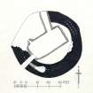
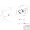
RCAHMS surveyed the Dun An Sticer broch on 19 September 2012. The survey, undertaken using dGPS and plane-table and alidade, produced a ground plan and sections at a scale of 1:250 and a site plan at a scale of 1:1250.


