Pricing Change
New pricing for orders of material from this site will come into place shortly. Charges for supply of digital images, digitisation on demand, prints and licensing will be altered.
North Uist, Ben Langass, Pobull Fhinn
Stone Circle (Neolithic) - (Bronze Age)
Site Name North Uist, Ben Langass, Pobull Fhinn
Classification Stone Circle (Neolithic) - (Bronze Age)
Alternative Name(s) Sornach Coir' Fhinn; Pobuill Fhinn
Canmore ID 10237
Site Number NF86NW 7
NGR NF 84274 65010
Datum OSGB36 - NGR
Permalink http://canmore.org.uk/site/10237
- Council Western Isles
- Parish North Uist
- Former Region Western Isles Islands Area
- Former District Western Isles
- Former County Inverness-shire
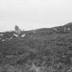
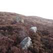
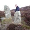
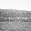
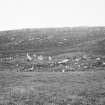
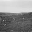
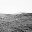
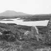
Poball Fhinn (Finn's people), possibly 2nd millennium bc. A little-disturbed oval ring of weathered stone slabs, standing upright or fallen on a saucer of ground terraced into the hill above Loch Langass.
Taken from "Western Seaboard: An Illustrated Architectural Guide", by Mary Miers, 2008. Published by the Rutland Press http://www.rias.org.uk
NF86NW 7 8427 6502.
(NF 8427 6502) Pobul Fhinn (NR)
OS 6" map, Inverness-shire, 2nd ed., (1903)
This stone circle is known locally as Sornach Coir' Fhinn. The OS 6"map, 1903 erroneously applies this name to another circle (NF86SW 28).
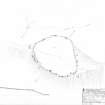
The circle is oval, being 122ft E-W and 100ft N-S. The enclosed area has been partly levelled by excavation to a depth of 4ft on the N side, and a slight bank of earth with some stones in it has been erected along the southern side on the edge of the plateau and round the ends. The standing stones generally are placed on the outer edge of this bank and against the face of the slight scarp on the northern side. About 24 erect stones and boulders can be counted in the ring of the circle, eight on the northern and sixteen on the southern half, but a considerable length of the NE segment is devoid of stones.
E Beveridge 1911; RCAHMS 1928.
Pobul Fhinn is generally as described by the RCAHMS, the eight stones on the northern half being the most prominent although there are 23 others. A wall on the north side is no more than 0.5m high and 0.3m thick and may not be contemporary with the circle. Neither name could be authenticated locally.
Surveyed at 1/10,560.
Visited by OS (J T T) 10 June 1965.
NF 84270 65020 An archaeological watching brief was carried out during the creation of a new pathway at the stone circle of Poball Fhinn. No features of archaeological significance were observed during the excavation of the path foundations. Excavation of the first culvert, to a depth of 320mm, revealed shallow peat deposits and exposed the underlying geology at at depth of 160mm. Elsewhere the shallow depth of excavated material (c.250mm) meant that little information was gained about the depth of the peat across this area. The path was created without damaging any archaeological deposits.
Rebbecca Rennell, 2007.
Field Visit (28 July 1915)
Stone Circle, Pobull Fhinn*, Ben Langass.
This circle occupies a small plateau, some 50 feet above sea-level, on the southern slope of Ben Langass, about 450 yards east-south-east of Langass Lodge, and about 100 yards north of Loch Langass, one of the inner arms of Loch Eport. The setting of stones is oval, measuring some 122 feet from east to west, and 100 feet from north to south. The area enclosed by the circle has been partly levelled by excavation to a depth of some 4 feet on the northern side, and a slight bank of earth with some stones in it has been erected along the southern side on the edge of the plateau and round the ends. The standing stones as a rule are placed on the outer edge of this bank, and against the face of the slight scarp on the northern side. About twenty-four pillars and boulders can be counted in the ring of the circle, eight on the northern, and sixteen on the southern half, but a considerable length of the north-eastern segment is devoid of stones.
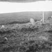
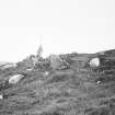
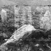
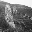
Of the existing stones fourteen are clearly of the type seen in stone circles; one is completely prostrate, two nearly so, and the others erect. They vary from 3 feet to 4 feet 10 inches in height. The remaining ten stones are smaller boulders and small pillars set on end. The prostrate stone, a very irregular pillar lying on the south-west, measures 7 feet 8 inches in length, 2 feet 6 inches in breadth, and 1 foot 10 inches in thickness. Some 4 feet within the eastern end of the circle is a thin monolith roughly oval in shape, and pointed at the top. It is the best stone of the group and measures 6 feet 9 inches in height, 3 feet 2 inches in breadth, and 1 foot in thickness. Outside the western arc of the circle are two stones an overthrown pillar 7 feet 2 inches in length, and I foot 6 inches in width, and a standing_ stone tilted towards the south-east 3 feet9 inches high, 3 feet 10 inches broad, and 1 foot thick. The former, which lies 9 feet 9 inches from the ring of the circle, lies in a line pointing north-east, and the latter, which stands some2 feet 4 inches to the south-east of the former, is 7 feet 4 inches distant from the nearest stone in the circle. (Fig. 140.)
RCAHMS 1928, visited 28 July 1915.
OS map: North Uist xl.
*Locally known as Sornach Coir Fhinn, but this name erroneously applied by O. S. to NF86SW 28. (Beveridge's North Uist, p. 259.)
Measured Survey (22 July 1924)
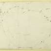
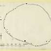
RCAHMS surveyed this site by plane-table on 22 July 1924. The resultant plan was redrawn in ink and published at a reduced size in RCAHMS 1928 as Figure 141.
Field Visit (2007)
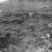
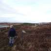
NF 8427 6502 Sornach Coir Fhinn stands on a fairly steep slope immediately to the N of Loch Langass and is rare in having been built on an artificial platform; the stone ring is set on a level bay cut out of the hillside and the material excavated in this way was spread around the circle as a broad bank. A path leads to the site from the road (RCAHMS 1928, 83, no. 250). An accurate plan was made by A Thom (Thom, Thom and Burl 1980, 310-11: site H/17) and it seems to be partly built as a true circle with a diameter of 125ft; the arc on the southern (downhill) side is flattened. There are possible entrances at the ends of this arc. Various suggestions have been made about how the circle may be indicating short, calendar alignments to neighbouring sites (op cit: Ruggles 1984,102, site UI28) but none are very convincing. Yet the site’s position had obviously been carefully chosen and involved extra labour to construct.
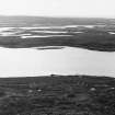
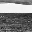
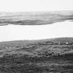
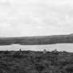
The weather was fine and the air clear on a recent visit so it was possible to look for distant peaks which might mark accurate long alignments to sunrises or sunsets. Most of the horizon is only a few miles away but in the SE the landscape is particularly striking. The low hills Eaval and South Lee stand out, framing a stretch of local low ground between them. In that gap showed faintly two much more distant flat-topped mountains – MacLeod’s Tables on Skye – Healabhal Beag on the right and Healabhal Mhor, about 27 miles away. Just to the left of the latter, and showing even more dimly (almost vanishing before the end of the visit), was Glamaig, a conical peak also on Skye almost exactly 47 miles away. The azimuth from the stone circle to the top of Glamaig is very close to 122º and it therefore seems likely that the diameter of the true circle which forms the boundary with the flattened part was actually aimed at this remote peak, so that it is a genuine indicated alignment. It also seems likely that the reason for digging out the platform for the circle at this point on the hillside was to keep the top of Glamaig in view, together with whatever other nearer horizon targets, if any, were being aimed at. The astronomical declination of top of Glamaig is about – 16.5º so that, when the sun rises with its upper edge at the peak, its centre has a declination of from –16.7 to –16.8º; this would have been very suitable in prehistoric times for marking two of the ‘eighth’ divisions of the Thom solar calendar, namely the first and last Quarter Days of the year – at the beginnings of February and November respectively.
Some useful points emerge from this new discovery. First, how many more such long alignments, visible only in clear weather, await discovery? A Thom and CLN Ruggles between them have surveyed more British standing stone sites than anyone else, but they rarely comment on the weather at the time of the site visits. Obviously if a distant peak is recorded it must have been clear but it is unlikely to have been equally good when all the sites shown having only near horizons were surveyed. With present climatic conditions it must often be a matter of luck whether a vital distant peak is seen during a short visit.
The second point is that investigations of the astronomical qualities of standing stone sites should be a little more flexible. The irreducible requirement must remain of course: to be plausible a celestial alignment must include a direction indicator of some kind in the backsight which points at the horizon foresight. However, as with Sornach Coir Fhinn the landscape itself could often be giving us important clues about what the circle builders and stone erectors intended. There the distant mountains in Skye, framed between local hills, seemed an obvious potential sunrise foresight and an examination of the site plan showed that this direction was indeed marked.
The third point is that the discovery of the rarely visible yet indicated Glamaig sight-line surely points again to a better climate and clearer air in Neolithic times. Other rarely seen long sight-lines suggest the same, like those to Boreray in the St. Kilda group. The literature on the climatic deterioration in Britain between the middle Bronze and the Iron Ages is large but an essential point is that peat is repeatedly found to have grown over Highland archaeological sites of these earlier periods, marking the onset of wetter and cooler weather. A local example is Callanish in Lewis the stones of which were originally half submerged by about 5ft of peat. It simply will not do to argue from present atmospheric conditions that long alignments are implausible.
Mackie, E W, University of Glasgow, 2007
(RCAHMS 1928; Ruggles, CLN 1984 Megalithic astronomy; Thom, A, Thom, AS and Burl, HAW 1980 Megalithic rings)
Archive to be deposited with RCAHMS.
Watching Brief (16 February 2009 - 19 February 2009)
NF 844 657 A watching brief was carried out on 16–19 February 2009 during the extraction of gravel for the
construction of a footpath. The extraction pits were on the northern flank of Beinn Langais, an area that was the focus for activity throughout the Neolithic period. There are two scheduled ancient monuments less than 600m from the pits; Pobuill Fhinn a stone circle (NF86NW 7), and Barpa Langass (NF86NW 6), an early Neolithic chambered burial cairn. Evidence for an early settlement, of Neolithic or perhaps even earlier date, had been discovered during widening of the main road c800m to the N of the site. No features of archaeological
significance were found during the excavation of the four gravel pits.
Archive: RCAHMS (intended). Report: CNES SMR and RCAHMS
Funder: North Uist Woodland Trust
Kate MacDonald and Rebecca Rennell – Uist Archaeology
Field Visit (5 March 2010)
This stone circle, which stands at the SE end of a terrace overlooking the W end of Loch Langass from the NE, is generally as described by RCAHMS in 1928. Oval on plan, its interior is levelled into the gently sloping surface of the terrace, and the excavated material seems to have been used to build the bank in which the upright stones of the circle are set. On the SSE, the taller ringstones stand along the inner edge of the bank, which also has an external kerb. Without excavation it is impossible to determine the relationship between the stones of the circle and the bank of the enclosure. Two fallen stones lie outside the circle on the SW.
Visited by RCAHMS (ARG,SPH) 5 March 2010
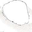
Measured Survey (18 September 2012)
RCAHMS surveyed the stone circle at Ben Langass, Pobull Fhinn on 18 September 2012 with plane-table and alidade producing a plan and section at a scale of 1:200. The plan was used as the basis of an illustration redrawn in vector graphics software.


