Field Visit


Date 28 July 1915
Event ID 1103571
Category Recording
Type Field Visit
Permalink http://canmore.org.uk/event/1103571
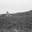
Stone Circle, Pobull Fhinn*, Ben Langass.
This circle occupies a small plateau, some 50 feet above sea-level, on the southern slope of Ben Langass, about 450 yards east-south-east of Langass Lodge, and about 100 yards north of Loch Langass, one of the inner arms of Loch Eport. The setting of stones is oval, measuring some 122 feet from east to west, and 100 feet from north to south. The area enclosed by the circle has been partly levelled by excavation to a depth of some 4 feet on the northern side, and a slight bank of earth with some stones in it has been erected along the southern side on the edge of the plateau and round the ends. The standing stones as a rule are placed on the outer edge of this bank, and against the face of the slight scarp on the northern side. About twenty-four pillars and boulders can be counted in the ring of the circle, eight on the northern, and sixteen on the southern half, but a considerable length of the north-eastern segment is devoid of stones.
Of the existing stones fourteen are clearly of the type seen in stone circles; one is completely prostrate, two nearly so, and the others erect. They vary from 3 feet to 4 feet 10 inches in height. The remaining ten stones are smaller boulders and small pillars set on end. The prostrate stone, a very irregular pillar lying on the south-west, measures 7 feet 8 inches in length, 2 feet 6 inches in breadth, and 1 foot 10 inches in thickness. Some 4 feet within the eastern end of the circle is a thin monolith roughly oval in shape, and pointed at the top. It is the best stone of the group and measures 6 feet 9 inches in height, 3 feet 2 inches in breadth, and 1 foot in thickness. Outside the western arc of the circle are two stones an overthrown pillar 7 feet 2 inches in length, and I foot 6 inches in width, and a standing_ stone tilted towards the south-east 3 feet9 inches high, 3 feet 10 inches broad, and 1 foot thick. The former, which lies 9 feet 9 inches from the ring of the circle, lies in a line pointing north-east, and the latter, which stands some2 feet 4 inches to the south-east of the former, is 7 feet 4 inches distant from the nearest stone in the circle. (Fig. 140.)
RCAHMS 1928, visited 28 July 1915.
OS map: North Uist xl.
*Locally known as Sornach Coir Fhinn, but this name erroneously applied by O. S. to NF86SW 28. (Beveridge's North Uist, p. 259.)