Pricing Change
New pricing for orders of material from this site will come into place shortly. Charges for supply of digital images, digitisation on demand, prints and licensing will be altered.
Upcoming Maintenance
Please be advised that this website will undergo scheduled maintenance on the following dates:
Thursday, 9 January: 11:00 AM - 3:00 PM
Thursday, 23 January: 11:00 AM - 3:00 PM
Thursday, 30 January: 11:00 AM - 3:00 PM
During these times, some functionality such as image purchasing may be temporarily unavailable. We apologise for any inconvenience this may cause.
Date August 2007
Event ID 995263
Category Recording
Type Archaeological Evaluation
Permalink http://canmore.org.uk/event/995263
Sea & Land Power and Energy Ltd. commissioned Headland Archaeology Ltd to undertake an archaeological survey and assessment of an area for a proposed temporary anemometer mast and anchor points at the south end of Inchkeith Island in the Firth of Forth. As Inchkeith is a Scheduled Ancient Monument (SAM 3838), Scheduled Monument Consent is required for the installation of the anemometer from Historic Scotland, acting
on behalf of the Scottish Ministers. The assessment identified thirteen structures and four areas of archaeological interest that lie within the assessment area, which formed an area approximately 90m by 60m or 5400m². The survey succeeded in plotting these structures and features within a general topographic survey in relation to the proposed location of the mast plate and 5 anchor points. These locations were assessed as to the level of potential impacts that their introduction may have on archaeological features. This has resulted in a minor modification of
the proposed location in order to minimize any impacts.
Ordnance Survey licence number AC0000807262. All rights reserved.
Canmore Disclaimer.
© Bluesky International Limited 2025.
|
Inchkeith
Plague Burial(S) (16th Century), Plague Burial(S) (15th Century)
Canmore ID 52875 |
|
|
Inchkeith, General
Island (Period Unassigned)
Canmore ID 118556 |
|
|
Forth Defences, Inchkeith, Anti Aircraft 3-inch Gun Emplacement
Guardhouse (20th Century), Gun Emplacement (Second World War)
Canmore ID 271437 |
|

DP 354306
Archaeological survey phase 1, General view, Inchkeith Island, Firth of Forth
Records from Headland Archaeology Ltd, archaeologists, Edinburgh, Scotland
22/8/2007
© Headland Archaeology Ltd. Courtesy of HES

DP 354307
Archaeological survey phase 1, Detail view, Inchkeith Island, Firth of Forth
Records from Headland Archaeology Ltd, archaeologists, Edinburgh, Scotland
22/8/2007
© Headland Archaeology Ltd. Courtesy of HES

DP 354297
Archaeological survey phase 1, Anchor point 4 - S, Inchkeith Island, Firth of Forth
Records from Headland Archaeology Ltd, archaeologists, Edinburgh, Scotland
23/8/2007
© Headland Archaeology Ltd. Courtesy of HES

DP 354298
Archaeological survey phase 1, Area A and Structure 6, Inchkeith Island, Firth of Forth
Records from Headland Archaeology Ltd, archaeologists, Edinburgh, Scotland
23/8/2007
© Headland Archaeology Ltd. Courtesy of HES

DP 354299
Archaeological survey phase 1, Linear rubble feature near structure 1 - SE, Inchkeith Island, Firth of Forth
Records from Headland Archaeology Ltd, archaeologists, Edinburgh, Scotland
23/8/2007
© Headland Archaeology Ltd. Courtesy of HES

DP 354300
Archaeological survey phase 1, Linear rubble feature near structure 2 - NW, Inchkeith Island, Firth of Forth
Records from Headland Archaeology Ltd, archaeologists, Edinburgh, Scotland
23/8/2007
© Headland Archaeology Ltd. Courtesy of HES

DP 354301
Archaeological survey phase 1, Part of ret. wall to rear of gun emplacement - N, Inchkeith Island, Firth of Forth
Records from Headland Archaeology Ltd, archaeologists, Edinburgh, Scotland
23/8/2007
© Headland Archaeology Ltd. Courtesy of HES

DP 354302
Archaeological survey phase 1, Structure 10 - N, Inchkeith Island, Firth of Forth
Records from Headland Archaeology Ltd, archaeologists, Edinburgh, Scotland
23/8/2007
© Headland Archaeology Ltd. Courtesy of HES

DP 354303
Archaeological survey phase 1, Structure 7 - W, Inchkeith Island, Firth of Forth
Records from Headland Archaeology Ltd, archaeologists, Edinburgh, Scotland
23/8/2007
© Headland Archaeology Ltd. Courtesy of HES

DP 354304
Archaeological survey phase 1, Structure 9 - E, Inchkeith Island, Firth of Forth
Records from Headland Archaeology Ltd, archaeologists, Edinburgh, Scotland
23/8/2007
© Headland Archaeology Ltd. Courtesy of HES

DP 354305
Archaeological survey phase 1, Tarmac path near Area A and B - W, Inchkeith Island, Firth of Forth
Records from Headland Archaeology Ltd, archaeologists, Edinburgh, Scotland
23/8/2007
© Headland Archaeology Ltd. Courtesy of HES

DP 354308
Archaeological survey phase 1, General view, Inchkeith Island, Firth of Forth
Records from Headland Archaeology Ltd, archaeologists, Edinburgh, Scotland
22/8/2007
© Headland Archaeology Ltd. Courtesy of HES

DP 354309
Archaeological survey phase 1, General view, Inchkeith Island, Firth of Forth
Records from Headland Archaeology Ltd, archaeologists, Edinburgh, Scotland
22/8/2007
© Headland Archaeology Ltd. Courtesy of HES

DP 354310
Archaeological survey phase 1, General view, Inchkeith Island, Firth of Forth
Records from Headland Archaeology Ltd, archaeologists, Edinburgh, Scotland
22/8/2007
© Headland Archaeology Ltd. Courtesy of HES

DP 354311
Archaeological survey phase 1, General view, Inchkeith Island, Firth of Forth
Records from Headland Archaeology Ltd, archaeologists, Edinburgh, Scotland
22/8/2007
© Headland Archaeology Ltd. Courtesy of HES

DP 354312
Archaeological survey phase 1, General view, Inchkeith Island, Firth of Forth
Records from Headland Archaeology Ltd, archaeologists, Edinburgh, Scotland
22/8/2007
© Headland Archaeology Ltd. Courtesy of HES

DP 354313
Archaeological survey phase 1, General view, Inchkeith Island, Firth of Forth
Records from Headland Archaeology Ltd, archaeologists, Edinburgh, Scotland
22/8/2007
© Headland Archaeology Ltd. Courtesy of HES

DP 354314
Archaeological survey phase 1, General view, Inchkeith Island, Firth of Forth
Records from Headland Archaeology Ltd, archaeologists, Edinburgh, Scotland
22/8/2007
© Headland Archaeology Ltd. Courtesy of HES

DP 354315
Archaeological survey phase 1, General view, Inchkeith Island, Firth of Forth
Records from Headland Archaeology Ltd, archaeologists, Edinburgh, Scotland
22/8/2007
© Headland Archaeology Ltd. Courtesy of HES

DP 354316
Archaeological survey phase 1, General view, Inchkeith Island, Firth of Forth
Records from Headland Archaeology Ltd, archaeologists, Edinburgh, Scotland
22/8/2007
© Headland Archaeology Ltd. Courtesy of HES

DP 354317
Archaeological survey phase 1, General view, Inchkeith Island, Firth of Forth
Records from Headland Archaeology Ltd, archaeologists, Edinburgh, Scotland
22/8/2007
© Headland Archaeology Ltd. Courtesy of HES

DP 354318
Archaeological survey phase 1, General view, Inchkeith Island, Firth of Forth
Records from Headland Archaeology Ltd, archaeologists, Edinburgh, Scotland
22/8/2007
© Headland Archaeology Ltd. Courtesy of HES

DP 354319
Archaeological survey phase 1, General view, Inchkeith Island, Firth of Forth
Records from Headland Archaeology Ltd, archaeologists, Edinburgh, Scotland
22/8/2007
© Headland Archaeology Ltd. Courtesy of HES

DP 354320
Archaeological survey phase 1, General view, Inchkeith Island, Firth of Forth
Records from Headland Archaeology Ltd, archaeologists, Edinburgh, Scotland
22/8/2007
© Headland Archaeology Ltd. Courtesy of HES

DP 354321
Archaeological survey phase 1, General view, Inchkeith Island, Firth of Forth
Records from Headland Archaeology Ltd, archaeologists, Edinburgh, Scotland
22/8/2007
© Headland Archaeology Ltd. Courtesy of HES

DP 354322
Archaeological survey phase 1, General view, Inchkeith Island, Firth of Forth
Records from Headland Archaeology Ltd, archaeologists, Edinburgh, Scotland
22/8/2007
© Headland Archaeology Ltd. Courtesy of HES

DP 354323
Archaeological survey phase 1, General view, Inchkeith Island, Firth of Forth
Records from Headland Archaeology Ltd, archaeologists, Edinburgh, Scotland
22/8/2007
© Headland Archaeology Ltd. Courtesy of HES

DP 354324
Archaeological survey phase 1, General view, Inchkeith Island, Firth of Forth
Records from Headland Archaeology Ltd, archaeologists, Edinburgh, Scotland
22/8/2007
© Headland Archaeology Ltd. Courtesy of HES

DP 354325
Archaeological survey phase 1, General view, Inchkeith Island, Firth of Forth
Records from Headland Archaeology Ltd, archaeologists, Edinburgh, Scotland
22/8/2007
© Headland Archaeology Ltd. Courtesy of HES

DP 354326
Archaeological survey phase 1, General view, Inchkeith Island, Firth of Forth
Records from Headland Archaeology Ltd, archaeologists, Edinburgh, Scotland
22/8/2007
© Headland Archaeology Ltd. Courtesy of HES

DP 354327
Archaeological survey phase 1, General view, Inchkeith Island, Firth of Forth
Records from Headland Archaeology Ltd, archaeologists, Edinburgh, Scotland
22/8/2007
© Headland Archaeology Ltd. Courtesy of HES

DP 354328
Archaeological survey phase 1, General view, Inchkeith Island, Firth of Forth
Records from Headland Archaeology Ltd, archaeologists, Edinburgh, Scotland
22/8/2007
© Headland Archaeology Ltd. Courtesy of HES

DP 354329
Archaeological survey phase 1, General view, Inchkeith Island, Firth of Forth
Records from Headland Archaeology Ltd, archaeologists, Edinburgh, Scotland
22/8/2007
© Headland Archaeology Ltd. Courtesy of HES

DP 354330
Archaeological survey phase 1, General view, Inchkeith Island, Firth of Forth
Records from Headland Archaeology Ltd, archaeologists, Edinburgh, Scotland
22/8/2007
© Headland Archaeology Ltd. Courtesy of HES

DP 354331
Archaeological survey phase 1, General view, Inchkeith Island, Firth of Forth
Records from Headland Archaeology Ltd, archaeologists, Edinburgh, Scotland
22/8/2007
© Headland Archaeology Ltd. Courtesy of HES

DP 354332
Archaeological survey phase 1, General view, Inchkeith Island, Firth of Forth
Records from Headland Archaeology Ltd, archaeologists, Edinburgh, Scotland
22/8/2007
© Headland Archaeology Ltd. Courtesy of HES

DP 354333
Archaeological survey phase 1, General view, Inchkeith Island, Firth of Forth
Records from Headland Archaeology Ltd, archaeologists, Edinburgh, Scotland
22/8/2007
© Headland Archaeology Ltd. Courtesy of HES

DP 354334
Archaeological survey phase 1, General view, Inchkeith Island, Firth of Forth
Records from Headland Archaeology Ltd, archaeologists, Edinburgh, Scotland
22/8/2007
© Headland Archaeology Ltd. Courtesy of HES

DP 354335
Archaeological survey phase 1, General view, Inchkeith Island, Firth of Forth
Records from Headland Archaeology Ltd, archaeologists, Edinburgh, Scotland
22/8/2007
© Headland Archaeology Ltd. Courtesy of HES

DP 354336
Archaeological survey phase 1, General view, Inchkeith Island, Firth of Forth
Records from Headland Archaeology Ltd, archaeologists, Edinburgh, Scotland
22/8/2007
© Headland Archaeology Ltd. Courtesy of HES

DP 354337
Archaeological survey phase 1, General view, Inchkeith Island, Firth of Forth
Records from Headland Archaeology Ltd, archaeologists, Edinburgh, Scotland
22/8/2007
© Headland Archaeology Ltd. Courtesy of HES

DP 354338
Archaeological survey phase 1, General view, Inchkeith Island, Firth of Forth
Records from Headland Archaeology Ltd, archaeologists, Edinburgh, Scotland
23/8/2007
© Headland Archaeology Ltd. Courtesy of HES

DP 354339
Archaeological survey phase 1, General view, Inchkeith Island, Firth of Forth
Records from Headland Archaeology Ltd, archaeologists, Edinburgh, Scotland
23/8/2007
© Headland Archaeology Ltd. Courtesy of HES

DP 354340
Archaeological survey phase 1, General view, Inchkeith Island, Firth of Forth
Records from Headland Archaeology Ltd, archaeologists, Edinburgh, Scotland
23/8/2007
© Headland Archaeology Ltd. Courtesy of HES

DP 354341
Archaeological survey phase 1, General view, Inchkeith Island, Firth of Forth
Records from Headland Archaeology Ltd, archaeologists, Edinburgh, Scotland
23/8/2007
© Headland Archaeology Ltd. Courtesy of HES

DP 354342
Archaeological survey phase 1, General view, Inchkeith Island, Firth of Forth
Records from Headland Archaeology Ltd, archaeologists, Edinburgh, Scotland
23/8/2007
© Headland Archaeology Ltd. Courtesy of HES

DP 354343
Archaeological survey phase 1, General view, Inchkeith Island, Firth of Forth
Records from Headland Archaeology Ltd, archaeologists, Edinburgh, Scotland
23/8/2007
© Headland Archaeology Ltd. Courtesy of HES

DP 354344
Archaeological survey phase 1, General view, Inchkeith Island, Firth of Forth
Records from Headland Archaeology Ltd, archaeologists, Edinburgh, Scotland
23/8/2007
© Headland Archaeology Ltd. Courtesy of HES

DP 354345
Archaeological survey phase 1, General view, Inchkeith Island, Firth of Forth
Records from Headland Archaeology Ltd, archaeologists, Edinburgh, Scotland
23/8/2007
© Headland Archaeology Ltd. Courtesy of HES

DP 354346
Archaeological survey phase 1, General view, Inchkeith Island, Firth of Forth
Records from Headland Archaeology Ltd, archaeologists, Edinburgh, Scotland
23/8/2007
© Headland Archaeology Ltd. Courtesy of HES

DP 354347
Archaeological survey phase 1, General view, Inchkeith Island, Firth of Forth
Records from Headland Archaeology Ltd, archaeologists, Edinburgh, Scotland
23/8/2007
© Headland Archaeology Ltd. Courtesy of HES

DP 354348
Archaeological survey phase 1, General view, Inchkeith Island, Firth of Forth
Records from Headland Archaeology Ltd, archaeologists, Edinburgh, Scotland
23/8/2007
© Headland Archaeology Ltd. Courtesy of HES

DP 354349
Archaeological survey phase 1, Area C - S, Inchkeith Island, Firth of Forth, Fife
Records from Headland Archaeology Ltd, archaeologists, Edinburgh, Scotland
23/8/2007
© Headland Archaeology Ltd. Courtesy of HES

DP 354350
Archaeological survey phase 1, Area C and plinth - S, Inchkeith Island, Firth of Forth, Fife
Records from Headland Archaeology Ltd, archaeologists, Edinburgh, Scotland
22/8/2007
© Headland Archaeology Ltd. Courtesy of HES

DP 354351
Archaeological survey phase 1, Area D - S, Inchkeith Island, Firth of Forth, Fife
Records from Headland Archaeology Ltd, archaeologists, Edinburgh, Scotland
23/8/2007
© Headland Archaeology Ltd. Courtesy of HES

DP 354352
Archaeological survey phase 1, Panoramic view part 1, Inchkeith Island, Firth of Forth, Fife
Records from Headland Archaeology Ltd, archaeologists, Edinburgh, Scotland
22/8/2007
© Headland Archaeology Ltd. Courtesy of HES

DP 354353
Archaeological survey phase 1, Panoramic view part 2, Inchkeith Island, Firth of Forth, Fife
Records from Headland Archaeology Ltd, archaeologists, Edinburgh, Scotland
22/8/2007
© Headland Archaeology Ltd. Courtesy of HES

DP 354354
Archaeological survey phase 1, Panoramic view part 3, Inchkeith Island, Firth of Forth, Fife
Records from Headland Archaeology Ltd, archaeologists, Edinburgh, Scotland
22/8/2007
© Headland Archaeology Ltd. Courtesy of HES

DP 354355
Archaeological survey phase 1, Anchor points 1 and 2- SE, Inchkeith Island, Firth of Forth, Fife
Records from Headland Archaeology Ltd, archaeologists, Edinburgh, Scotland
22/8/2007
© Headland Archaeology Ltd. Courtesy of HES

DP 354356
Archaeological survey phase 1, Structure 5c - NW, Inchkeith Island, Firth of Forth, Fife
Records from Headland Archaeology Ltd, archaeologists, Edinburgh, Scotland
22/8/2007
© Headland Archaeology Ltd. Courtesy of HES

DP 354357
Archaeological survey phase 1, Structure 7 and anchor point 4 - NW, Inchkeith Island, Firth of Forth, Fife
Records from Headland Archaeology Ltd, archaeologists, Edinburgh, Scotland
23/8/2007
© Headland Archaeology Ltd. Courtesy of HES

DP 354358
Archaeological survey phase 1, Structure 10 - S, Inchkeith Island, Firth of Forth, Fife
Records from Headland Archaeology Ltd, archaeologists, Edinburgh, Scotland
23/8/2007
© Headland Archaeology Ltd. Courtesy of HES

DP 354359
Archaeological survey phase 1, Area A and structure 6 - S, Inchkeith Island, Firth of Forth, Fife
Records from Headland Archaeology Ltd, archaeologists, Edinburgh, Scotland
22/8/2007
© Headland Archaeology Ltd. Courtesy of HES

DP 354360
Archaeological survey phase 1, Area B and anchor point 5, Inchkeith Island, Firth of Forth, Fife
Records from Headland Archaeology Ltd, archaeologists, Edinburgh, Scotland
23/8/2007
© Headland Archaeology Ltd. Courtesy of HES

DP 354361
Archaeological survey phase 1, Panoramic view stitched together, Inchkeith Island, Firth of Forth, Fife
Records from Headland Archaeology Ltd, archaeologists, Edinburgh, Scotland
22/8/2007
© Headland Archaeology Ltd. Courtesy of HES

DP 354362
Archaeological survey phase 1, Structure 5d and anchor point 2 - NE, Inchkeith Island, Firth of Forth, Fife
Records from Headland Archaeology Ltd, archaeologists, Edinburgh, Scotland
22/8/2007
© Headland Archaeology Ltd. Courtesy of HES
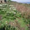

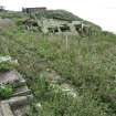


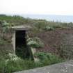


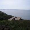


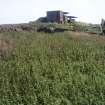


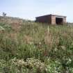


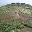

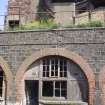




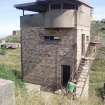


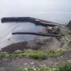
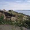



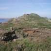


Archive from archaeological survey and assessment at Inchkeith Island, Firth of Forth, Fife
Archive from phase 1, archaeological survey and assessment at Inchkeith Island, Firth of Forth
Reports and illustrations from phase 1, archaeological survey and assessment at Inchkeith Island, Firth of Forth


