
Pricing Change
New pricing for orders of material from this site will come into place shortly. Charges for supply of digital images, digitisation on demand, prints and licensing will be altered.
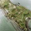
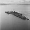
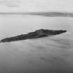
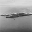
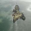
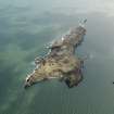
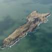
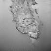
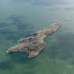
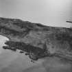
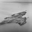
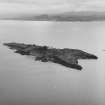
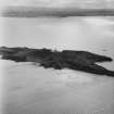
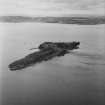
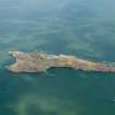
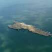
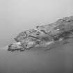
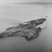
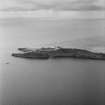
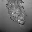
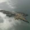
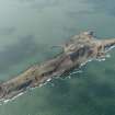
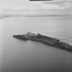
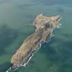
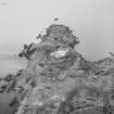
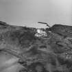
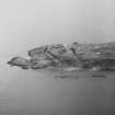
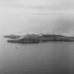
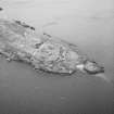
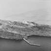
Inchkeith, General


Island (Period Unassigned)
Site Name Inchkeith, General
Classification Island (Period Unassigned)
Canmore ID 118556
Site Number NT28SE 10
NGR NT 295 825
NGR Description Centred NT 295 825
Datum OSGB36 - NGR
Permalink http://canmore.org.uk/site/118556


- Council Fife
- Parish Kinghorn
- Former Region Fife
- Former District Kirkcaldy
- Former County Fife
NT28SE 10 centred 295 825
REFERENCE: NATIONAL LIBRARY
Mylne's 'Master Masons': Volume 1, page 54 Plan of fort 1778.
(Undated) information in NMRS.
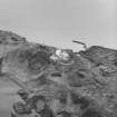
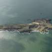
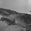
Archaeological Evaluation (August 2007)
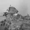
Sea & Land Power and Energy Ltd. commissioned Headland Archaeology Ltd to undertake an archaeological survey and assessment of an area for a proposed temporary anemometer mast and anchor points at the south end of Inchkeith Island in the Firth of Forth. As Inchkeith is a Scheduled Ancient Monument (SAM 3838), Scheduled Monument Consent is required for the installation of the anemometer from Historic Scotland, acting
on behalf of the Scottish Ministers. The assessment identified thirteen structures and four areas of archaeological interest that lie within the assessment area, which formed an area approximately 90m by 60m or 5400m². The survey succeeded in plotting these structures and features within a general topographic survey in relation to the proposed location of the mast plate and 5 anchor points. These locations were assessed as to the level of potential impacts that their introduction may have on archaeological features. This has resulted in a minor modification of
the proposed location in order to minimize any impacts.

